Satellite maps provide yield forecasts - in this case turnip yield


Satellite maps provide yield forecasts - in this case turnip yield
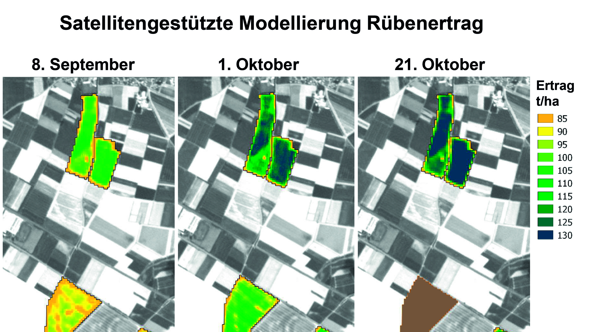
Satellite maps provide farmers with reliable yield forecasts at short intervals that they can use to accurately plan when to harvest a field. This image shows the change in yield from the beginning of September to the middle of October. The field on the bottom left had already been harvested prior to the latest satellite recording, as a result of the excellent forecast.