Topographical map of Margaritifer Terra and Aurorae Chaos


Topographical map of Margaritifer Terra and Aurorae Chaos
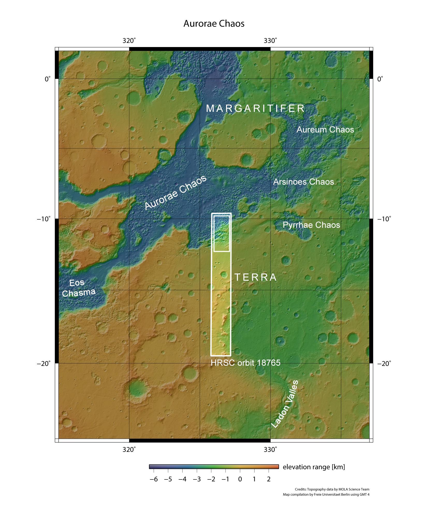
The Martian highlands to the east and northeast of the Valles Marineris canyon system are characterised by large outflow valleys. Large amounts of water must once have flowed through these valleys in the direction of the northern lowlands, at least sporadically, during Mars’ early history. A considerable proportion of the runoff water must have originated from underground ice, which was stored in large quantities in cavities beneath the surface. Heat melted this ice, which then emerged as water and flowed north. The empty cavities created as a result collapsed, leaving a confused pattern of isolated table mountains behind on the surface, which geologists refer to as ‘chaotic terrain’. The fissures and valleys that lie in between show that tectonic processes have also played a part in shaping the landscape. ESA’s Mars Express spacecraft flew over the region on 31 October 2018 during orbit 18,675 and imaged the transition between the highland region of Margaritifer Terra and Aurorae Chaos using DLR’s HRSC camera system. The images shown here are taken from the small rectangle in the longer strip.