Topographical image map of the southern part of Aurorae Chaos

Topographical image map of the southern part of Aurorae Chaos
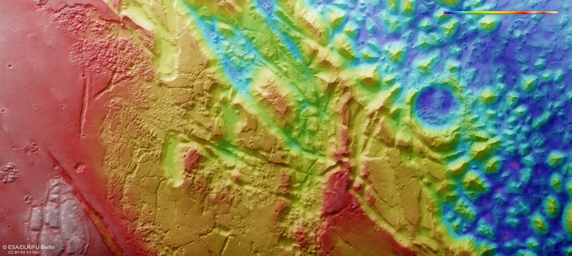
Image strips acquired from different angles by the HRSC camera system on board Mars Express were used to generate digital terrain models of the Martian surface, containing height information for each recorded pixel. The reference level to which the elevation data refer is an imaginary surface that experiences the same gravitational attraction as that found at sea level on Earth. Known as an equipotential surface, this is shaped like a biaxial ellipsoid and is known as an areoid, a name derived from Ares, the Greek name for Mars. North is to the right. The colour coding of the digital terrain model (legend top right) indicates the differences in elevation. The bottom of the Aurorae Chaos depression (the blue area on the right in the image) lies about 4000 metres below the level of the highlands (red, on the left of the image). The colouration also reveals tectonic fracture structures and their direction. A striking escarpment runs through the middle of the image from northeast to southwest, forming a connection between the high plateau in the south and Aurorae Chaos, which lies thousands of metres lower.