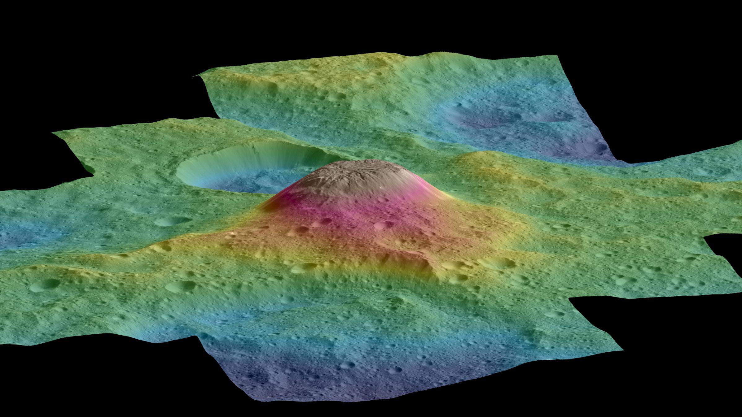
An oblique view of Ahuna Mons with elevation coding


An oblique view of Ahuna Mons with elevation coding
Digital terrain models of Ceres’ surface were calculated on the basis of stereo image data acquired by the framing camera on board NASA's Dawn spacecraft. The image shows a perspective view of the 4000-metre-tall Ahuna Mons. At its highest point, Ahuna Mons towers over its surroundings by almost 5000 metres. It thus has approximately the same dimensions as Mont Blanc in the Alps. There is an elevation difference of nine kilometres between the deepest areas (blue) and the summit of Ahuna Mons.