Topographic image map of Lowell Crater on Mars.

Topographic image map of Lowell Crater on Mars.
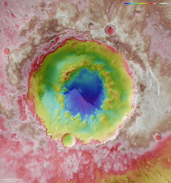
Image strips captured from different angles by the High Resolution Stereo Camera (HRSC) on board Mars Express were used to generate digital terrain models of the Martian surface. They contain height information for each recorded pixel. The colour coding of the digital terrain model (top right) indicates the elevation differences. The maximum difference in elevation is 4500 metres. One particularly striking feature is the ring of mountains inside the impact crater, which has a diameter of 90 kilometres. This ring lies around 1.5 kilometres below the level of the surface prior to the impact.