TanDEM-X forest map – southern Germany


TanDEM-X forest map – southern Germany
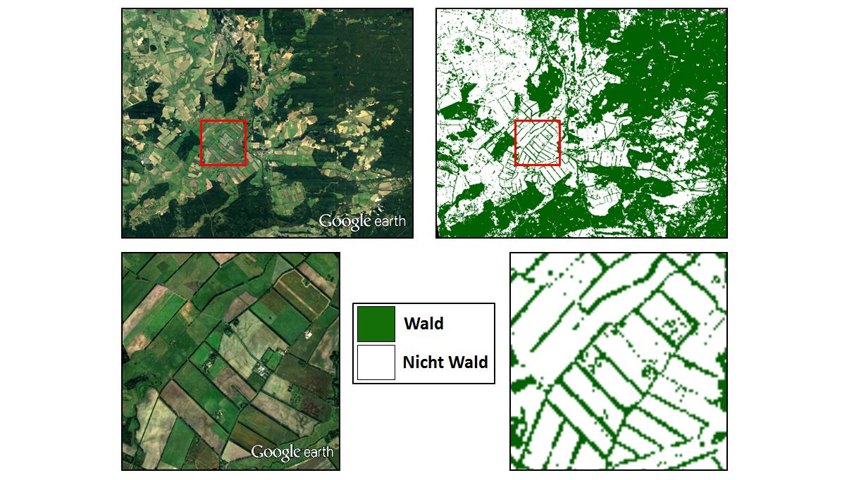
Comparison of a Google Earth image with the TanDEM-X forest map for a region in southern Germany. Individual rows of trees at the edges of fields can be clearly distinguished in the image, demonstrating the degree of detail offered by the forest map.