Topographic image map of the northern part of Deuteronilus Mensae


Topographic image map of the northern part of Deuteronilus Mensae
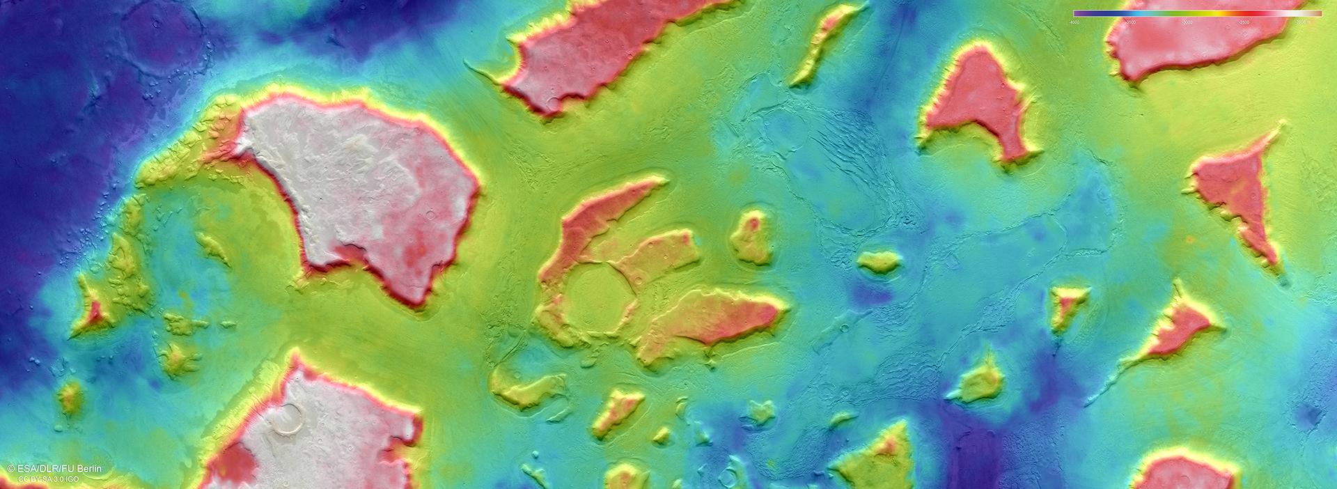
Scientists from DLR and Freie Universität Berlin derive digital terrain models of the surface of Mars from the image strips acquired by the High Resolution Stereo Camera (HRSC) on the Mars Express spacecraft, which are recorded from different angles. The colour coding of the digital terrain model (legend top right) provides information about the differences in altitude in the region. The plateaus of the 10-to-30-kilometre-long mesas are approximately 2000 metres above the surrounding lowlands. This makes them about twice as tall as the famous 'Table Mountain' in Cape Town, South Africa. The altitudes range from minus 4000 metres (blue) to minus 2000 metres (red). This entire transition zone, which lies at about 40 degrees north is therefore below the reference level on Mars, an ‘Areoid’ (from Ares, the Greek equivalent of the Roman god of war Mars). The Areoid is a calculated surface of equal gravitational attraction, an ‘equipotential surface’.