Topographic image map of Moreux Crater

Topographic image map of Moreux Crater
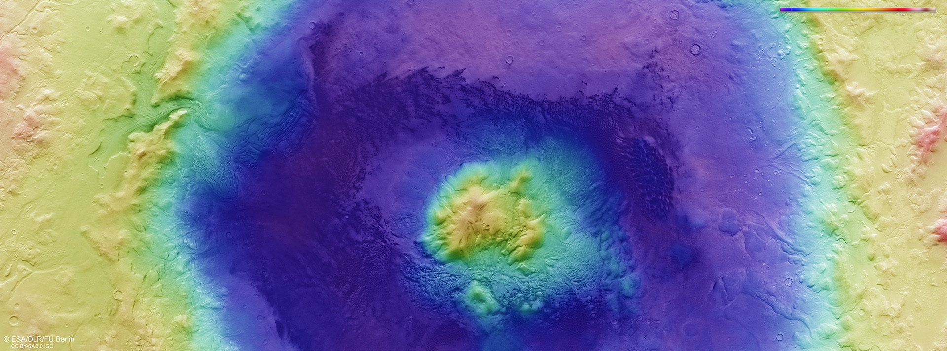
Using image strips acquired by the High Resolution HRSC camera system on Mars Express, which were imaged from different angles, researchers from DLR and Freie Universität Berlin have computed digital terrain models of the Martian surface, which contain elevation information for each pixel. The colour coding of the digital terrain model (legend in the top right-hand corner) provides information about differences in altitude. The crater floor is at an altitude of approximately minus 4000 metres, while the areas surrounding the crater are at around minus 2000 metres. The surrounding Protonilus Mensae region is approximately at the height of the ‘areoid’ – a calculated surface of equal gravitational attraction referred to as an ‘equipotential surface’. On Earth, the equivalent reference surface is sea level.