Comparison of condensation trail coverage on 16 April 2020 for different air traffic conditions (without contrails highlighted)

Comparison of condensation trail coverage on 16 April 2020 for different air traffic conditions (without contrails highlighted)
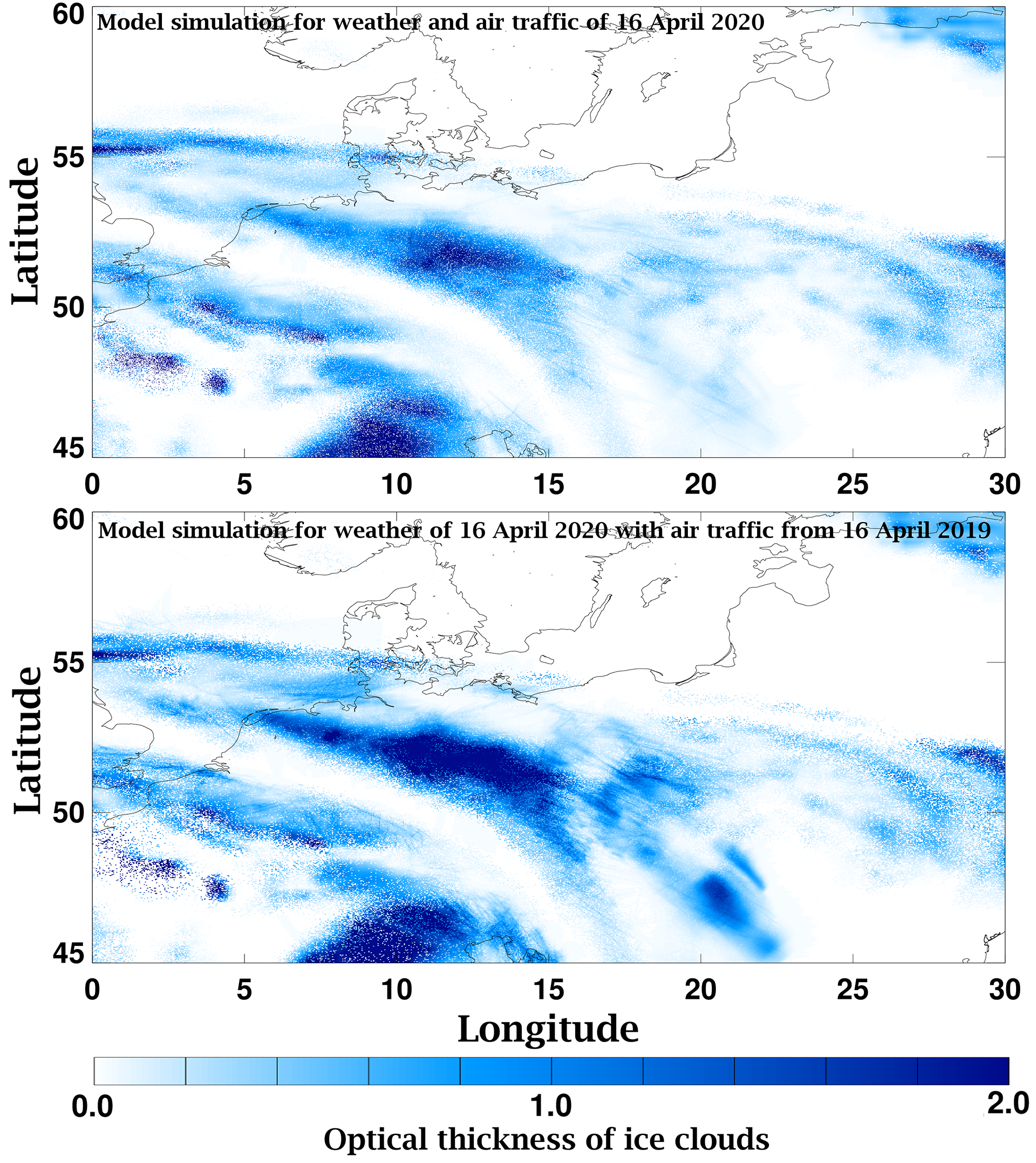
The images compare the modelled optical thickness of cirrus clouds and condensation trails for weather conditions and air traffic on 16 April 2020 at 12:00 CET (top) with the modelled coverage that the significantly higher air traffic of 16 April 2019 would have caused under the same weather conditions (bottom). Without restrictions on air traffic, around ten times as many contrails would have formed in the region shown over Central Europe on 16 April 2020. Weighted with the optical thicknesses, the degree of coverage of the partially overlapping contrails would be four times greater. The optical thicknesses of the ice clouds were simulated with the contrail and cirrus model CoCiP. The condensation trails are graphically highlighted.