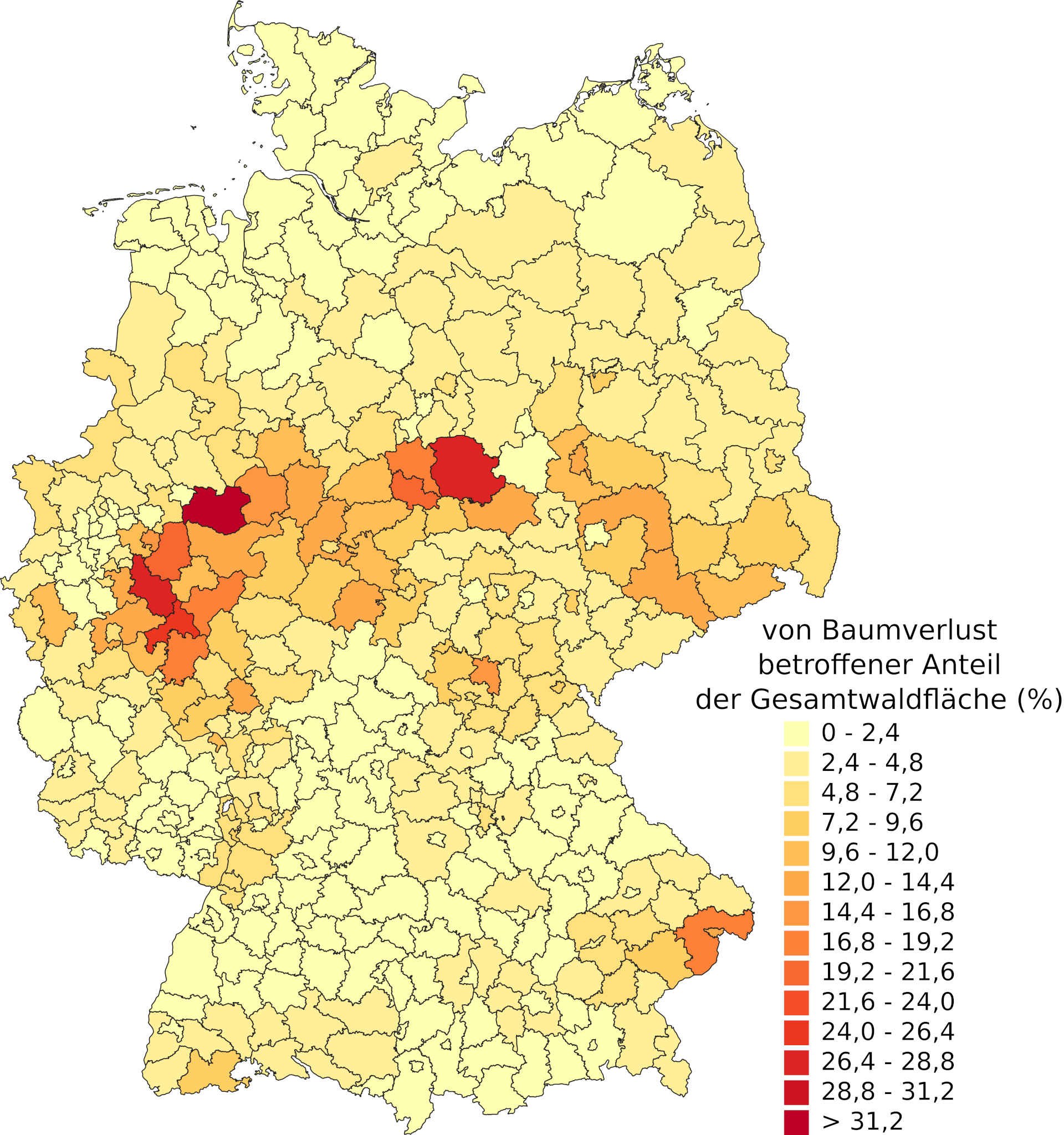
Tree loss in Germany – overview map
Tree loss in Germany – overview map
The illustration shows the amount of dead and, for the most part, already felled forest areas per district. Of note is that the highest percentage is exhibited in the middle of Germany from the Eifel, over the Sauerland and the Harz Mountains, and up to Sachsen. The coniferous forests there are especially affected. For this analysis, the DLR-Earth Observation Center (EOC) used satellite data from Sentinel-2 und Landsat-8 from the years 2018 to 2021.

