The topography of the Eumenides Dorsum region


The topography of the Eumenides Dorsum region
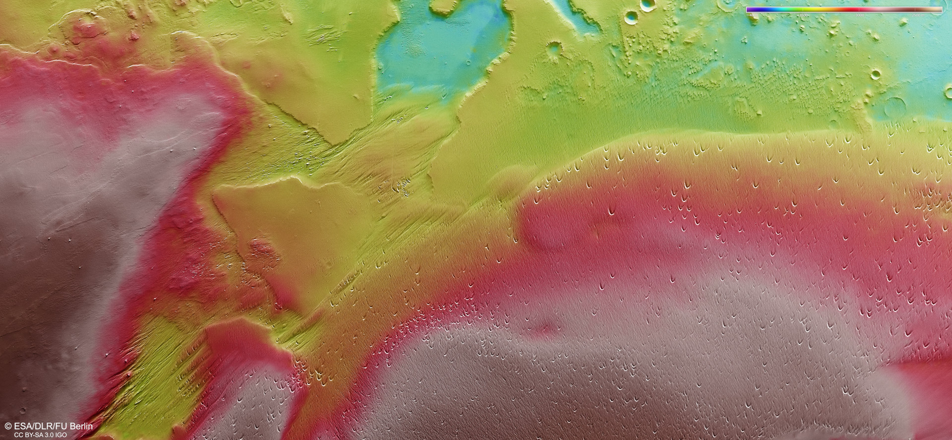
The DLR High Resolution Stereo Camera (HRSC) on ESA's Mars Express orbiter acquires images of the Martian surface at different angles and with four colour channels using its nine sensors, which are arranged across the line of flight. From the four stereo channels looking at an angle and the nadir channel pointing perpendicularly at Mars, teams of scientists at the DLR Institute of Planetary Research and Freie Universität Berlin compute digital terrain models that assign elevation information to each pixel. The colour scale at the top right of the image shows the differences in altitude in the region. The flat mountain peaks in the south and east (north is on the right of the image) rise between 1500 and 2000 metres above the turquoise depressions in the west at the top of the image. Between the elevations of the mountain range of Eumenides Dorsum, one can see the lower-lying area with its yardangs, wind gullies and blowouts, which were created by long-term wind erosion.