Deforestation in the Amazon

Deforestation in the Amazon
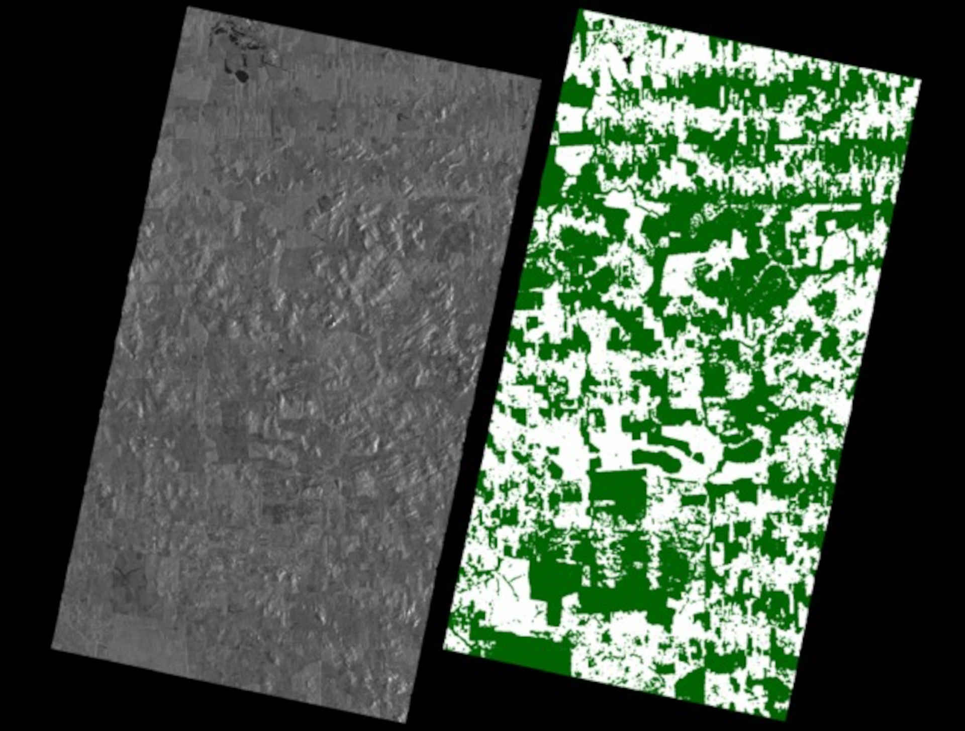
The assessment and monitoring of forest resources is a key task for current and upcoming radar satellite missions. The images show an area in the Brazilian state of Rondônia, taken from DLR's global TanDEM-X forest map. On the left is the ‘conventional’ amplitude image as generated by TerraSAR-X alone. The low contrast differences make it difficult to recognise forested areas when only a grey-scale image is available. This changes when additional information is available, provided by the twin satellite TanDEM-X and included in a forest map. The result can be seen in the image on the right. The forested areas in green and cleared areas in white can be clearly distinguished from one another. With two radar 'eyes', more can be seen than with just one. In this case, interferometric data acquired for the global elevation model created using the German radar satellite mission TanDEM-X was used and algorithms from the field of artificial intelligence were applied for global data processing.