EnMAP – one image, a wealth of information

EnMAP – one image, a wealth of information
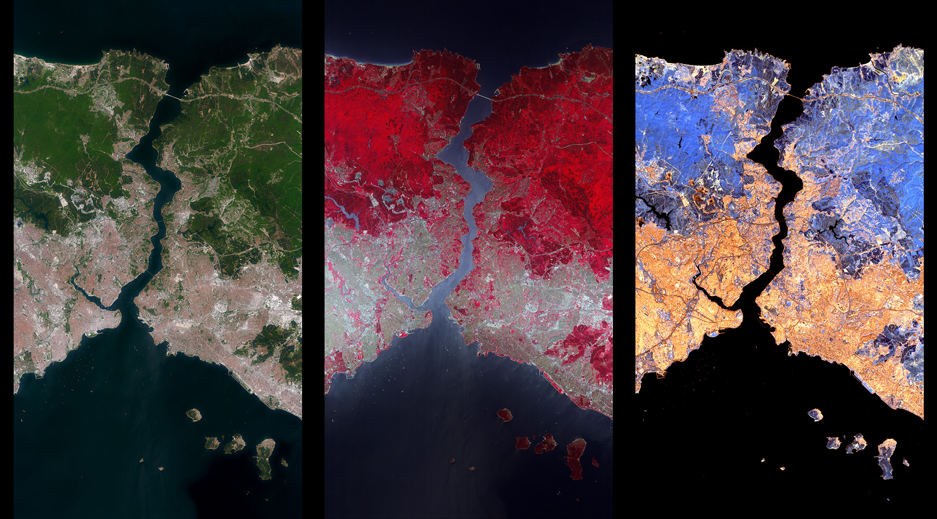
The German EnMAP environmental satellite has imaged a strip approximately 30 kilometres wide and 180 kilometres long over Istanbul, Turkey, with its hyperspectral instrument. These three sections are each approximately 30 kilometres by 54 kilometres and show the Bosporus, where the European continent meets the Asian continent. The left image shows a true-colour representation, which roughly corresponds to human colour perception, with this area being scanned by the VNIR camera with almost 50 individual fine channels. The middle image is a false colour image from the VNIR camera. In the near infrared, differences in vegetation become visible, which are related to the plant species and their condition, such as their biomass and chlorophyll content. The image on the right was taken with the SWIR camera in the short-wave infrared. Here, special features in the soil such as clays and in the rock, such as lime, can be identified and conclusions drawn about soil fertility.