TanDEM-X elevation model – brittle ice shelf of the Thwaites Glacier
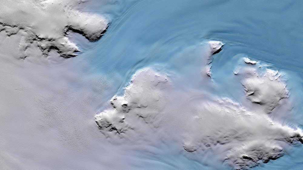
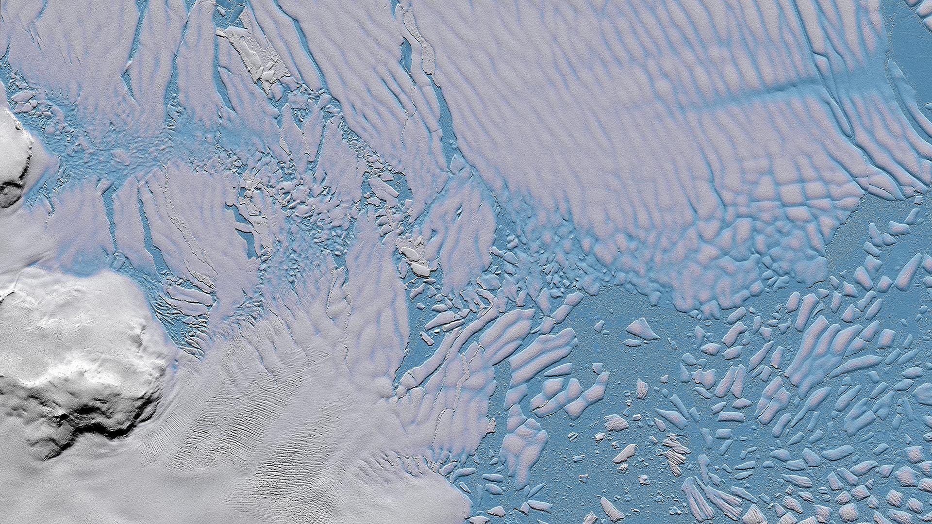
TanDEM-X elevation model from 15 July 2014 over the ice shelf of Thwaites Glacier in the West Antarctic. The detached icebergs in the sea ice are clearly visible.
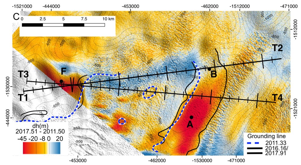
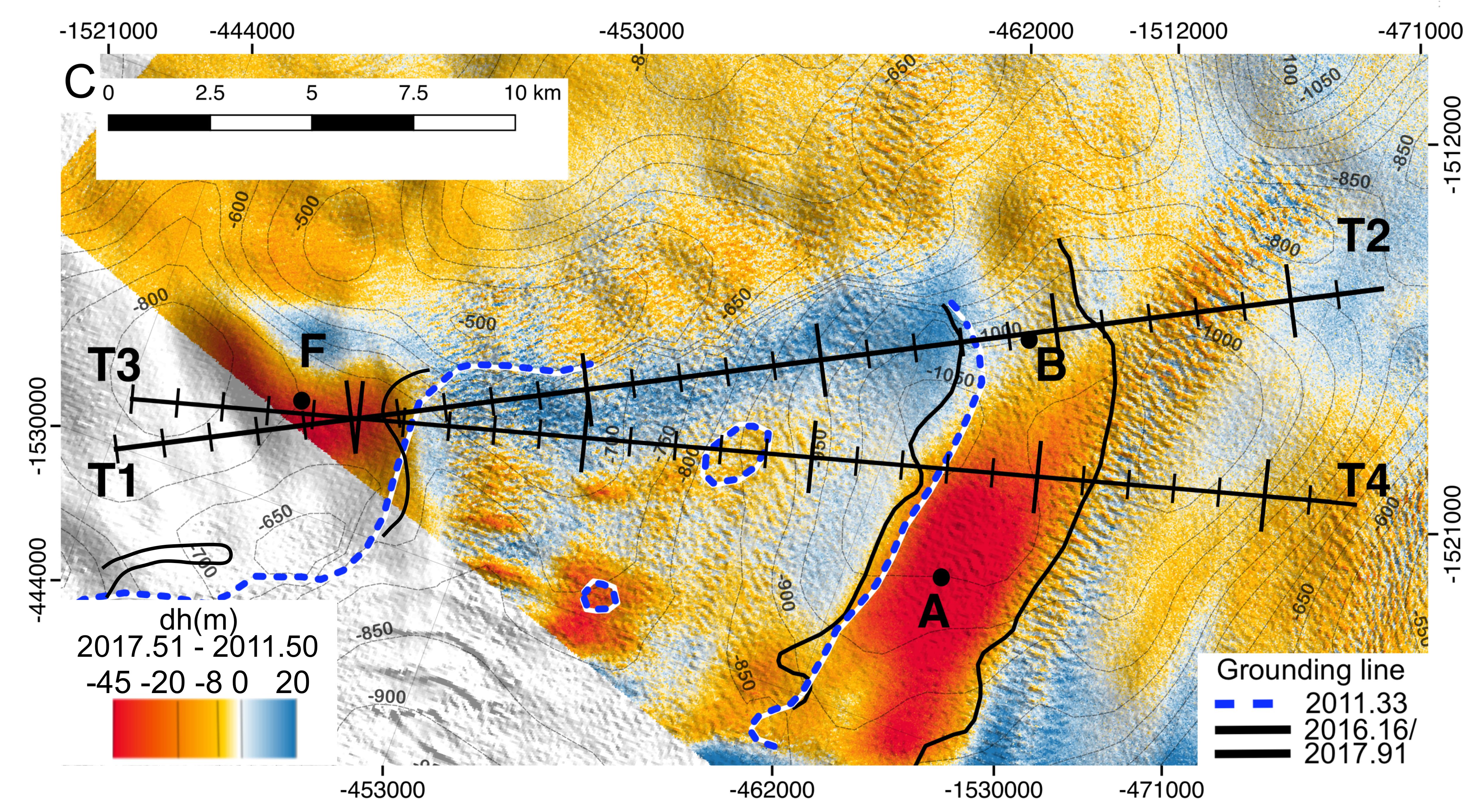
Elevation changes of the ice surface of the Thwaites Glacier in the Antarctic, derived from a series of TanDEM-X elevation models (created between 2011 and 2017). The detailed elevation changes significantly improve the modeling of melting processes and climate changes in these sensitive regions.
For the first time, TanDEM-X elevation models and data from the latest generation of radar satellites enable detailed observation of glacier changes
Published in the 'Science Advances' journal: Findings from novel radar analyses show dramatic development of Thwaites Glacier
The melting of Thwaites Glacier could cause global sea levels to rise more than 65 centimetres
Focus: Global change, Earth observation, Tandem-L
Thwaites Glacier, one of the most fragile glaciers in western Antarctica, is melting inexorably into the Amundsen Sea at an ever-increasing rate. Until now, it has been responsible for approximately four percent of the global rise in sea level and will cause the oceans to rise by over 65 centimetres in future as its remaining ice melts. With the German radar satellites TerraSAR-X and TanDEM-X, it is now possible, for the very first time, to observe Thwaites Glacier and other polar regions at regular intervals, with high resolution and in three dimensions. Scientists from the German Aerospace Center (Deutsches Zentrum für Luft- und Raumfahrt; DLR) have generated special TanDEM-X elevation models to better understand and predict the melting processes and changes occurring on Thwaites Glacier. The results of the NASA-led study have now been published in the scientific journal Science Advances.
There is a gigantic, 350-metre cavity in the floor of the Antarctic glacier, with the penetrating seawater continuously eating further into the ice. Experts have long suspected that Thwaites is not firmly attached to the bedrock beneath it, but the size of the cavity and the formation of subglacial channels was as surprising as it was alarming. Satellite data acquired by the partners from the United States, Germany and Italy revealed that a total of 14 billion tonnes of ice have already been washed out, mainly in the last three years. The melt rate was calculated based on TanDEM-X images.
In addition, the TanDEM-X elevation models reveal the glacier's special dynamics. The changes in the ice surface elevation were measured with millimetre accuracy, allowing important conclusions to be drawn about the underlying melting processes. With images from the Italian Cosmo-Skymed satellites, it was possible to closely monitor the glacier's 'grounding line', which marks the threshold at which the ice mass no longer has bedrock beneath it and begins to float in the sea. Scientists thus discovered that although the glacier surface is rising, the overall thickness of the ice is decreasing. The consequences of interactions between ice masses and penetrating seawater are far greater than previously thought. These and other such insights are essential to predict the effects of glacier melt on global sea levels more accurately. The current study shows the decisive role played by innovative radar satellite technologies.
For the detailed time series analyses, the DLR experts ordered a total of 120 TanDEM-X images over the period from 2010 to 2017. A time series of elevation models was created from these using the global TanDEM-X elevation model. "This unique capability of TanDEM-X makes it possible to accurately observe changes in surface topography and thus provide in-depth analyses of melt processes in the polar ice caps," says co-author Paola Rizzoli from the DLR Microwaves and Radar Institute.
The highly accurate determination of the glacier's structure is achieved thanks to high-precision interferometric processing, geocoding and calibration of TanDEM-X images, which was implemented at the DLR Microwaves and Radar Institute. The input data is provided by the automated TanDEM-X processing chain of the DLR Remote Sensing Technology Institute. The data from TerraSAR-X and TanDEM-X are received by the German Remote Sensing Data Center at its stations in Neustrelitz, Inuvik (Canadian Arctic) and GARS O'Higgins (Antarctic). The satellites are operated by the German Space Operations Center at the DLR site in Oberpfaffenhofen.
New radar remote sensing technologies and methods make it possible for scientists to conduct more targeted research into critical climate processes and further improve predictive models. The latest findings on the development of Thwaites Glacier provide a valuable guide for climate and environmental research. The study 'Heterogeneous retreat and ice melt of Thwaites Glacier, West Antarctica' was written by Pietro Milillo of the NASA Jet Propulsion Laboratory with co-authors from the University of California, the German Aerospace Center (DLR) and the Université Grenoble Alpes, and is available here on the online portal of the journal Science Advances.
Follow-up Tandem-L mission
A possible follow-up mission to TanDEM-X has already been designed by DLR. The Tandem-L mission concept envisages two radar satellites operating in the L-band (23.6-centimetre wavelength) to record global processes such as the melting of Thwaites Glacier globally and systematically. The aim of Tandem-L is to map the entire Earth's land mass on a weekly basis. The mission will set new standards in Earth observation, observe global change with a new quality and allow important recommendations for action to be made. The new technology will enable the recording of the three-dimensional structures of vegetation and ice areas as well as the large-scale measurement of deformations with millimetre accuracy.

