DLR tests innovative crisis management solutions in The Hague


- DLR participates in a European crisis trial as part of the EU project DRIVER+.
- DLR's main contributions are innovative 2D and 3D maps and a traffic routing system.
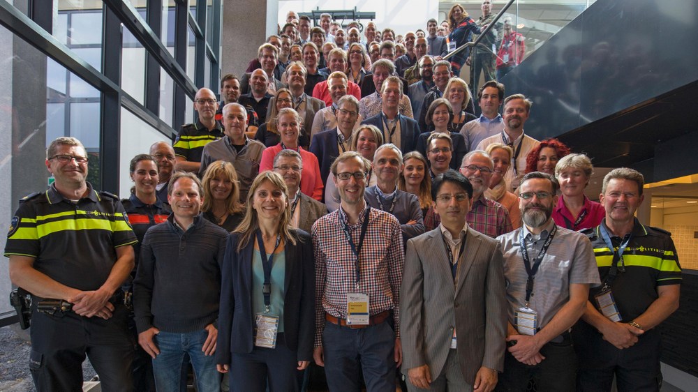
A comprehensive flood scenario was simulated in The Hague from 22 to 23 May 2019 as part of the Driving Innovation in Crisis Management for European Resilience (DRIVER+) project. Five innovative solutions were evaluated. The trial, which was conducted with the participation of crisis managers from several countries, was an opportunity to examine innovative solutions for crisis management in Europe. The German Aerospace Center (Deutsches Zentrum für Luft- und Raumfahrt; DLR) conducted the trial together with the crisis team in The Hague and at the same time tested new developments from the Centre for Satellite Based Crisis Information (ZKI) and also the 'KeepOperational' traffic management system from the DLR Institute of Transportation Systems.
Tabletop trial
"The trial examined a simulated flooding scenario in which a lock in The Hague failed due to extreme weather conditions," explains Konstanze Lechner, leader of the crisis exercise at DLR. "A large part of The Hague city centre was flooded and the infrastructure damaged, threatening a large proportion of the city’s population," Lechner continued.
End-users and decision-makers from all levels of crisis management participated in a 'tabletop' trial in various situation centres. Their task was to take measures against flooding in a simulated environment and to integrate the products developed in DRIVER+ into their existing procedures and test them.
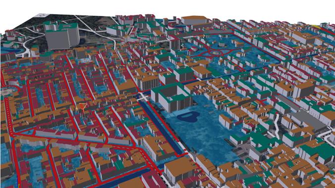
The ZKI supported each situation centre by providing up-to-date information about the extent of the disaster and the buildings and infrastructure that might have been affected. "A simulated flood mask was generated, which was derived from current aerial imagery," explains Lechner. “The flood data were made available to the participants via standardised interfaces, so that they could be integrated into various systems and other solutions used by the participants." In addition, the ZKI solution generated digital, interactive 2D and 3D map products showing the extent of the flooding and its effects on the infrastructure in specific areas. The overall objective was to simulate an aerial overview of the affected area and to support the crisis management team with innovative information products.
During the trial, the police action centre used the DLR traffic management system KeepOperational to draw up traffic plans and analyse the accessibility of the affected area. The flooding information provided by the ZKI and the flood prediction model created by another simulation tool were also taken into account. The police action centre also added its own information to the KeepOperational tool, such as traffic congestion reported by local units. KeepOperational combined traffic information from ground-based traffic sensors with airborne information and other sources and provided improved navigation data based on a common situation picture.
"The DRIVER+ trial was a complete success," says Lechner. "The crisis managers were able to sufficiently test all technical innovations in their working environment. Both the new developments from the ZKI and KeepOperational were very well received by the police action centre in particular," Lechner summarised.
About ZKI
The Centre for Satellite Based Crisis Information (ZKI) supports emergency forces with rapid aerial and satellite mappings for use in natural disasters, humanitarian crisis and civil security. Satellite data are recorded, analysed and compiled to produce needs-based, topical maps and visualisations at very short notice within the framework of the 'International Charter Space and Major Disasters', the Copernicus Emergency Mapping Service and the national ZKI-DE Service for Federal Authorities. In recent years, ZKI has established itself as one of the leading institutions in satellite-based crisis information – nationally, in Europe and globally. Reliable and fast provision of information, competent advice and training, as well as close contact with the users are the keys to success.
About KeepOperational
KeepOperational uses derived situation and traffic information to present a comprehensive situation picture of the crisis area and its effects on the traffic situation. KeepOperational is based on the DLR Traffic Data Platform. The Traffic Data Platform is a service framework for the collection, processing and utilisation of traffic data. These can be obtained from different sources, for example loop detector data or floating car data. In combination with location information from aerial photographs, KeepOperational offers functions for traffic analysis and route planning. In contrast to public transport portals, added value is achieved by considering the application specifics. Information layers can also be imported from other data sources by using standardised formats. The KeepOperational tool is provided as a web application with a service-oriented back-end system.
DRIVER+
DRIVER+ (Driving Innovation in Crisis Management for European Resilience) is an EU-funded project that supports crisis management experts in devising solutions for complex disaster recovery operations. A total of four crisis exercises (trials) and a final demonstration with the active participation of crisis management experts will be conducted during the project. The aim is to identify and evaluate innovative solutions that meet the experts' expectations and address pre-identified concerns.
For more information about the Dutch trial and DRIVER+ activities, go to www.driver-project.eu. Further information about this crisis trial is available here.