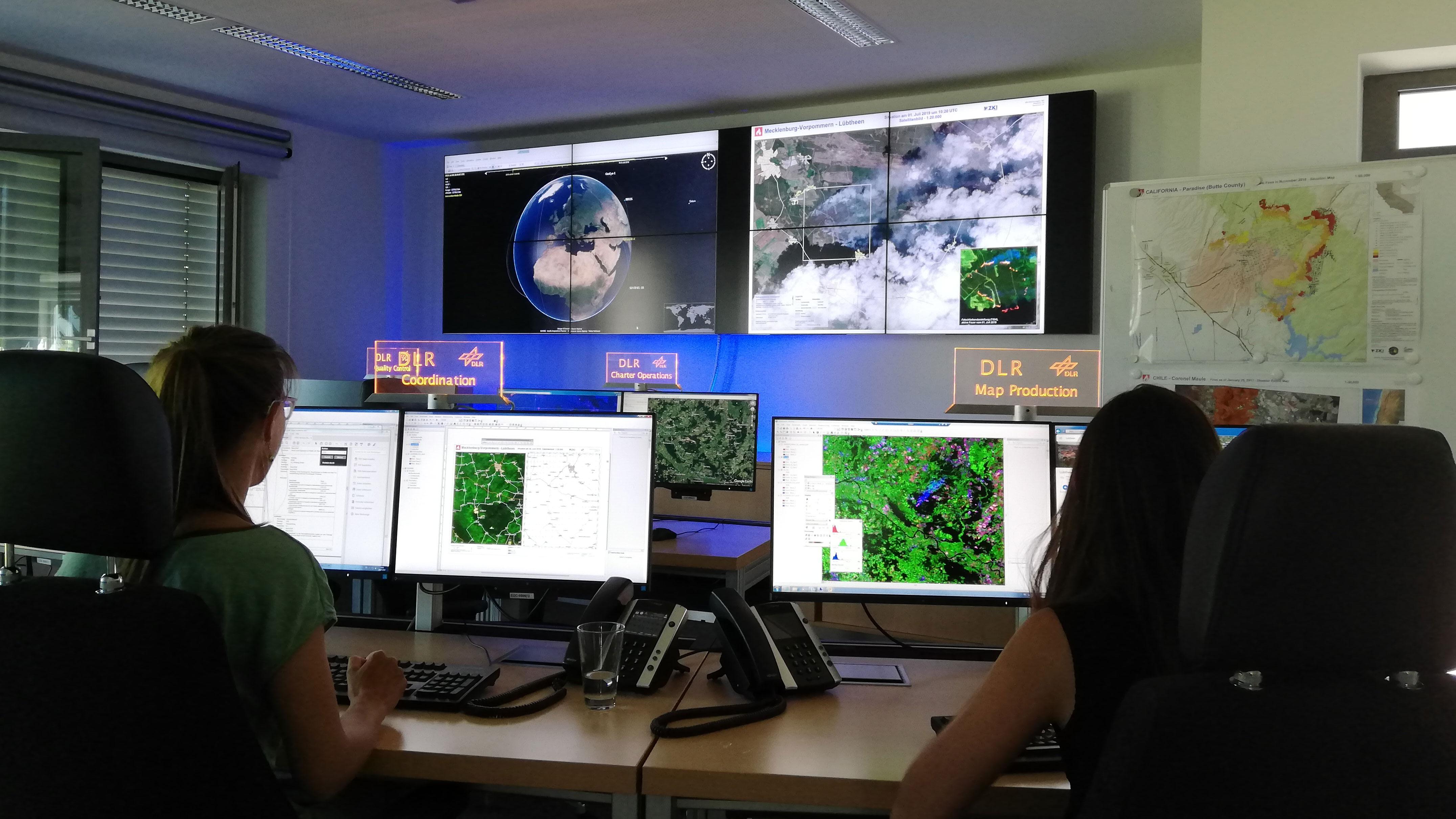
The DLR Institute of Optical Sensor Systems and the DLR Center for Satellite Based Crisis Information (ZKI) provide emergency services with up-to-date situation maps of the affected areas in Mecklenburg-Western Pomerania.
Focus: Disaster assistance
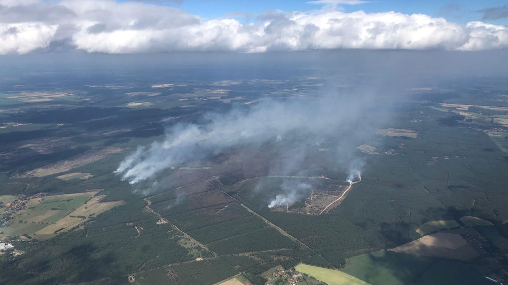
Mecklenburg-Western Pomerania, a state in the northeast of Germany, is currently experiencing the worst forest fires in its history. On 2 July 2019, the German Aerospace Center (Deutsches Zentrum für Luft- und Raumfahrt; DLR) Institute of Optical Sensor Systems used a special version of the Modular Aerial Camera System (MACS) to map large parts of the forest fires in the military training area near Lübtheen. In cooperation with the DLR Center for Satellite Based Crisis Information (ZKI) at the German Remote Sensing Data Center (DFD), up-to-date situation maps of the affected areas were made available to the emergency services.
Airborne detection with MACS
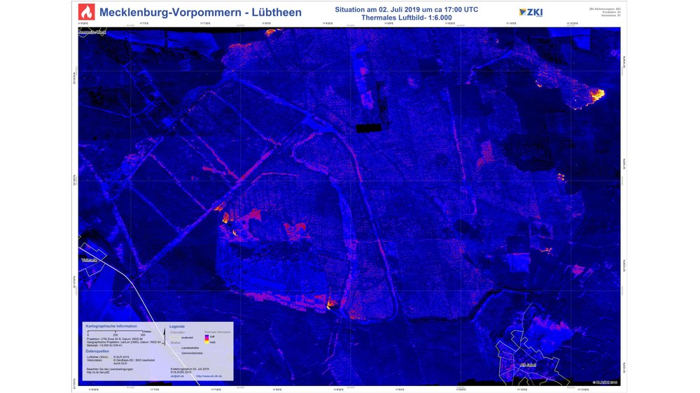
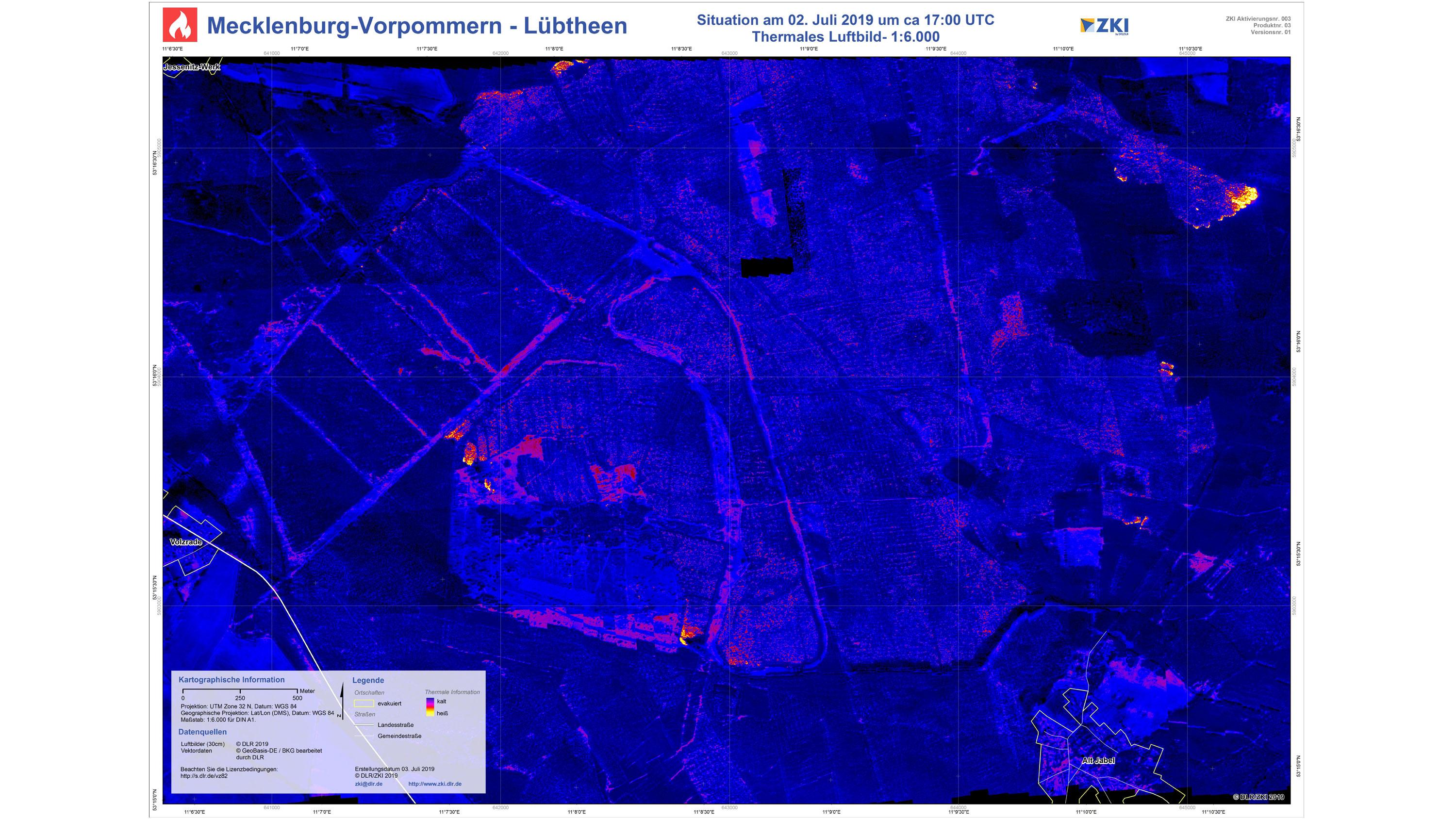
The forest fires near Lübtheen were overflown several times between 16:50 and 17:20 and, in addition to the acquisition of high-resolution aerial photographs, MACS was used to produce thermal images with a ground resolution of one metre, revealing what was happening from the air. After landing at 18:00, the first situation maps were transmitted to the emergency services in Mecklenburg-Western Pomerania at 21:00.
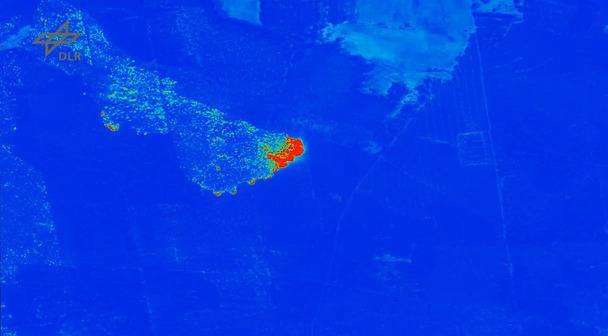
DLR’s patented process allows aerial photographs and thermal images to be projected onto a digital map in real time and in the correct location. The resulting image mosaics can quickly be made available to the emergency services and used directly in existing geoinformation systems. The temperature information in the thermal images makes it possible to detect fires under treetops and smoke clouds, as well as to evaluate the intensity of the fires.
(1 minute, without sound, 4.55 MB)
Visualisation of the thermal image mosaic as an overlay in a geoinformation system
Your consent to the storage of data ('cookies') is required for the playback of this video on Quickchannel.com. You can view and change your current data storage settings at any time under privacy.
Visualisation of the thermal image mosaic as an overlay in a geoinformation system
(1 minute, without sound, 4.55 MB)
Credit:
DLR Institute of Optical Sensor Systems
Satellite-based acquisition using various sensors
Optical and thermal remote sensing data are generally suitable for monitoring forest fires. In the case of the forest fires near Lübtheen, the ZKI used a freely available Sentinel-2 image, in which false-colour data in particular provided information on the current fires. In addition, the smoke columns are clearly visible on one Terra and one Aqua image, both acquired by a Moderate Resolution Imaging Spectroradiometer (MODIS) sensor. European Space Imaging also made a high-resolution GeoEye-1 scene available. Data from the two sensors Visible Infrared Imaging Radiometer Suite (VIIRS) and MODIS could also be used to locate fires at different times. The European Forest Fire Information System (EFFIS) also made it possible to analyse fire areas at various points in time.
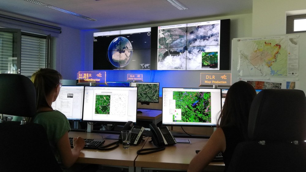
In an acute situation such as this, the ZKI collects all available satellite and airborne information, prepares and analyses the data and adds essential geoinformation obtained from the German Federal Office of Cartography and Geodesy (BKG) in order to produce dedicated, easily understandable and comprehensive situation image products for the area concerned. Information on the evacuation situation on site is provided to the ZKI by the Joint Reporting and Situation Centre (GMLZ) of the Federal Office for Civil Protection and Disaster Assistance (BBK). Due to the large number of ZKI users, the generated products can be distributed directly to the relevant interested parties. The ZKI is currently in close contact with the German Federal Agency for Technical Relief (THW) and the GMLZ, as well as with the local operations management, to whom it immediately forwards its maps and some of the raw data. The products generated by the ZKI are also freely accessible to the public and can be downloaded from the ZKI activations page.
The ZKI is continuing its work through further planned flights and satellite imaging and is continuing to monitor the crisis situation. On Thursday, 4 July 2019, the area was overflown again in coordination with the operations management. The resulting images and thermal data showed significantly reduced burn areas and have also been processed and distributed by the ZKI.
