Flood areas in the Ahrweiler region

Flood areas in the Ahrweiler region
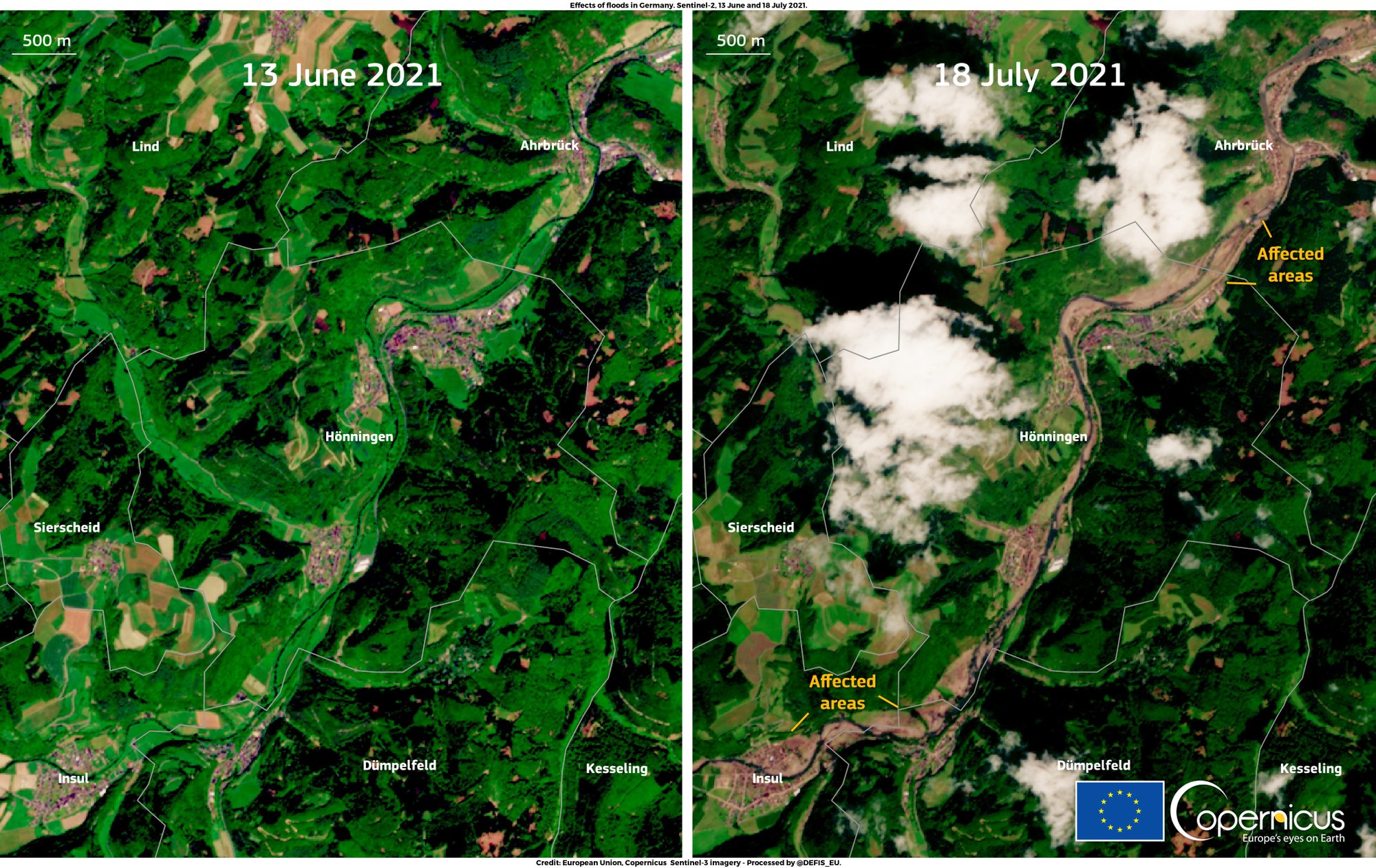
The images from the Copernicus Sentinel-2 satellite show the Ahrweiler region before the catastrophic heavy rain event in the summer of 2021 (13 June, left) and afterwards (18 July, right). The flooded areas and mud masses around the river Ahr are clearly visible from space.