Elevation model showing the Very Large Array in New Mexico

Elevation model showing the Very Large Array in New Mexico
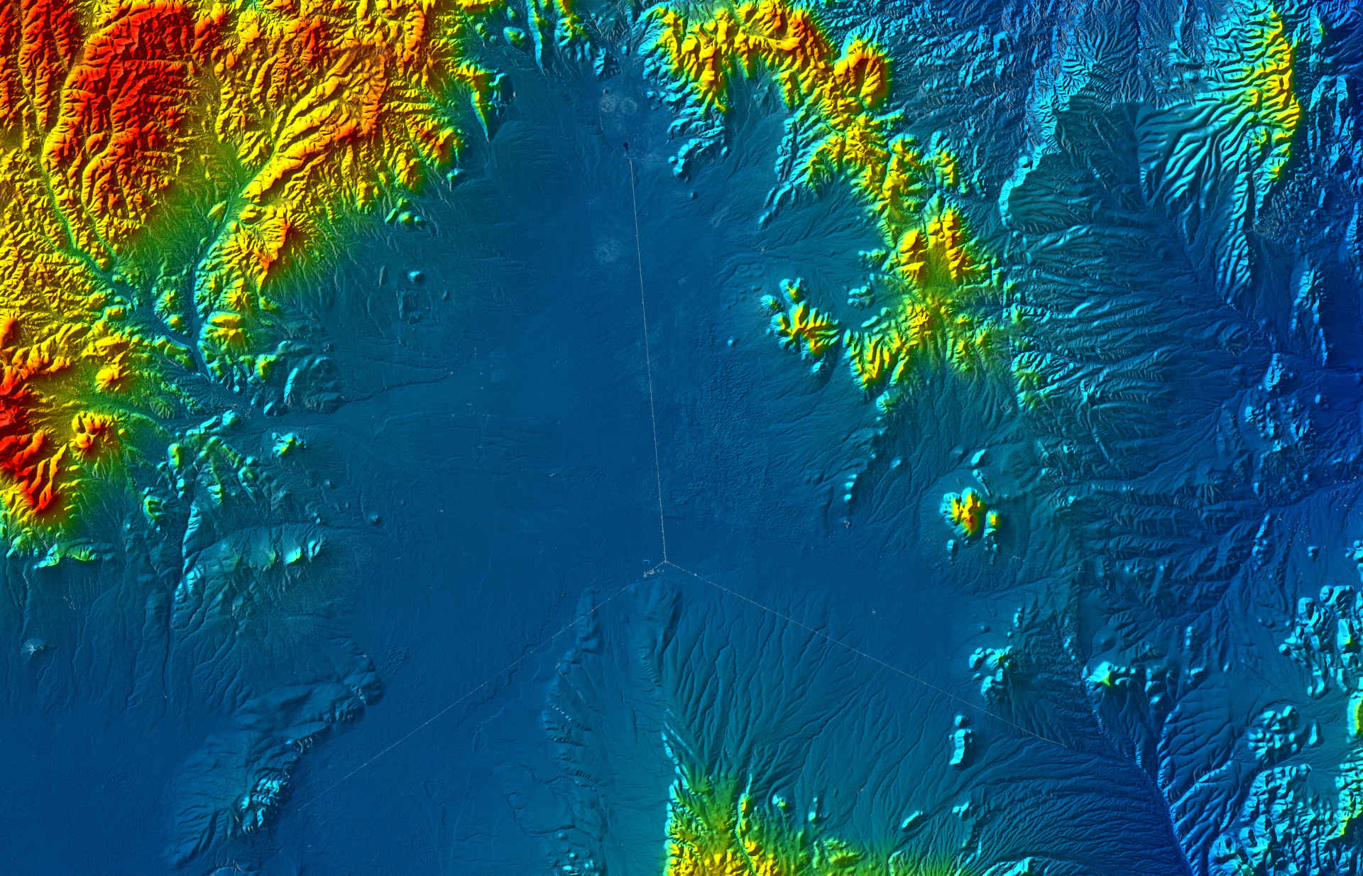
Due to their close formation flight, the TerraSAR-X and TanDEM-X satellites can also acquire data for digital elevation models, in addition to SAR images. For this purpose, a technique referred to as synthetic aperture radar interferometry is used to generate an elevation map. The colour coding in this altitude map shows the surroundings of the Very Large Array (VLA). The location of the VLA on a plateau at an altitude of 2120 metres in New Mexico is clearly visible. The bright lines are the three rails on which the telescopes can be moved. The image is approximately 70 kilometres from left to right and 30 kilometres from top to bottom.