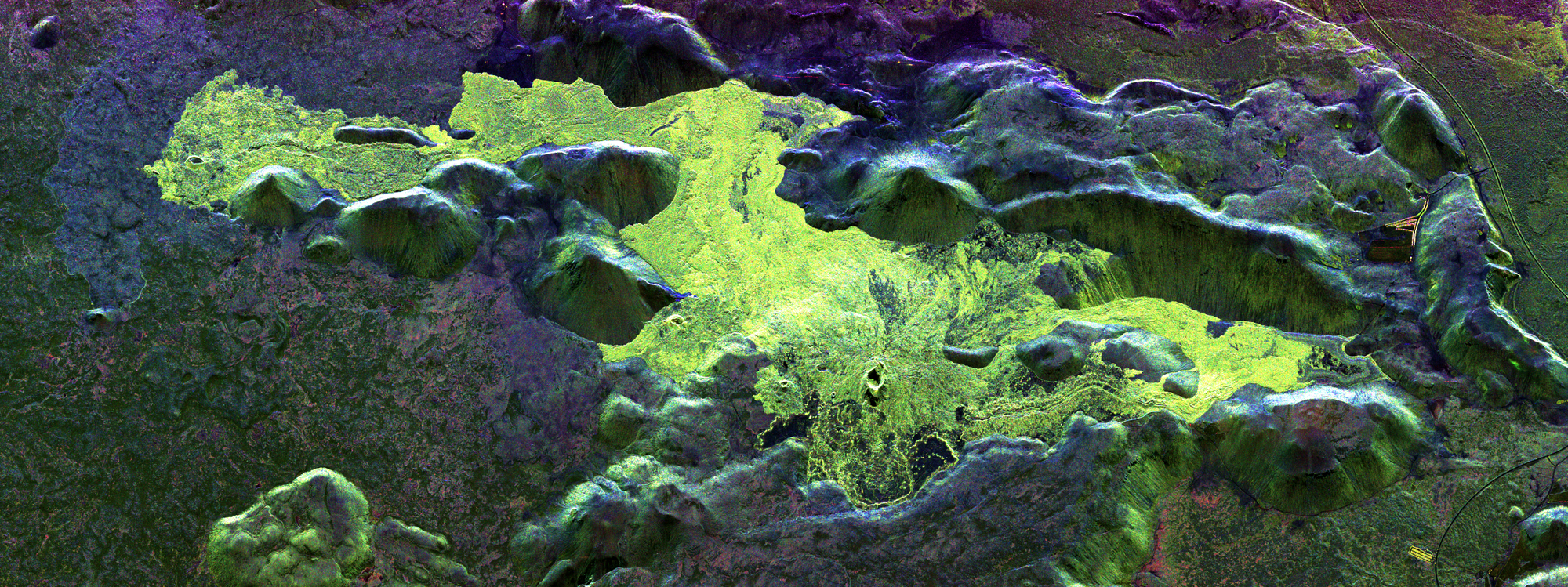
Radar image acquired by DLR's F-SAR sensor in S-band (nine-centimetre wavelength) over the area of the recently erupted Litli-Hrútur volcano

Radar image acquired by DLR's F-SAR sensor in S-band (nine-centimetre wavelength) over the area of the recently erupted Litli-Hrútur volcano
The colours correspond to different polarisations of the radar waves and are related to the physical properties of the imaged surfaces. In particular, the light green areas correspond to lava flows occurring subsequent to 2021. The image shows a small subset of the recorded data and covers an area approximately 12 kilometres long and four kilometres wide.