South Atlantic Anomaly satellite data and flight path in March/April 2021

South Atlantic Anomaly satellite data and flight path in March/April 2021
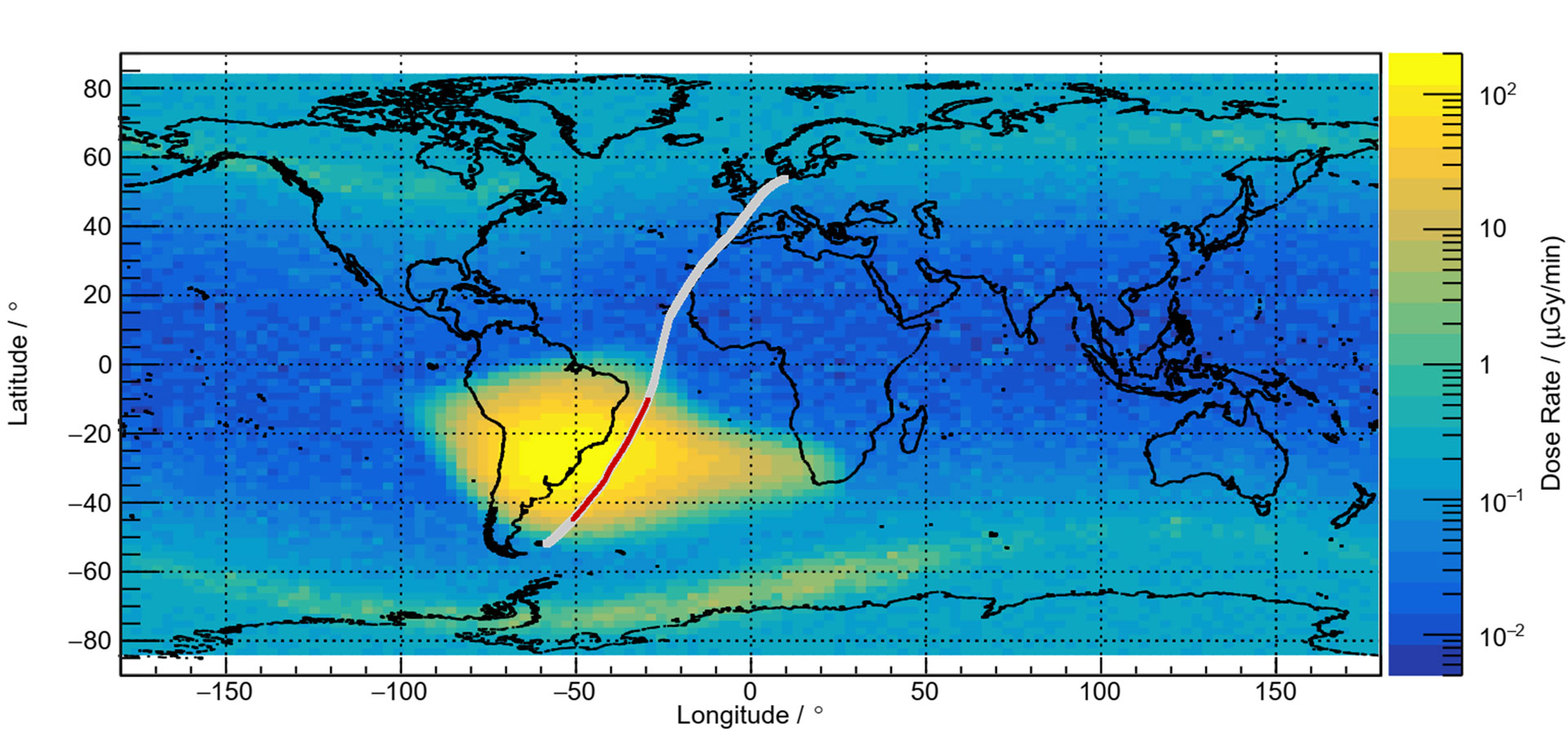
Data from DLR's Eu:CROPIS satellite show the South Atlantic Anomaly (yellow) at an example altitude of 600 kilometres. The flight path of the Atlantic Kiss mission led directly through this geographical region at an altitude of 13 kilometres (marked in red). The research team from the DLR Institute of Aerospace Medicine measured cosmic radiation at cruising altitude.