In December 2023 and January 2024, volcanic eruptions occurred in the area of Iceland's Sundhnúkur crater row.
The TerraSAR-X and TanDEM-X satellites operated by DLR recorded radar images of the area before and after the eruptions.
In the event of natural disasters such as earthquakes, floods or volcanic eruptions, radar satellites provide important additional information about the location, extent and magnitude of the event and thus support civil protection on site.
Focus: Spaceflight, Earth observation
On 18 December 2023, a volcanic eruption occurred in the area of the Sundhnúkur 'crater row' between Grindavík and Fagradalsfjall. This had been anticipated by small earthquake swarms – a series of seismic events in a local area within a relatively short period – in the preceding weeks. The main eruption lasted for four days until 21 December 2023. On 14 January 2024, there was another lava eruption through two fissures further south, sending lava as far as the first houses in Grindavík.
Weather services and civil protection organizations around the world are increasingly using data generated by satellites with a Synthetic Aperture Radar (SAR) to collect precisely this information regardless of lighting and weather conditions. The two radar satellites TerraSAR-X and TanDEM-X, operated by the German Aerospace Center (Deutsches Zentrum für Luft- und Raumfahrt; DLR), acquired radar images of the Sundhnúkur region before and after the start of the eruption on 18 December 2023.
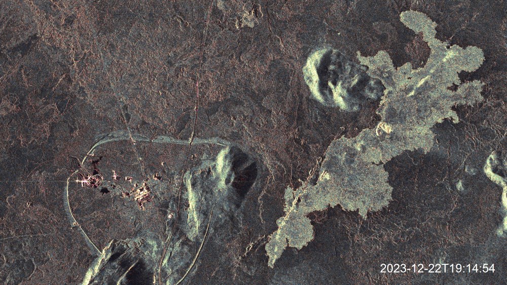
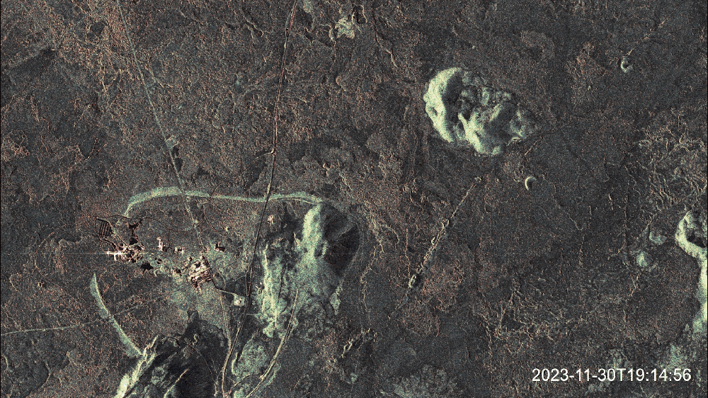
Animated representation of the lava flow at the Sundhnúkur crater row between November 2023 and January 2024
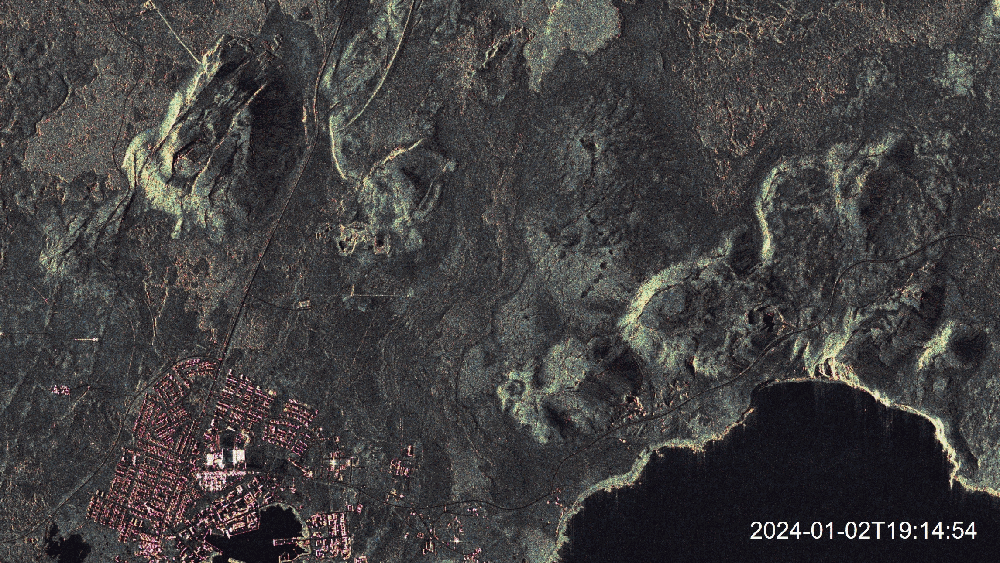
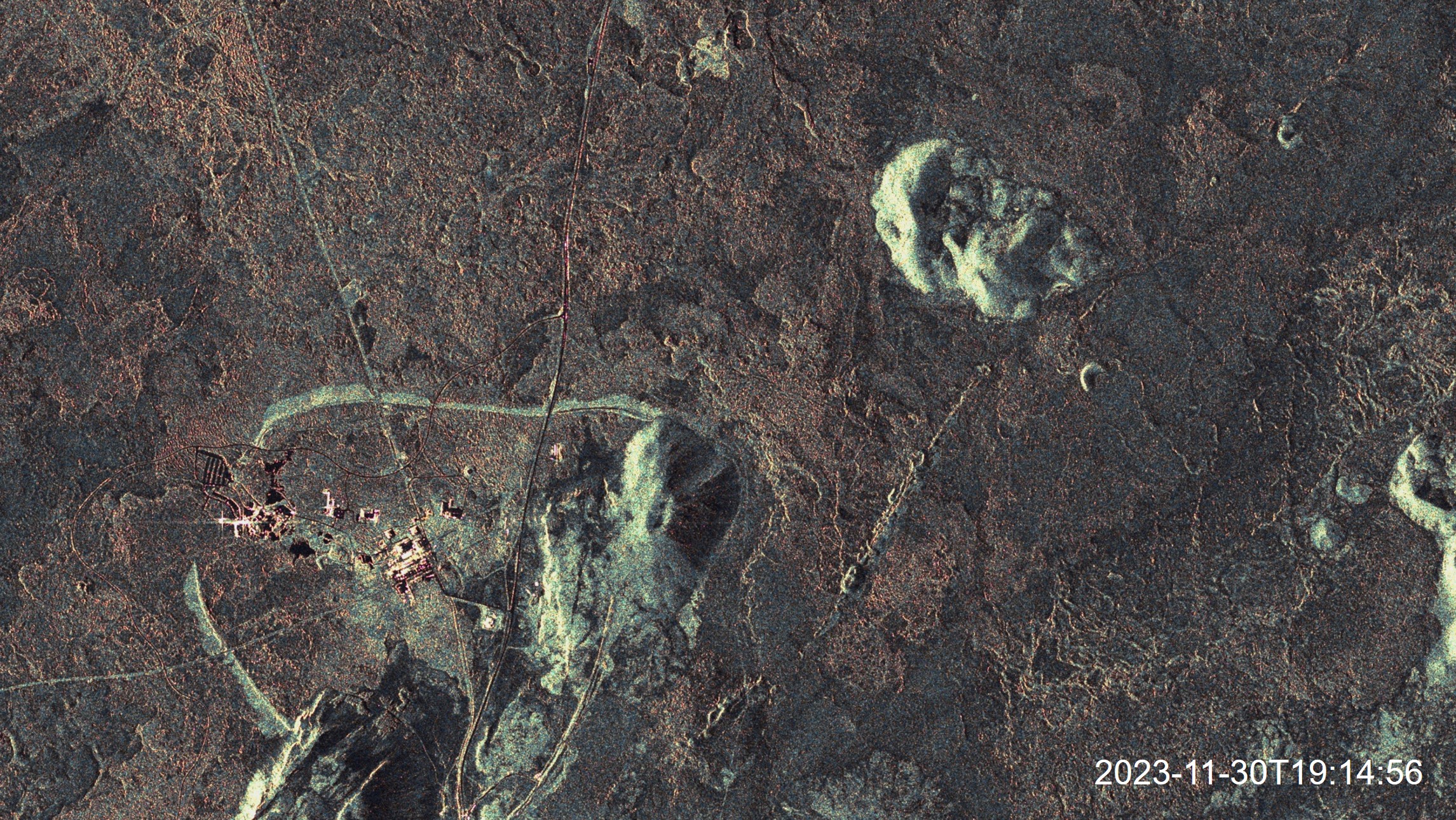
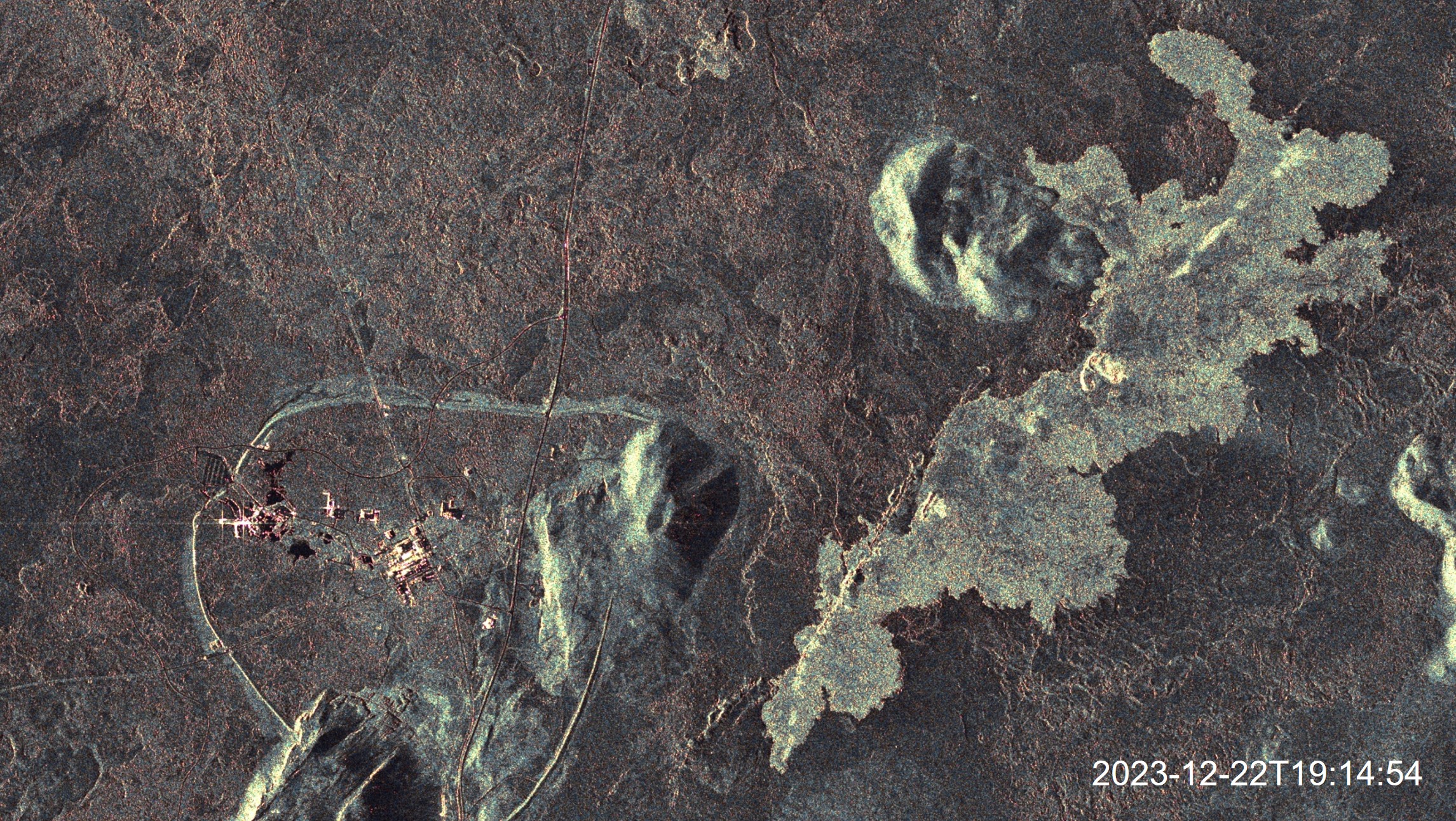
The colours of the images are derived from statistical analyses and show the surface roughness of the lava.
The colour of the images is derived from statistical analyses and indicates surface roughness. The SAR images clearly show the lava that has erupted. The eruption is still very bright one day after the end of the eruption (second image in the animation), but in the weeks that follow (third and fourth images in the animation) its brightness in the SAR image decreases. This is most likely due to the change in the roughness of the lava, which determines its 'backscattering' properties – that is, how much of the radar signal is reflected directly back to the antenna. As the lava flow cools, its surface becomes smoother and it becomes similar in roughness to the surrounding cooled lava from previous eruptions.
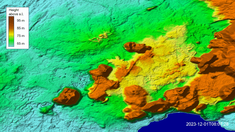
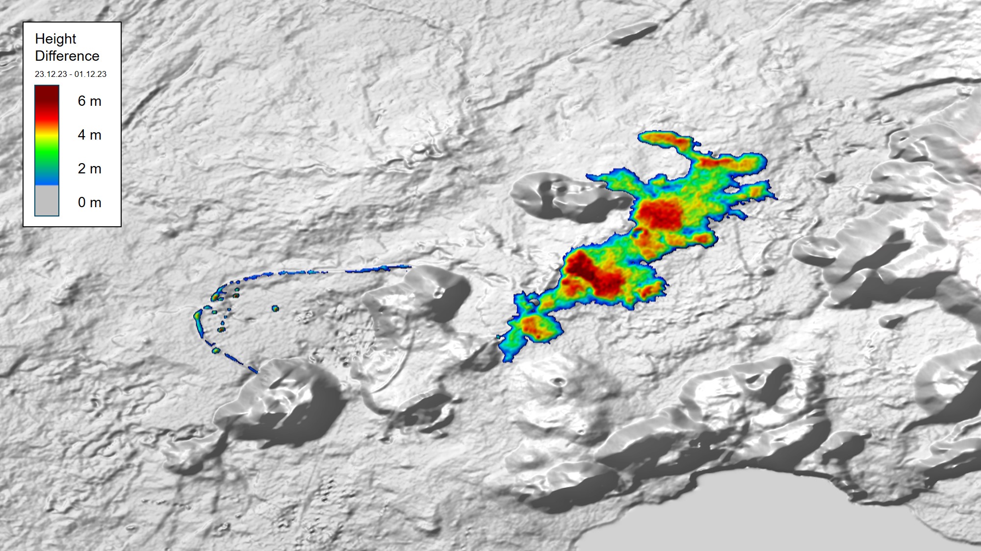
Topographical changes in the area of the Sundhnúkur crater row
These were caused by the volcanic eruption on 18 December 2023.
The two satellites recorded the region both individually and together to calculate a digital elevation map (Digital Elevation Model, DEM), from the combination of a pair of images using interferometry (image above, before and after the eruption). The change in height of the terrain caused by the lava flow and the direction of the flow towards the north-east can be clearly recognised in these maps. The height change is calculated from the difference between two height maps, before and after the eruption (image below). From this, conclusions can be drawn about how much lava was ejected in the eruption. An initial estimate gives a volume of around 15 million cubic metres of lava within the first five days of the eruption. By way of comparison: the volume of material that will be dug for the Brenner Base Tunnel running through the Alps is estimated at around 21.5 million cubic metres, with a planned construction period of 25 years.
Difference between the two elevation models on 1 December 2023 and 23 December 2023
The elevation changes caused by the lava are highlighted in yellow/red.
An interesting detail: The Svartsengi geothermal power plant, an important source of energy for the region, and the well-known Blue Lagoon nearby – closed to visitors before the eruption – are on the centre left of the image. A circular protective wall was quickly built to protect infrastructure and divert the potential lava flows. The construction of this wall can be seen in the comparison of the two DEMs. It was largely completed in the time between the first and second images being taken.
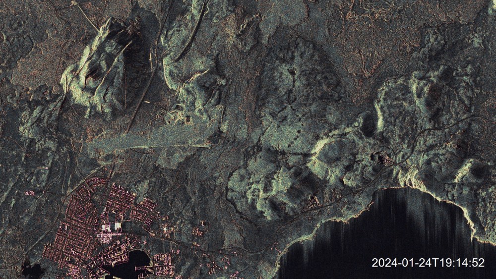
The second eruption on 14 January 2024 can also be seen in the SAR images. Here, lava emerged from two fissures south of the first eruption. To the north of Grindavík, the lava's surface can be recognised above one of the protective walls and directly at the northern end of the town (below, left half of the image). On the right of the second image, slightly lighter areas can be seen on the mountains, presumably caused by snowfall between the first and second images. No elevation model is yet available for this second eruption.
Animated representation of the second eruption of 14 January 2024 on the northern outskirts of Grindavík
A new near-surface magma accumulation of a similar magnitude north of Grindavík makes further eruptions in the area appear likely in the near future.
The TerraSAR-X and TanDEM-X missions were implemented on behalf of the German Aerospace Center (Deutsches Zentrum für Luft- und Raumfahrt; DLR), with funding from the Federal Ministry for Economic Affairs and Climate Action (Bundesministerium für Wirtschaft und Klimaschutz; BMWK). They are the first German satellites to have been created as part of a Public-Private Partnership (PPP) between DLR and Airbus Defence and Space GmbH.
DLR is responsible for the construction and operation of the ground segment as well as for the scientific use of the data and its distribution to external researchers worldwide. Airbus Defence and Space GmbH contributed to the costs of the development, construction and launch of the satellites. The Intelligence Programme Line at Airbus Defence and Space is responsible for the commercial marketing of the data. Since 2016, the project has continued under a follow-on agreement with Airbus.
TerraSAR-X and TanDEM-X are particularly suitable for observing the changes of Earth's surface. They are capable of capturing 2D and 3D images with high resolution, independent of weather conditions and time of day. Both satellites provide high-quality radar images for a wide range of applications in the scientific, commercial and security sectors.


