Topographic map of Arcadia Planitia

Topographic map of Arcadia Planitia
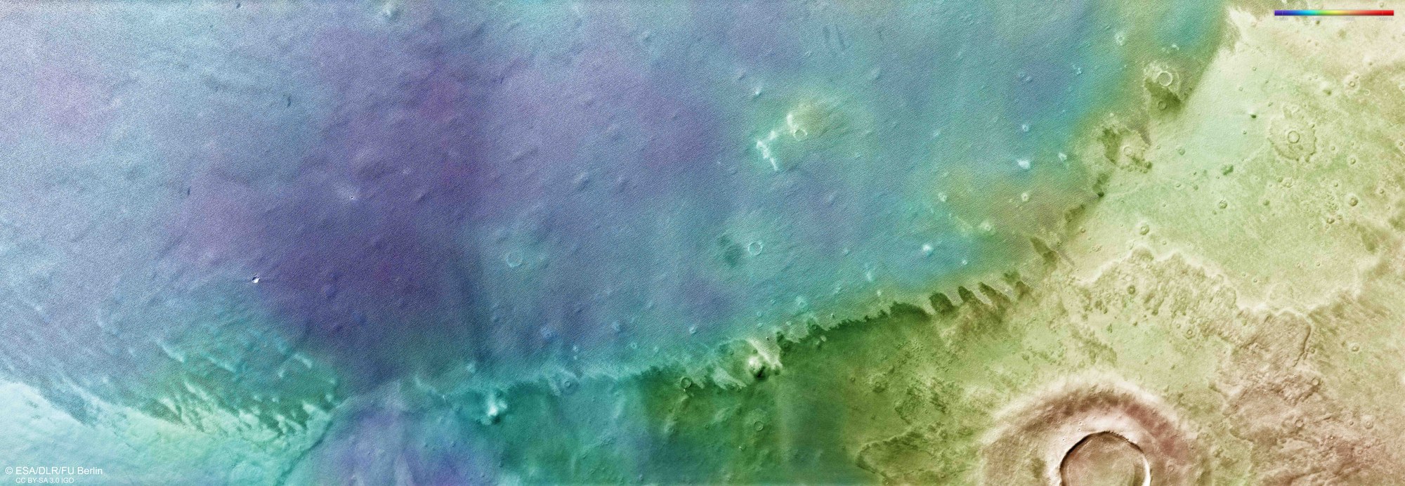
DLR's HRSC stereo camera on Mars Express captures the Martian surface from different angles. Using this data, the DLR Institute of Space Research and the Planetology Department of the Free University of Berlin create digital terrain models. The colour scale (top right) gives elevation values. Altitudes in this region of the northern lowlands vary only by approximately 500 metres. A striking ridge extends diagonally through the scene.