Topographic image map of the Coloe Fossae region

Topographic image map of the Coloe Fossae region
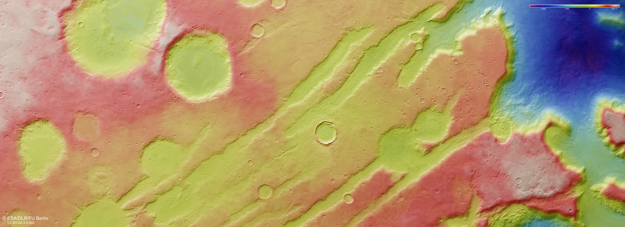
DLR’s HRSC stereo camera on board Mars Express captures the Martian surface from multiple viewing angles using its nine sensors. From this data, the DLR Institute of Space Research and Freie Universität Berlin generate digital terrain models. The colour scale at the top right of the image indicates the elevation values. In the northern part of the Coloe Fossae region, which is crossed by tectonic rift valleys (‘fossae’), the Martian highlands drop abruptly more than 3000 metres into the northern lowlands of Utopia Planitia.