EO Wald – Germany's woodlands at a glance

EO Wald – Germany's woodlands at a glance
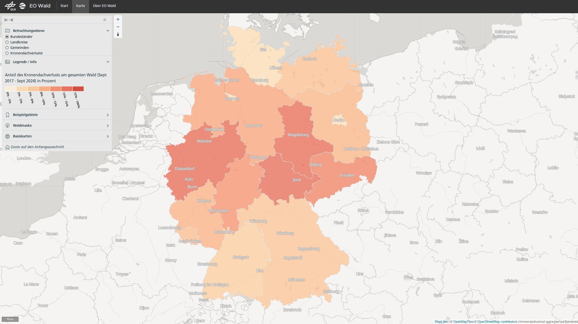
DLR's EO Wald web service offers open-access interactive maps depicting canopy loss across Germany. Losses have been recorded monthly since September 2017, with a spatial resolution of ten metres. Based on satellite data, the maps aim to support the sustainable management efforts of forestry and timber industries and public authorities. The map here provides an overview of canopy cover loss at municipal level from September 2017 to September 2024.