Mosaic image of Lake Lasuntay

Mosaic image of Lake Lasuntay
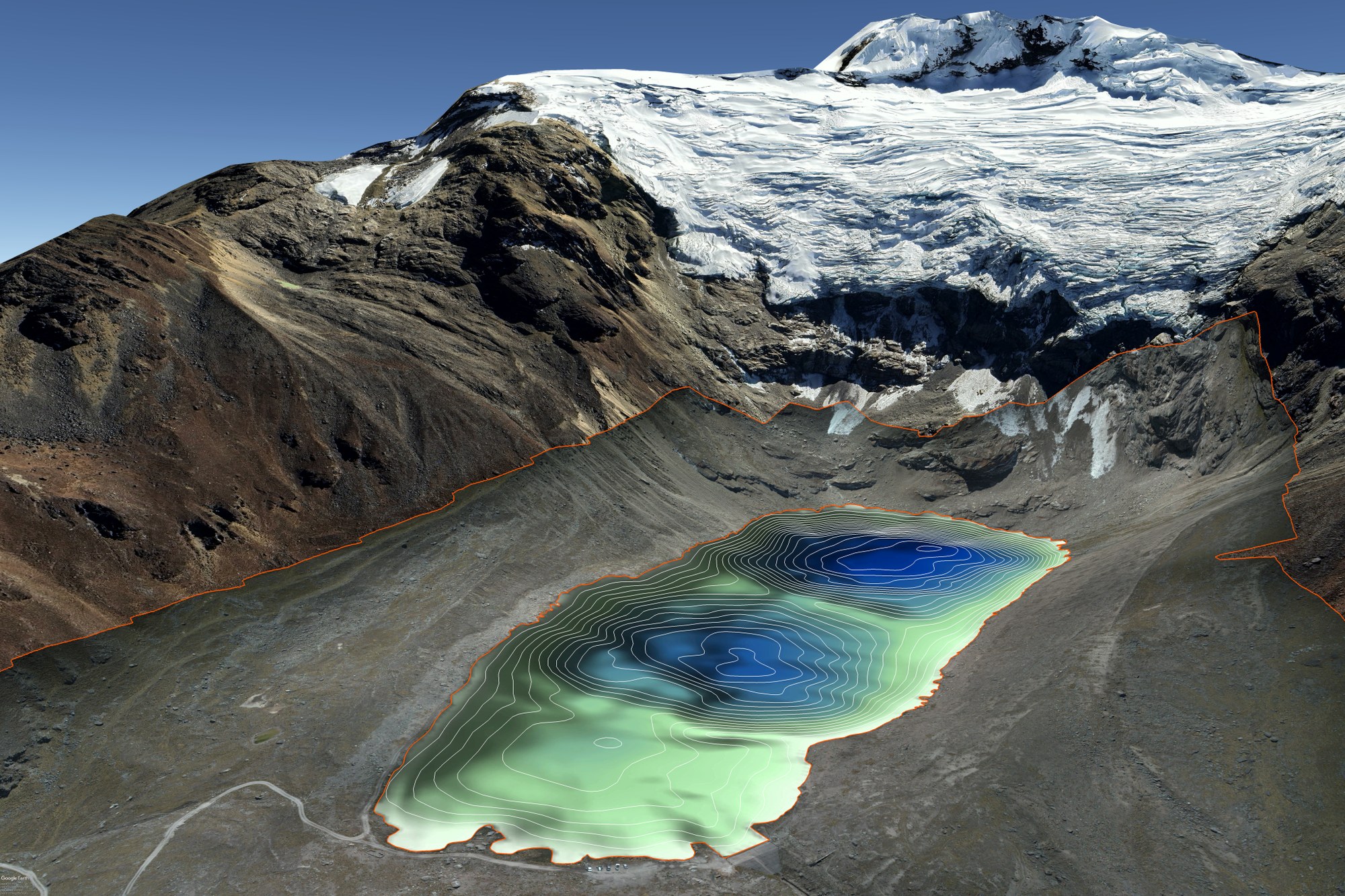
A high-resolution and georeferenced mosaic image of the entire lake and its surroundings (orange lines) was created from overlapping drone images. The topography of the lake bed – the bathymetry – was established on the basis of the water depth measurements and is represented by the white contour lines in the lake.