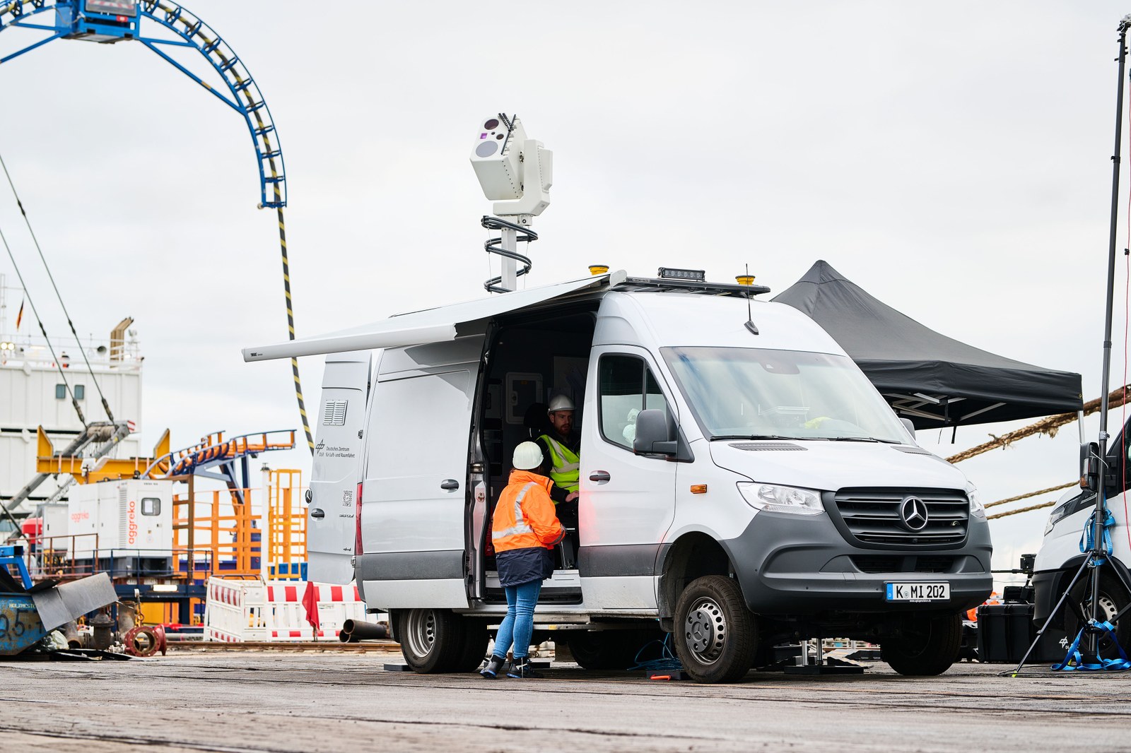
The sabotage of the Baltic Sea pipelines and Europe's dependence on global energy supply chains highlight the importance of protecting maritime infrastructures. Information acquired using sensors from the water, in the air and on land helps to provide an overview of hazardous situations. In Bremerhaven, researchers at the DLR Institute for the Protection of Maritime Infrastructures develop situational pictures based on these sensor data to protect ports and offshore wind farms from accidents and attacks or to inspect sunken objects.
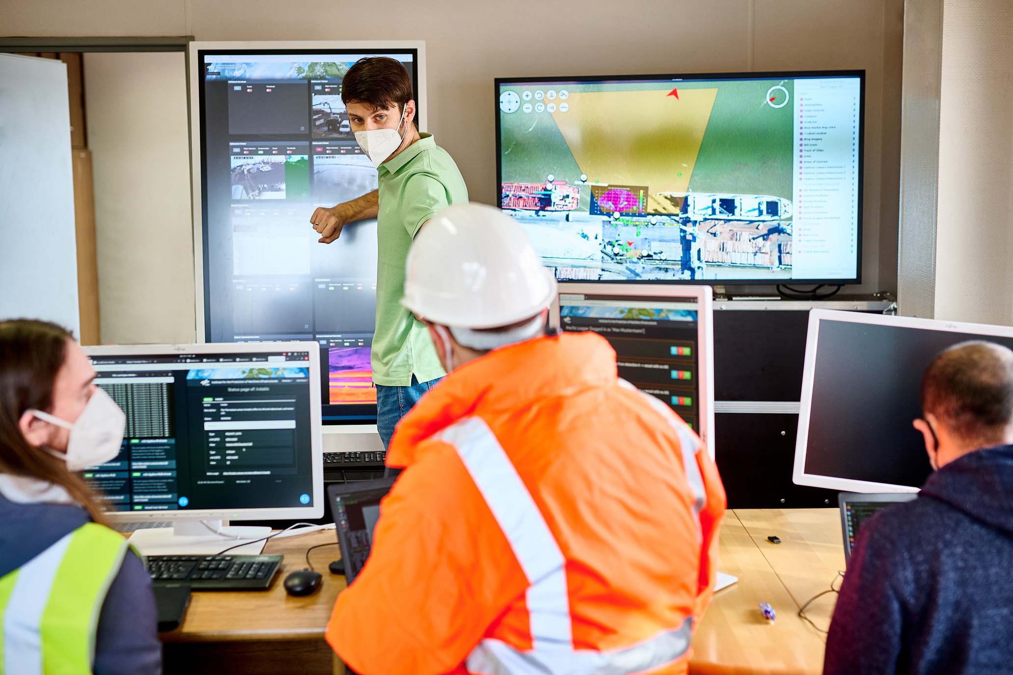
In the Maritime Awareness Realtime Instrumentation Network (MARLIN) project, DLR is developing a situational awareness system that displays security-relevant data in real time. It is intended to help authorities and port operators keep an eye on the situation at all times and to be able to intervene proactively in the event of an incident. The situational awareness system includes information acquired from the water, in the air and on land. Various cameras are installed at the port, or on drones, and autonomous submersibles record the situation underwater using sonar. Together, the individual systems provide a comprehensive overview of the situation. The researchers have already tested the system in two use cases. In the process, they were also able to demonstrate the effectiveness of the interaction between the individual sensors.
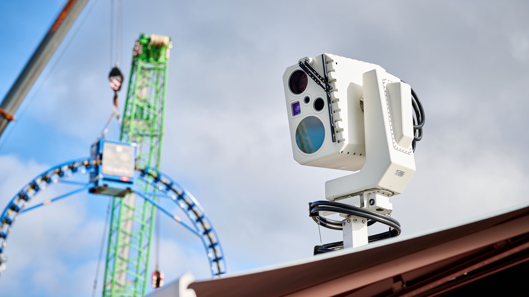
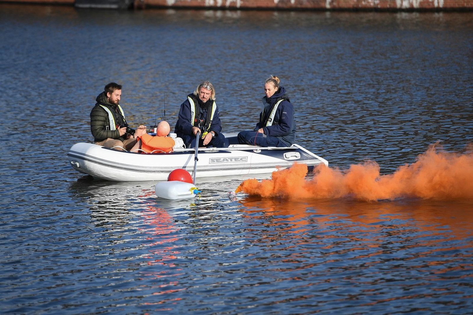
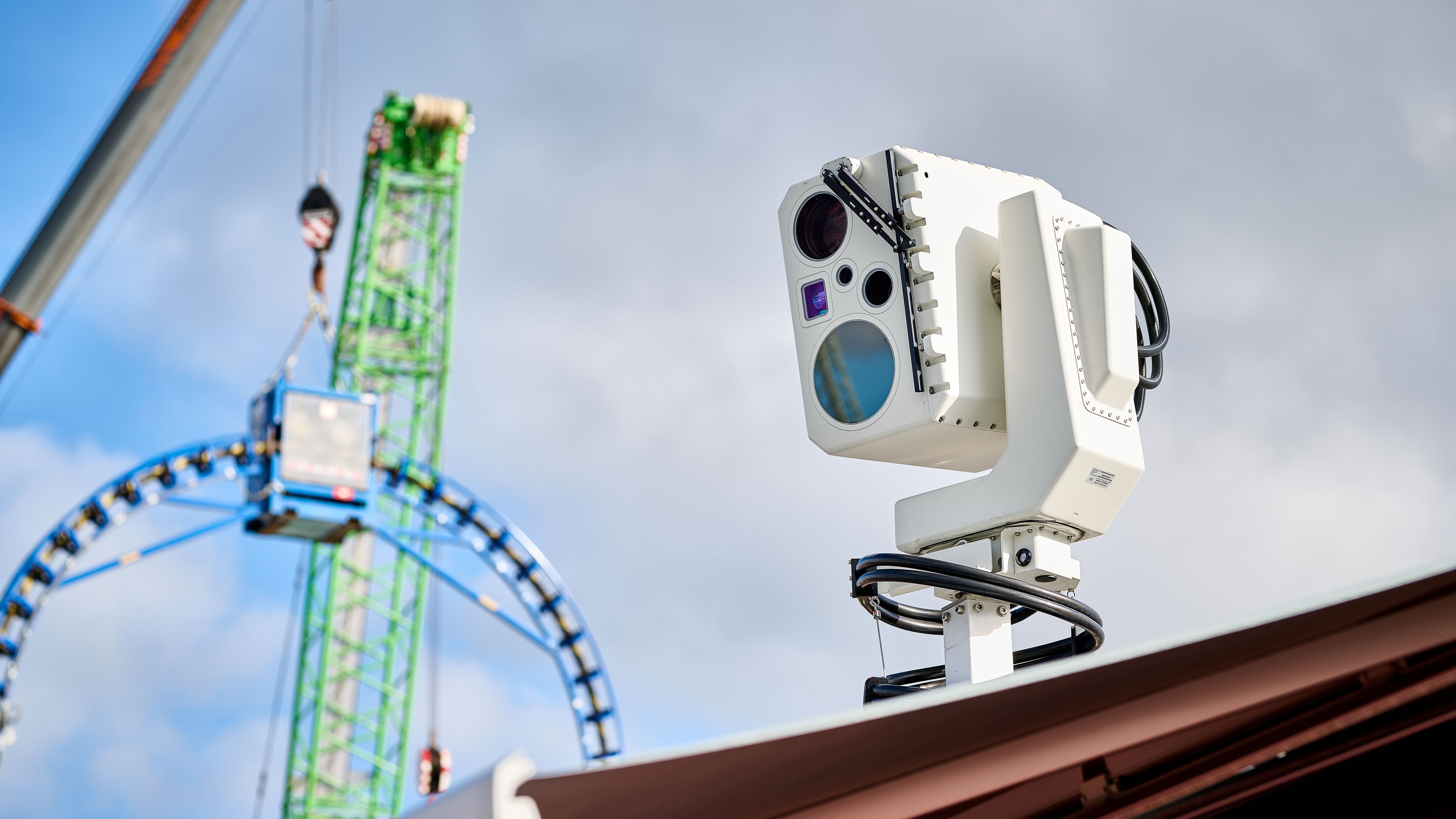
The first test took place in Bremerhaven's Fishery Harbor in 2019. Smoke flares simulated a fire on an inflatable boat while several crates were thrown overboard – some floated on the water while others sank to the bottom. One crew member, in this case a sea rescue training mannequin, also fell into the water. Fixed cameras installed in the harbour area as well as mobile cameras on emergency vehicles and drones – all part of the MARLIN system – observed the situation and provided an overview of the danger zone as well as the surrounding area. Thermal imaging cameras can be used to detect people even in poor visibility, as long as their body temperature has not yet dropped too much. Cameras with active laser illumination, known as rangegated systems, are able to measure the distance to objects through the fog, making it possible to easily locate the training mannequin and the flotsam.
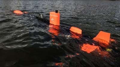
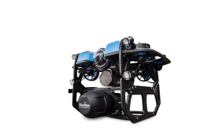
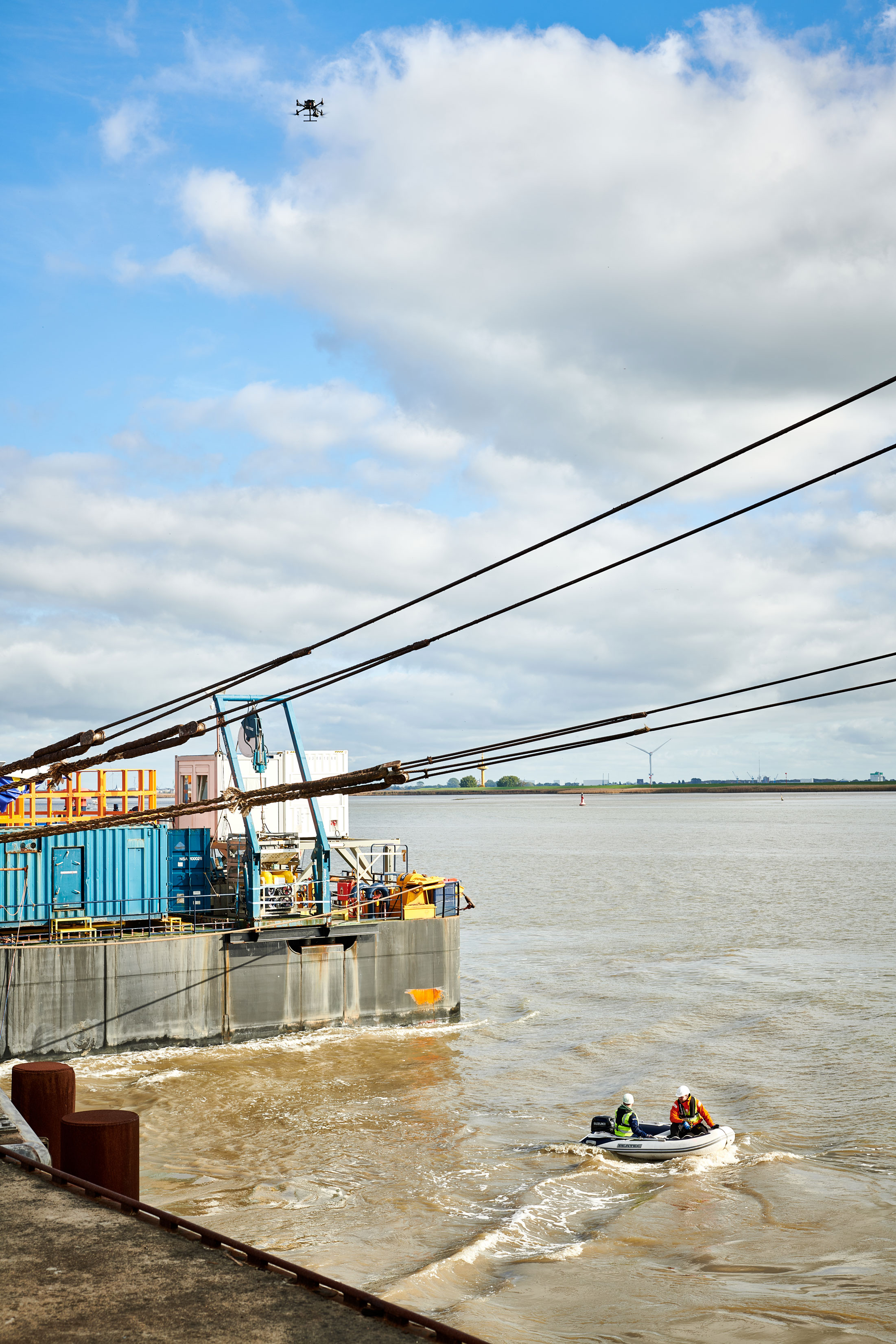
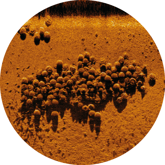
MARLIN combined this incoming information and displayed it in real time in a situational awareness system. Rescue and security teams can use this to obtain valuable information and optimise their operations. The DLR SeaCat, an autonomous underwater vehicle, was then used to survey the harbour basin to identify lost cargo and detect damages in the harbour basin. Detailed images of conspicuous areas were acquired using a smaller, remote-controlled diving robot.
A team of DLR researchers mimics the seaward entry into Nordenham harbour using an inflatable boat.
This was registered by the system and repelled by the second team, which took on the role of security forces.
In October 2022, MARLIN was put to the test a second time – this time in Nordenham harbour. The researchers were divided into two teams. The first team had the task of preventing the cargo of a fictitious dangerous goods transport from being brought ashore in the port. To do this, they first scouted the situation with a drone. This was registered by the system and repelled by the second team, which took on the role of security forces. The intruders then approached simultaneously in a boat and from land. The team approaching from land lit a smoke grenade as a distraction while the other team attempted to enter the harbour unnoticed in an inflatable boat. MARLIN pooled the information gathered by the various sensors in the harbour and analysed the situation. It then alerted the security team. The emergency forces successfully repelled this attempted intrusion, turned away the inflatable boat, averting all danger. "The demonstration was very successful. Our team had to combine many different technologies into a common situational awareness system in a very short time," says Maurice Stephan, head of the Department of Maritime Security Technologies at the DLR Institute for the Protection of Maritime Infrastructures.
The DLR underwater vehicle SeaCat dives to scan Bremerhaven's Fishery Harbor for sunken cargo.
MARLIN uses technologies specially developed by DLR. These include the range-gated camera system developed by the DLR Institute for the Protection of Maritime Infrastructures, which combines a very short laser pulse and a specialised camera. It generates detailed images even in poor visibility, such as in darkness, snow or fog. Another in-house development is the Modular Aerial Camera System (MACS) from the DLR Institute of Optical Sensor Systems, which can be used to quickly create digital maps of small-scale areas. MARLIN combines its own developments with commercial systems such as the Automatic Identification System (AIS) used in maritime navigation, 3D laser scanners and various sonar technologies. This enables it to provide comprehensive positional information. For data analysis, the system uses machine learning methods from the field of artificial intelligence. This makes it possible to automatically detect and classify relevant objects as well as conspicuous events in the scenes being monitored. "MARLIN is intended to form a basis for a variety of different situational awareness systems. From this modular system, different user groups can then select the hardware, such as cameras, underwater sensors or software modules, best suited for their specific purposes," explains Maurice Stephan.
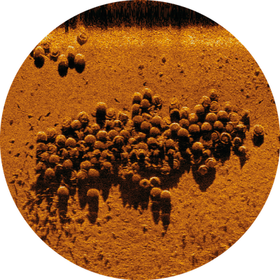
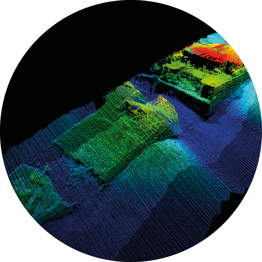
DLR also used the SeaCat and the diving robot to support the North Sea Wrecks project led by the German Maritime Museum. During the project, DLR sensor technology was used to provide detailed images, scans and videos of sunken ships.
3D scan of the barrage breaker Friesland
The ship sank off the coast of Heligoland in 1944. In the North Sea Wrecks project led by the German Maritime Museum. During the project, DLR sensor technology was used to provide detailed images, scans and videos of sunken ships. The rusting wrecks and munitions leak toxins that pollute marine animals and plants.
The deployment on the high seas helped the DLR researchers to improve the calibration of the instruments on the underwater vehicle for specialised situational awareness systems. Hundreds of ship and aircraft wrecks lie at the bottom of the North Sea, not least as a result of the two world wars. They are accompanied by thousands of tons of conventional and chemical munitions. The wrecks, their cargo, fuel tanks and ammunition are all obstacles to navigation and sources of toxins, not to mention often still explosive. They thus pose a threat to people and the environment. In 2021 and 2022, the Heincke, a research vessel of the Alfred Wegener Institute for Polar and Marine Research (AWI), travelled to the sea around Heligoland.
Image of sunken sea mines
The rusting wrecks and munitions leak toxins that pollute marine animals and plants. The toxic munitions should therefore be salvage.
DLR was on board and created underwater images of the World War I cruisers SMS Mainz, SMS Ariadne and SMS Hela, as well as the World War II barrage breaker Friesland. "Operating on the high seas has allowed us to further develop our sensor technology and our diving robot. Highresolution image data provide us with an even more precise overview of the situation underwater," reports David Heuskin, head of the Technology Testing Systems Group at the DLR Institute for the Protection of Maritime Infrastructures. "This experience will help us to use our underwater sensor technology for wider-area situational awareness at sea in the future."
"In the event of a hazardous situation, it is important to take targeted countermeasures and inform energy providers at an early stage so that supply remains secure."
Frank Sill Torres, Acting Director of the DLR Institute for the Protection of Maritime Infrastructures
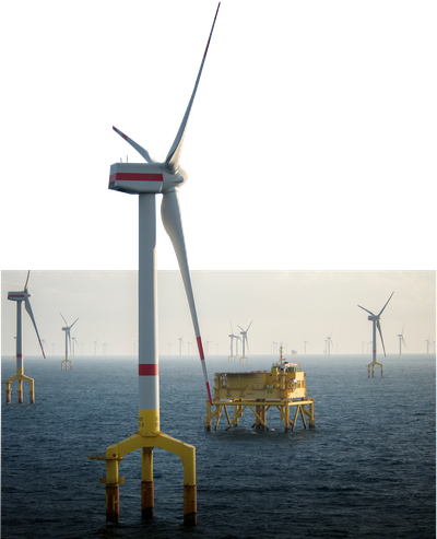
Protecting wind farms
Offshore wind farms are crucial infrastructures for which improved situational awareness could prove critical.
In the Applied Research on Resilience-driven Offshore Wind Farm Safety and Security (ARROWS) project, DLR is exploring possible hazard scenarios for these wind farms.
Credit:
istockphoto/Riccardo_Mojana
Crucial infrastructures for which improved situational awareness could prove critical include offshore wind farms. As their importance to a reliable energy supply continues to grow, so does the potential impact on society from related security threats. Possible hazards include severe weather or drifting ships, but also human threats such as sabotage or attack. In the Applied Research on Resilience-driven Offshore Wind Farm Safety and Security (ARROWS) project, DLR is exploring possible hazard scenarios for these wind farms. The researchers are developing recommendations for action for wind farm operators, energy suppliers and security forces in the event of such a scenario. An interesting factor here is that both the Coast Guard authorities and the potential attackers can only move much more slowly on the water than on the road or in the air. "As the distance of the wind farm from the coast increases, so does the response time of intervention forces like the Federal Maritime Police," says Frank Sill Torres, acting director of the DLR Institute for the Protection of Maritime Infrastructures. "In the event of a hazardous situation, it is important to take targeted countermeasures and inform energy providers at an early stage so that supply remains secure."
Identifying potential hazards, but how?
Situational awareness requires the assessment of a large number of parameters. These include information from camera, radar and sonar systems as well as AIS, weather and marine data. One possible hazard scenario could be an attack on a submarine cable that carries electricity from the wind farm to shore. Information on the location of buried power cables and where they are vulnerable to attacks can be obtained from freely accessible maps. Cables buried less deeply can be manipulated more easily. Thus, a ship approaching such a spot or following the route of a cable represents conspicuous behaviour. The ship's AIS signal sends information such as the voyage route, the type of ship and the national flag of the country under which the ship is sailing. This data can be used to check whether the ship has already attracted similar attention in the past. However, it is possible that the AIS data transmission has failed due to technical problems or that the ship's conspicuous route is due to defective steering. In this case, contacting the vessel directly can provide clarity. "A hazardous scenario cannot always be clearly distinguished from a harmless one. It often comes down to nuance," adds Frank Sill Torres.
From the situation overview to the recommendation for action
In the future, recommendations for action will be incorporated into situational awareness systems as part of efforts to make them 'smarter'. Critical objects and situations could be displayed graphically on a nautical chart or on a digital plan of a wind farm. A future system will map a comprehensive model of the wind farm and provide reliable and timely support to the security forces and operators making decisions in hazardous situations. "We are pleased to contribute to the security of supply of renewable energies," says engineer Sill Torres, referring to the work in the ARROWS project. "A constant exchange with wind farm operators, security authorities and energy suppliers is very important to us and enables us to support them in the best possible way using solutions developed by DLR."


