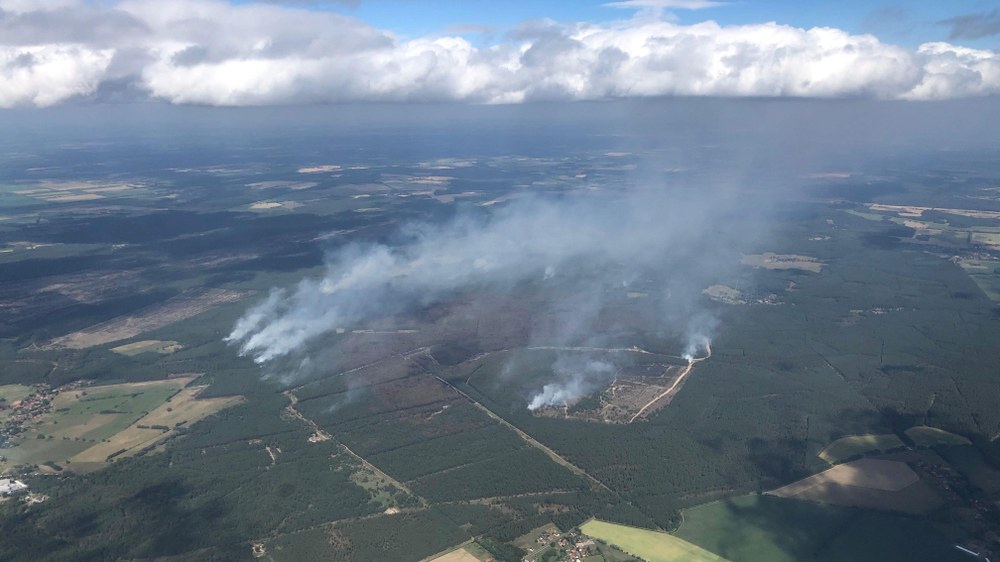
In the summer of 2019, Mecklenburg-Western Pomerania experienced the most severe wildfire in the federal state's history. On 2 July 2019, the DLR Institute of Space Research mapped large areas of the forest fire on the military training area near Lübtheen using a special version of DLR's Modular Aerial Camera Systems (MACS). In cooperation with the DLR Center for Satellite-based Crisis Information (ZKI), emergency services were provided with up-to-date situation maps of the affected regions.
Image: 2/5, Credit:
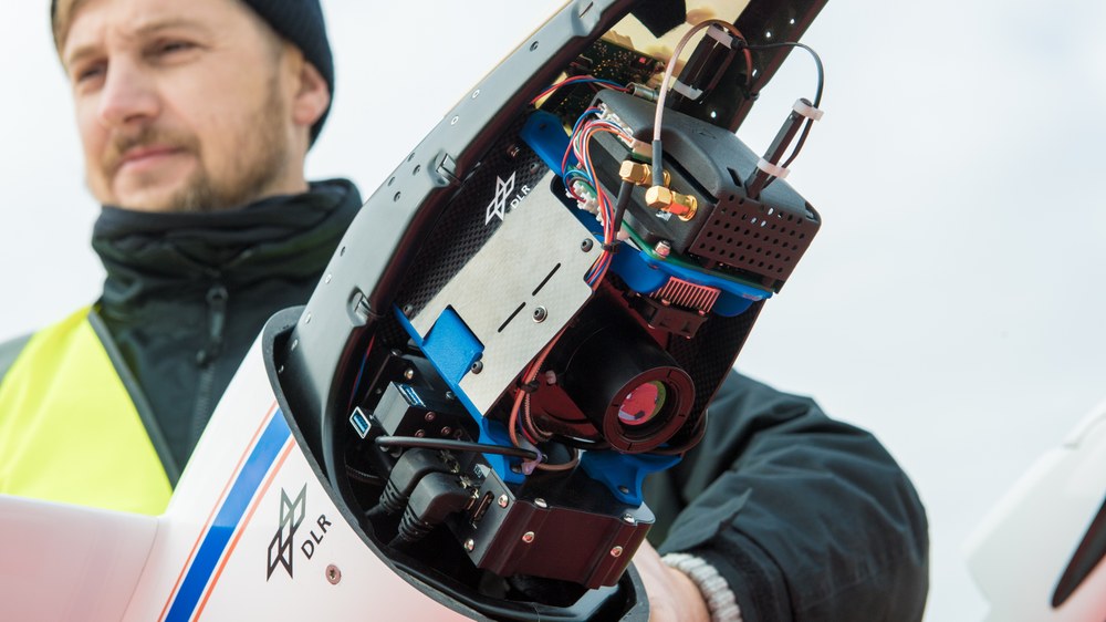
DLR Institute of Space Research
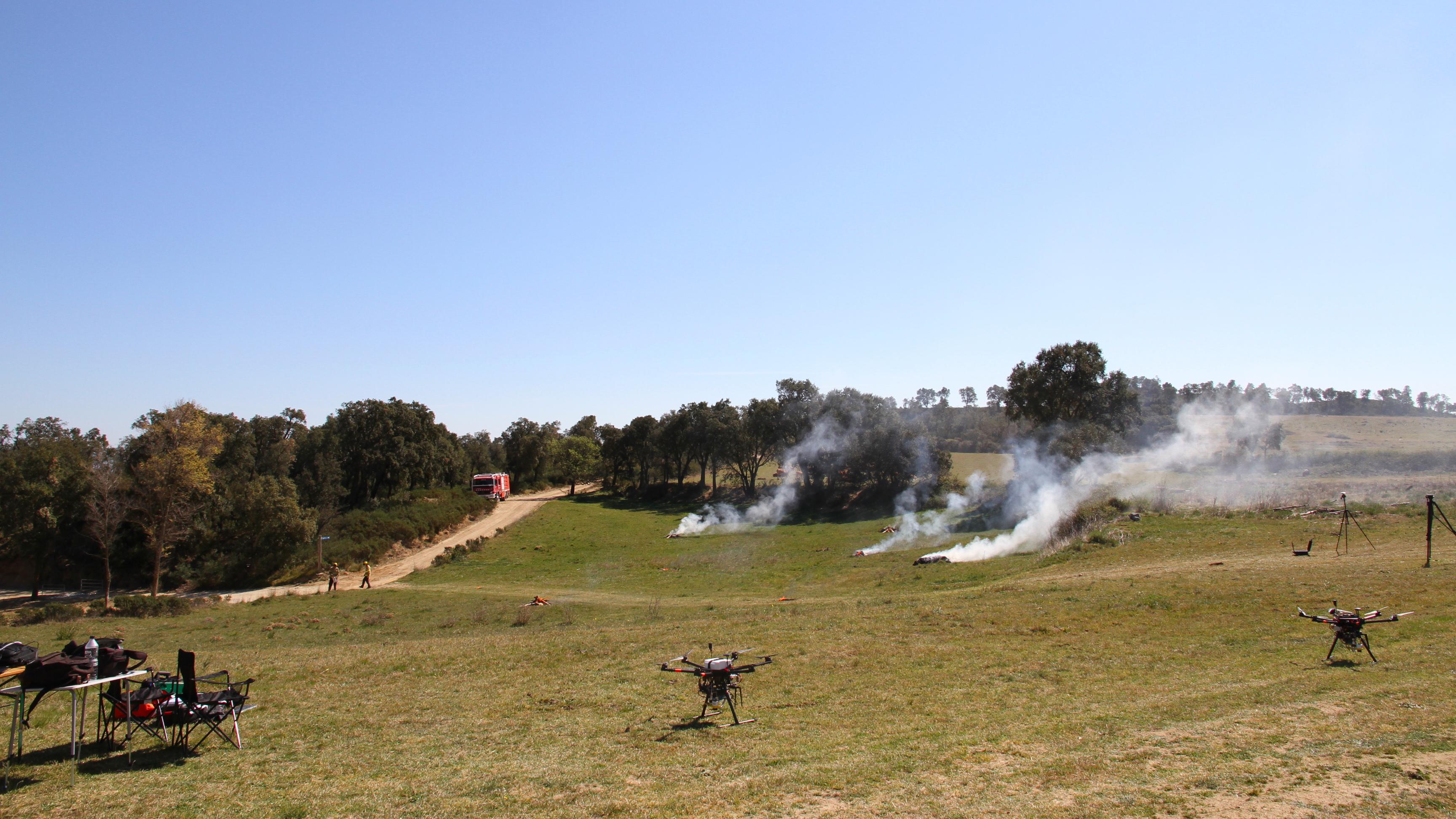
Setting up a measurement campaign
In preparation for a test scenario using DLR drones to research swarm exploration in wildfire fighting and disaster relief, three wildfire hotspots were distributed across a land area for the aerial measurement campaign.
Supplementing Earth observation satellites, crewed and uncrewed systems such as aircraft and drones can rapidly provide detailed data from low altitudes. These airborne systems enable rescue services to plan and execute their operations even more quickly and effectively. Satellites can be directed very precisely over affected regions with commands from the ground. However, when dealing with forest fires and other natural disasters – at least in easily accessible areas in or near inhabited regions – satellites generally cannot match the response speed of airborne reconnaissance. Airborne cameras also achieve far higher ground resolution (down to a few centimetres), making them ideal for detecting smaller fires and even embers that are difficult to spot from the ground. These are decisive advantages that enable rescue services to respond quickly and precisely to what are usually highly dynamic situations.
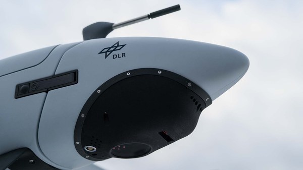
DLR's Modular Aerial Camera Systems (MACS), for example, provides high-resolution optical and thermal images that can precisely locate and measure fire sources while documenting their spread. Other tools being researched at DLR include intelligent drone and robot swarms which in the future will work autonomously and as teams to investigate forest fires and other acute crisis areas. In addition to cameras, detectors for various gases and particles are also used. The aim is to transmit all data to the operations command centre in near real-time and integrate it into the overall situation picture to support on-the-ground tactical decision-making.
The ADELE ('Automated drone use from the control center') project is just as innovative. Here, DLR is working with companies and public authorities to develop a system that enables drones to automatically launch as soon as an emergency call is received – even before the first emergency vehicle sets off. The aim is to transmit live optical and thermal images to the control centre over the 5G network before emergency services arrive, helping to more effectively plan and execute their deployment. The concept has been successfully tested in practice through initial test flights, with a complex large-scale exercise taking place in the Rostock area in September 2025.
Building on this work, the AI4Relief project was launched in the summer of 2025 to investigate how an advanced, AI-supported drone system combined with mixed-reality technologies can improve firefighters' situational awareness. The autonomous, vertical take-off and landing drones are integrated into existing control centre systems, enabling direct communication with the emergency services in a similar manner to ADELE. On top of fire detection, the system optimises resource management and dynamically plans deployment routes, based on a deep-learning model that predicts the spread of wildfires, taking into account weather data, topography and vegetation. This AI assistance system thus supports emergency services in making decisions on route and resource planning.

