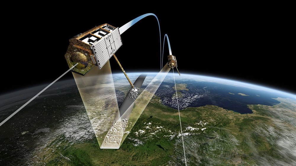
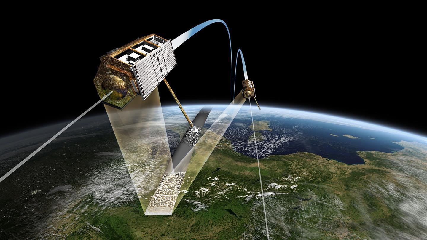
The satellite twins TerraSAR-X and TanDEM-X fly in close formation – sometimes separated by only a few hundred metres – and thus acquire data for digital elevation models.
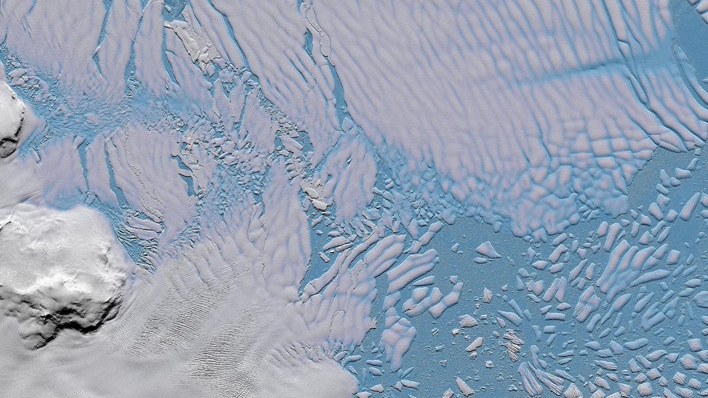
TanDEM-X elevation model – brittle ice shelf of the Thwaites Glacier
TanDEM-X elevation model from 15 July 2014 over the ice shelf of Thwaites Glacier in the West Antarctic. The detached icebergs in the sea ice are clearly visible.
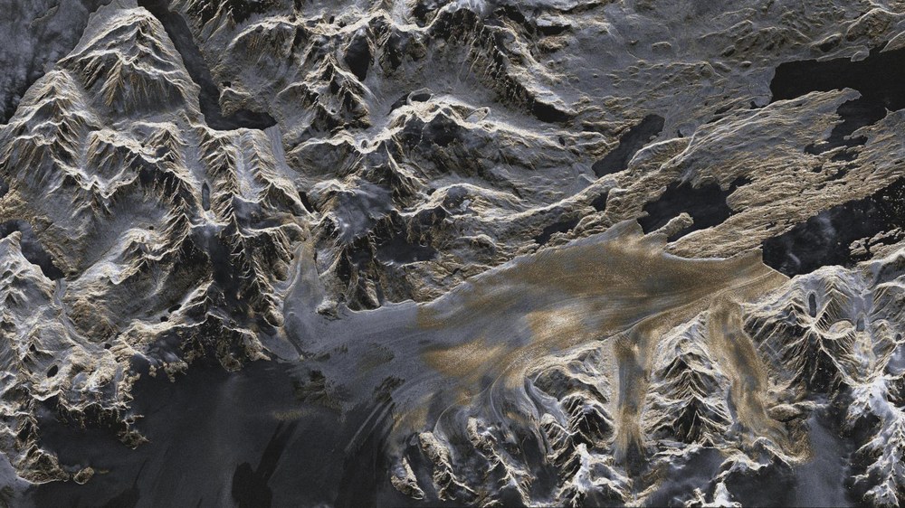
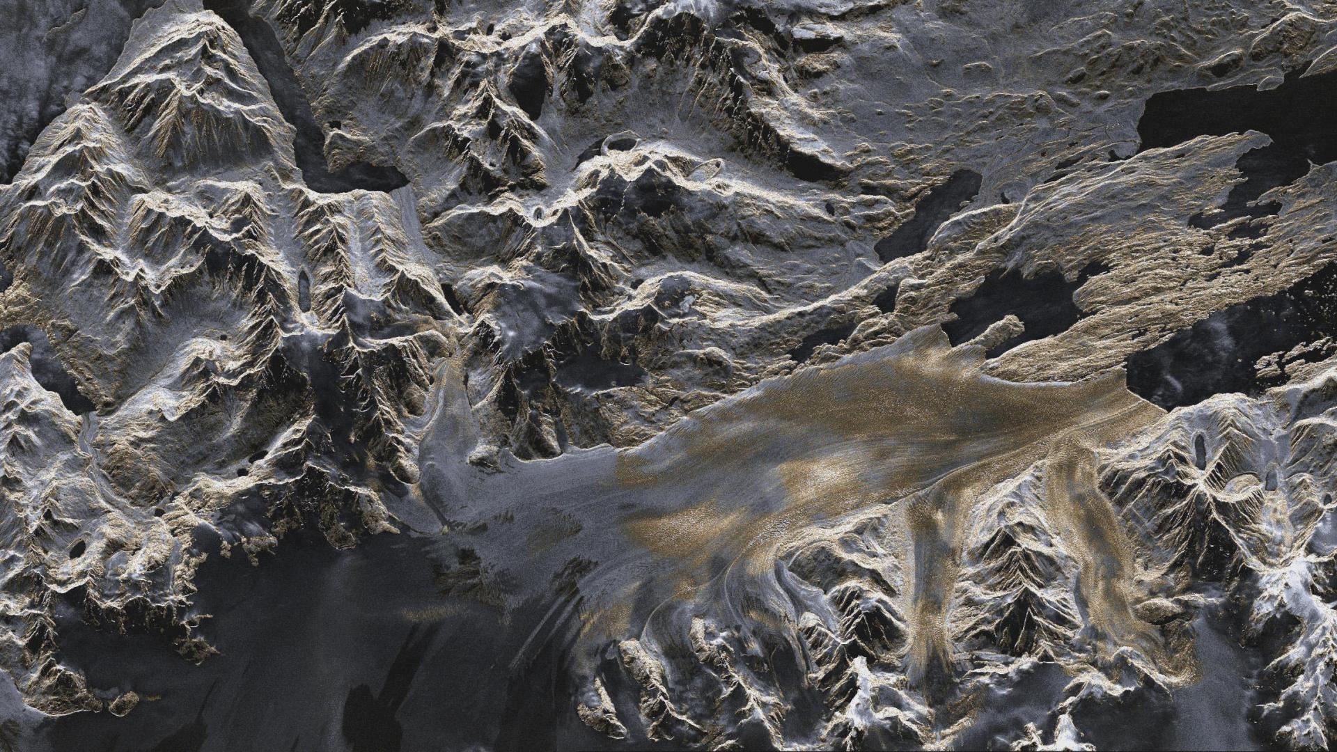
TerraSAR-X image – the Upsala Glacier in Patagonia
Artificially coloured TerraSAR-X image (strip mode) of the Upsala Glacier in Patagonia, Argentina, created using data acquired on 7 January 2008. The colours provide information about the roughness of the terrain. Areas that appear predominantly smooth to the radar are tinted in darker shades of blue and grey. Areas with a coarser surface texture are shown in yellow.
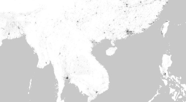
How is Earth changing? Which processes are driving these changes? Instruments on board satellites make it possible to acquire comprehensive information about these matters. They can obtain global inventories and make precise local measurements. With long time series, they also allow researchers to look back in time and to better predict future processes. They can be used to record and document the changes taking place on Earth and thus reveal the causes and consequences of climate change in a unique way. These data form an essential basis for the development of measures at both political and societal levels.
Earth observation satellites provide important information on topics such as the rise in sea levels, the state of global ice masses such as the Greenland Ice Sheet, the increasing greenhouse gas concentrations in the atmosphere and changes in vegetation. They also collect data on global deforestation and the damage to forest ecosystems.
Stefan Dech, Director of the DLR German Remote Sensing Data Center (DFD), explains: "Satellite-based Earth observation is an indispensable tool that seamlessly documents changes on Earth, providing early warning of irreversible damage and indications of when political intervention is necessary. It was the hole in the ozone layer – made visible to humans by satellites – that first led to such an approach. The international community was able to agree on common regulations to stop CFC emissions. The greatest challenge facing humanity now is the containment of unchecked global change on Earth, with its ensuing environmental destruction, loss of species and climate change driven by the growing population and rising demand for resources for food, energy and prosperity. Our satellites and the data they acquire provide a factual and impartial account of the current situation. They show where action is needed and where political measures are already making an impact. With state-of-the-art technologies on its radar satellites including TerraSAR-X and TanDEM-X, DLR facilitates Earth observation regardless of cloud cover and contributes decisively to improving the information on and the scientific understanding of many processes related to climate change. Future German radar technologies will significantly improve biomass measurement and thus also terrestrial carbon sequestration. This will support more robust political decision making and strengthen public acceptance of countermeasures."
Alberto Moreira, Director of the DLR Microwaves and Radar Institute, points out: "Climate change is one of the greatest challenges facing humanity this century, and its consequences are as yet unforeseeable. At the 2015 United Nations Climate Change Conference in Paris, all states committed to ambitious measures. The German Climate Protection Act and the European Commission's Green Deal prioritise practical implementation and greenhouse gas neutrality by 2050 at the latest. Climate monitoring – also as a means of gauging the effectiveness of political measures – is a global task that can only be accomplished with satellite observations. Radar satellites play a special role here because they enable global, high-resolution imaging of large sections of Earth's surface, regardless of weather conditions and the availability of daylight. No other sensor technology in space has this capability. Thus, radar satellites are perfectly equipped to provide geoinformation quickly, precisely, reliably and at a global scale. For several years, we have been working on the next generation of radar satellites for climate research and environmental monitoring, with the aim of providing information urgently needed to solve pressing issues. In times of intense scientific and public debate about the extent and impact of climate change, such a satellite mission could provide important, previously missing information that improves scientific forecasts of climate change and recommendations for socio-political action based on them. The TerraSAR-X and TanDEM-X missions serve as a good benchmark for what can be expected from a future national climate and environment satellite mission."
DLR is active in Earth observation – both satellite-based and airborne – on a large scale. The Remote Sensing Technology Institute, the Microwaves and Radar Institute, the Institute of Atmospheric Physics, the Institute of Optical Sensor Systems (today DLR Institute of Space Research) and the German Remote Sensing Data Center not only address many of the research topics associated with global change but also play leading roles in the related scientific fields. For many years, DLR has been researching global change with a wide variety of missions. It develops archiving and processing technologies, devises algorithms for extracting relevant parameters from Earth observation data and analyses the results.


