EnMAP – the German environmental satellite

The Environmental Mapping and Analysis Program (EnMAP) mission is the first hyperspectral satellite developed and built in Germany. With its two spectrometers, it analyses the solar radiation reflected from Earth's surface at wavelengths ranging from visible light to short-wave infrared – at a hitherto unparalleled spectral resolution. This information can be used to make precise statements about conditions on Earth's surface and how they are changing. Answers to current questions from the fields of environment and near-natural ecosystems, agriculture and forestry, land use, water management and quality, as well as mineralogy and geology, can then be obtained at various scales.

Until now, this sensor technology has only been deployed in aircraft. EnMAP is making this technology available on an operational satellite mission for the first time. The newly acquired data will help to develop a wide variety of applications in the fields of environmental planning and resource management. For example, the information can serve as a basis for the optimised management of arable land, contribute to determining the supply of nutrients and water for plants and assist in the quantification of soil properties.
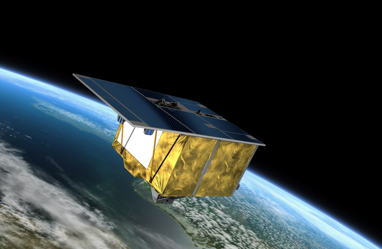
EnMAP was launched from NASA's Cape Canaveral Spaceport in Florida on 1 April 2022. It was transported to its target orbit on board a Falcon 9 rocket built by the US company SpaceX. The hyperspectral satellite will collect data on the state of our home planet for at least five years.
Making the invisible visible with a hyperspectral instrument
EnMAP will regularly deliver high-quality hyperspectral data. Conventional multispectral sensors record the radiation reflected from Earth in just a few, very broad spectral channels. These data can be used, for example, to derive reliable qualitative information about land cover and its spatial distribution. However, to obtain quantitative information concerning, for example, the supply of nutrients to crops, the water quality in lakes or the identification of soil minerals, high-resolution spectral data are required.
For this purpose, the environmental satellite is equipped with an imaging hyperspectral instrument that covers the spectral range from 420 to 1000 nanometres in 95 channels and from 900 to 2450 nanometres in 135 spectral channels, with high radiometric accuracy and measurement stability for the reflected solar intensity. EnMAP will orbit the Earth at an altitude of approximately 650 kilometres. When recording data, the hyperspectral instrument will cover a strip of Earth's surface with a width of 390 kilometres and a ground resolution of 30 metres by 30 metres. Its recording capacity is designed to map strips with lengths of up to 1000 kilometres per orbit and a maximum strip length of 5000 kilometres per day. Once a target location within a strip has been examined, it can be observed again within four days, because the satellite can be slewed perpendicular to its direction of flight by up to +/- 30 degrees. EnMAP is therefore ideally suited for the documentation of spatio-temporal changes such as erosion processes or vegetation cycles.
Spectroscopic Earth observation provides insights into the extent of the ecosystems in many different natural environments and what they are composed of – from coastal zones and man-made cultural landscapes to steppes, deserts and forest areas. Quantitative, diagnostic information can be obtained on this basis concerning vegetation, land use, rock surfaces and bodies of water. These data provide insights into the mineralogical composition of rocks, the damage to plants caused by airborne pollutants or the degree of soil contamination.
EnMAP – the German environmental mission and its partners
The EnMAP environmental mission is managed by the German Space Agency at DLR in Bonn on behalf of the Federal Ministry for Economic Affairs and Climate Action (BMWK). OHB System AG was commissioned to develop and build the satellite and its hyperspectral instrument. The German Research Centre for Geosciences (Deutsche GeoForschungsZentrum; GFZ) in Potsdam is the scientific lead for the study.
Three DLR institutes and facilities have been commissioned to set up and operate the ground segment. The German Space Operations Center in Oberpfaffenhofen will conduct and monitor satellite operations, while the German Remote Sensing Data Center and the DLR Remote Sensing Technology Institute will archive, process and validate the received satellite data and make them accessible to users in the scientific community. Companies and public authorities will also be able to view the data and use them to prepare future services. The use of EnMAP hyperspectral data by universities and scientific institutions and the development of special applications will be supported by BMWK funding programmes.