INTAS
Adobe Stock und Franz Andert
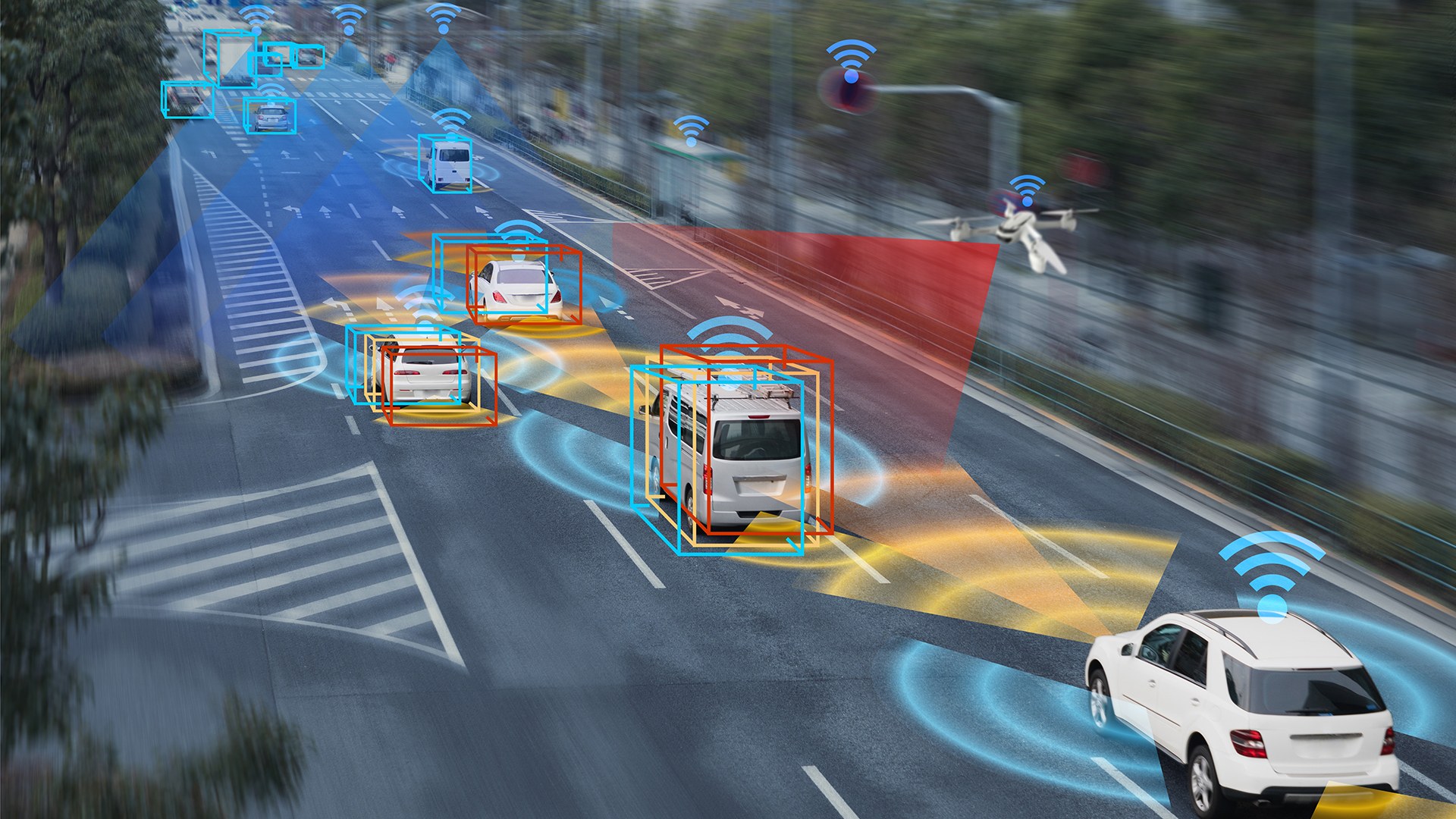
The interdisciplinary INTAS project focuses on integrating sensor data collected from different platforms to serve a unified objective. One example is the exploration of the environment with several air and ground vehicles: each vehicle is equipped with sensors to record the environment and communicate with the other vehicles. The vehicle network uses this data to generate a collaborative map of the environment, which not only serves the purpose of exploration, but also enables the individual participants to drive and fly with foresight and navigate in diverse environments.
Because of inaccuracies in vehicle positioning and sensor systems, the data intended for merging may not align perfectly, necessitating the use of intelligent processes for data registration and fusion. Furthermore, traffic data typically isn't inherently compatible with aerospace systems data.
INTAS – joint software solutions for transport
In this context, additional scientific challenges are present, and the DLR institutes engaged have already devised several solutions. The INTAS project consolidates these ideas and constructs unified software modules for subsequent utilisation across various institute applications. This software aims not only to establish a distributed environment recording system but also to facilitate spontaneous communication among diverse sensor platforms. It ensures the reliability of merged data and associated properties, such as accuracy specifications. Consequently, the collected distributed environmental data will be more precise and less vulnerable to interference. This advancement will enable vehicles to autonomously and spontaneously communicate and exchange data with unmanned aerial systems.
New opportunities through networked systems in transport, aviation and space
Ultimately, there are many applications for the methods developed in ground-based transport, aeronautics and spaceflight: networked and automated cars receive an extended field of vision by receiving information from the traffic infrastructure and from other vehicles and teleoperated vehicles can be manoeuvred with high precision using external sensors. In addition, unmanned aerial vehicles provide up-to-date data in the event of special incidents or in areas where there is little infrastructure.
Networking allows the aircraft to support each other and localise data collected with high precision. Planetary exploration missions with several spacecraft deliver faster and more accurate results and are more robust against failures of individual platforms. In test environments, transport technologies and infrastructure components can be used to support and evaluate space systems.
INTAS thus brings together scientific experts from different institutes and domains, and the joint software framework sustainably increases the performance of the participating institutes.
The INTAS project – Intelligent ad-hoc sensor networks
- Duration: January 2023 to Dezember 2025
- Lead institute: DLR Institute of Transport Research
- Project type: Cross-programme DLR-internal project from the Executive Board impulse
- Funding body: DLR Transport Programme Directorate, DLR Aviation Programme Directorate, DLR Space Programme Directorate, DLR Security Research Programme Directorate
- Project budget: 5,2 millionen euros full costs

