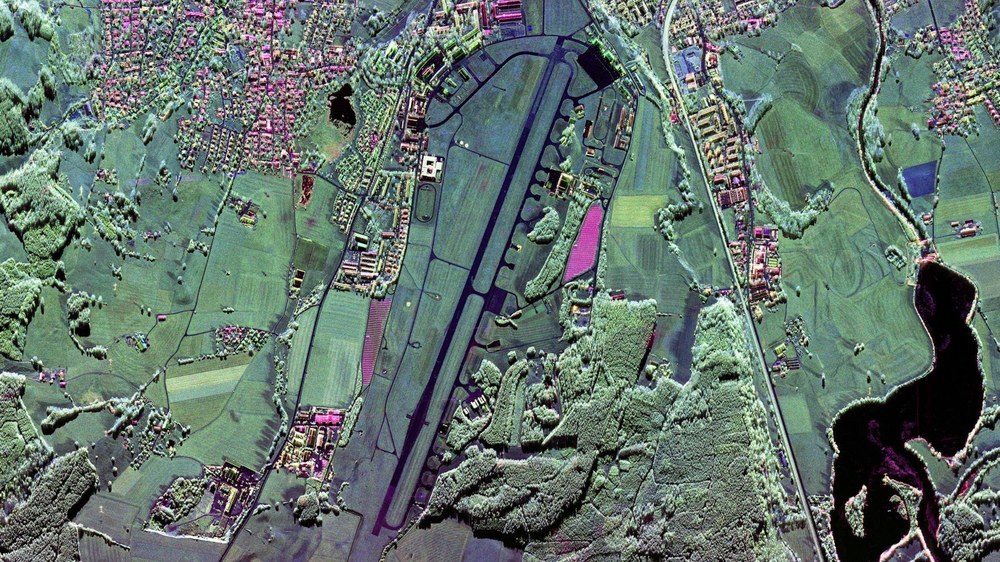
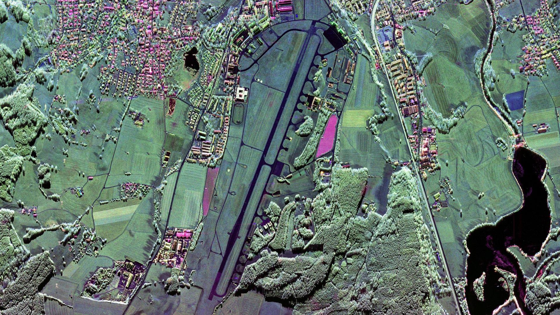
The former Bundeswehr air base, Kaufbeuren, lies about 70 kilometres away from the DLR Oberpfaffenhofen site. Radar reflectors are set up along the runway for testing and calibration purposes. This is a high-resolution, polarimetric F-SAR image in the X-band (2018).
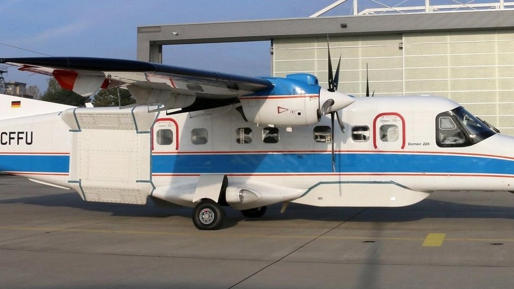
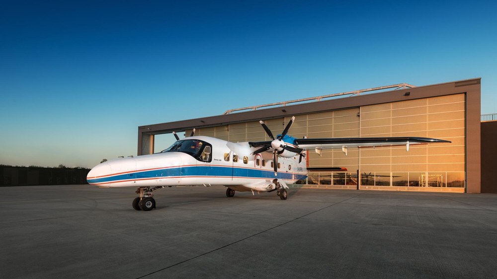
The airborne synthetic aperture radar (SAR), designated F-SAR, is a large-scale research facility at the DLR Microwaves and Radar Institute based in Oberpfaffenhofen. Operated on board DLR’s Dornier DO 228-212 research aircraft, the system is in a class of its own in terms of performance. Unique in the world, the F-SAR delivers SAR image data of the highest quality in five different frequency bands (X-, C-, S-, L- and P-band), up to four of them simultaneously. At the same time, the F-SAR offers fully polarimetric measurement modes in all frequency bands, as well as single-pass interferometric imaging in the X and S bands.
Precise surveying of the Earth's surface along pre-defined flight paths
A GNSS-supported high-precision navigation system integrated into the F-SAR enables well-trained pilots to fly predefined flight paths with metre accuracy. This ensures high data quality, which is particularly important for multi-pass SAR interferometry. Precisely flown, spatially and temporally variable interferometric baselines are a prerequisite, for example, for the detection of elevations and subsidence of the earth's surface (D-InSAR method) or the determination of forest heights (Pol-InSAR and TomoSAR methods). The F-SAR is also characterised by a highly accurate calibration of the entire system. This is ensured by the precise measurement of the signal transmission properties in the laboratory and by the operation of a permanent calibration field.
The large-scale research facility is used to develop new types of signal processing methods and to test new measurement techniques in the fields of environment, transport and security. For this purpose, regularly scientific flight campaigns are conducted with F-SAR, often in collaboration with external research institutes. The obtained data forms the basis for a wide range of further research activities in the fields of earth observation and environmental sciences. In addition, the knowledge gained on the technology and application of synthetic aperture radar provides essential information for the design and optimisation of current and future SAR satellite missions.
Contact
F-SAR management
German Aerospace Center (DLR)
Microwaves and Radar Institute
Münchener Straße 20, 82234 Weßling
Germany
Volker Speelmann
Head of Research Infrastructures
German Aerospace Center (DLR)
Executive Board department for Innovation, Transfer and Research Infrastructure
