Forest canopy height map of the Amazon basin derived by combining DLR’s interferometric TanDEM-X measurements and NASA’s GEDI lidar measurements.
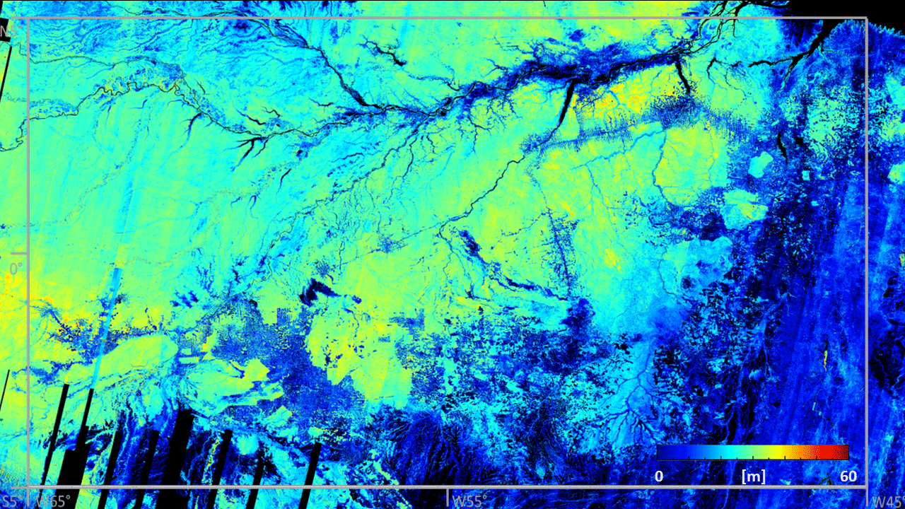

Forest canopy height map of the Amazon basin derived by combining DLR’s interferometric TanDEM-X measurements and NASA’s GEDI lidar measurements.
Credit: DLR (CC BY-NC-ND 3.0)