Research flights over Canada analyse greenhouse gases


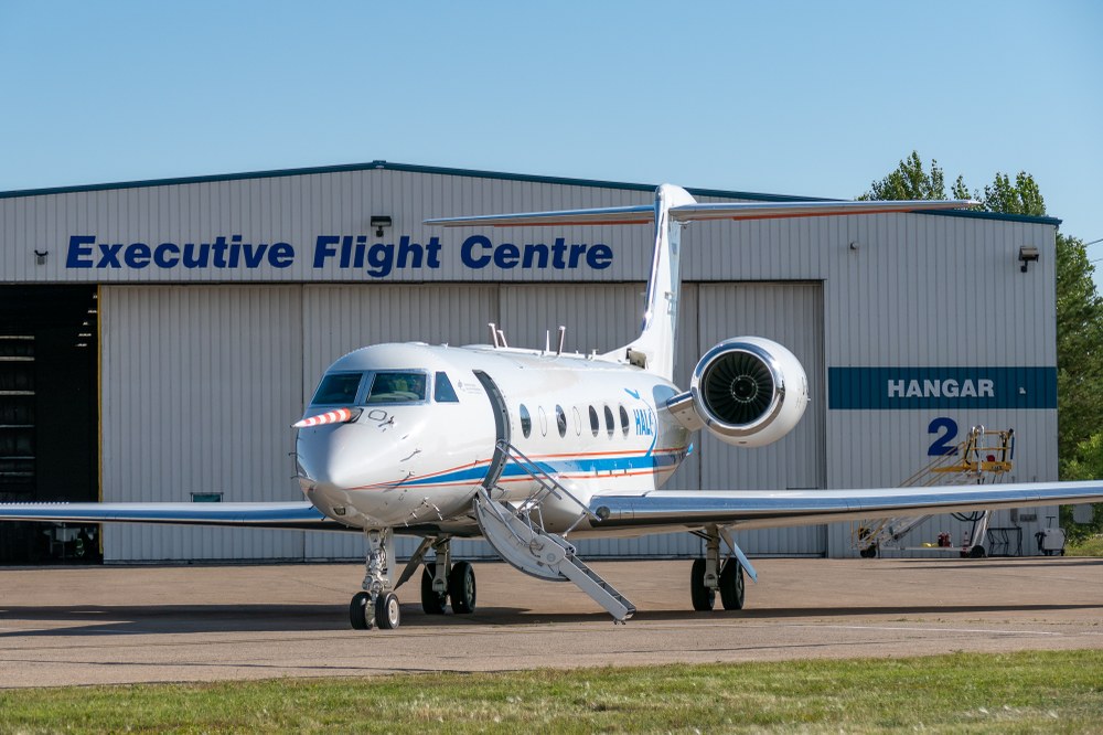
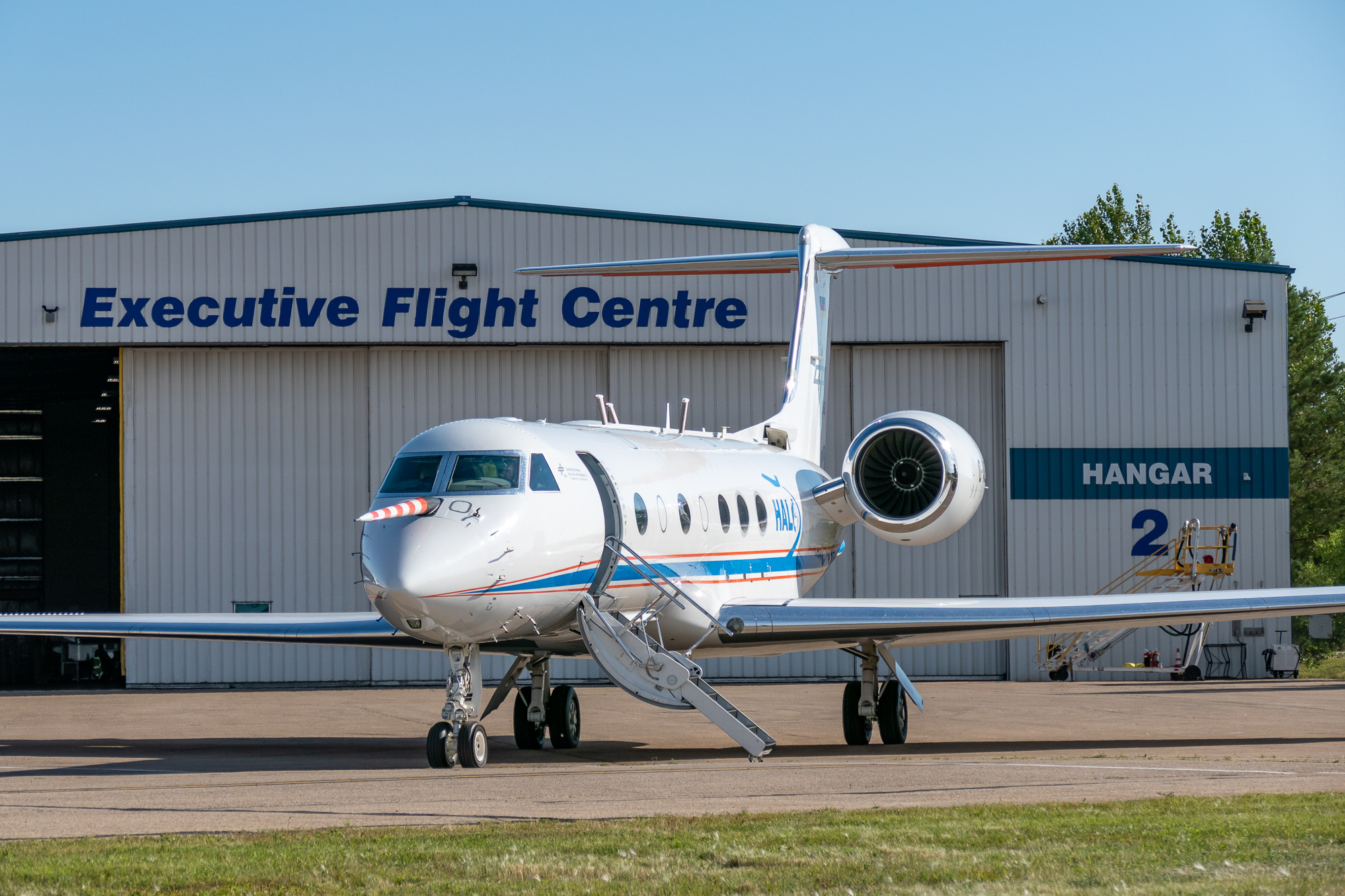
- The HALO research aircraft measures greenhouse gases over Canada.
- The CoMet 2.0 Arctic mission aims to analyse natural and manmade methane sources more closely and to test new climate monitoring tools.
- Focus: Space, Earth observation
Coal mining, oil and gas production, landfill and agriculture are all anthropogenic sources of the greenhouse gas methane, which is the second most important contributor to climate change after carbon dioxide. A methane molecule has an up to 86 times stronger climate impact than carbon dioxide. This is compounded by Earth's large wetlands and thawing permafrost, which are among the most important, albeit least understood, natural sources and sinks in the global methane and carbon dioxide budget. In August and September 2022, the German research aircraft HALO will fly over Canada to investigate more precisely how much these individual sources emit greenhouse gases and how more clearer distinctions can be drawn between natural and manmade sources in analysis. As part of the CoMet 2.0 Arctic (Carbon dioxide and methane mission for HALO) mission, the German Aerospace Center (Deutsches Zentrum für Luft- und Raumfahrt; DLR) is conducting research alongside partners from the Max Planck Institute for Biogeochemistry in Jena, the University of Bremen and Ludwig Maximilian University (LMU) in Munich to record climate gas emissions more precisely and extensively in future, with a view to making climate forecasting more accurate.
"Ambitious targets for limiting greenhouse gas emissions and thus global warming require effective monitoring of greenhouse gas emissions," says Anke Pagels-Kerp, DLR Divisional Board Member for Space. "The CoMet 2.0 mission makes a significant contribution towards providing new tools for climate monitoring and improving the data basis for future climate policy decisions. This demonstrates DLR's interdisciplinary strength in developing new space sensors and testing and using them on the ground, in the air and ultimately in space."
Innovative instruments for recording greenhouse gases are being tested as part of the mission. The CHARM-F (CH4 Atmospheric Remote Monitoring) lidar measuring device developed at the DLR Institute of Atmospheric Physics enables the measurement of methane and carbon dioxide independently of sunlight, from a great distance and with a high degree of accuracy. "In the future, this kind of a lidar instrument will be at the heart of the German-French Methane Remote Sensing Lidar Mission (MERLIN) to determine regional and global emissions of the greenhouse gas methane from space," explains CoMet 2.0 Arctic Project Manager Andreas Fix of the DLR Institute of Atmospheric Physics in Oberpfaffenhofen.
HALO also carries the MAMAP2DL imaging spectrometer from the University of Bremen, which records methane and carbon dioxide from local sources and is an airborne preliminary experiment for future satellite sensors such as the CO2M mission (Copernicus CO2 Monitoring). The spatially high-resolution imaging spectrometer specMACS, developed by the LMU Munich, characterises the reflectivity of the ground and allows the precise detection of clouds that interfere with methane remote sensing. The scientific instruments are supplemented by two cavity ringdown spectrometers from the Max Planck Institute for Biogeochemistry in Jena and the DLR, which are used to measure the main greenhouse gases in situ, as well as a sample collector for identifying the composition of these and other gases in laboratory analyses of the collected air samples. In addition, the research flights help to better calibrate data from already active satellite missions such as Sentinel-5P, GOSAT-1, GOSAT-2 or EnMAP. The location of large wetlands and permafrost regions at high latitudes is particularly challenging for passive satellite instruments without their own light source, as the often low levels of solar radiation and heavy clouds can have a disruptive effect.
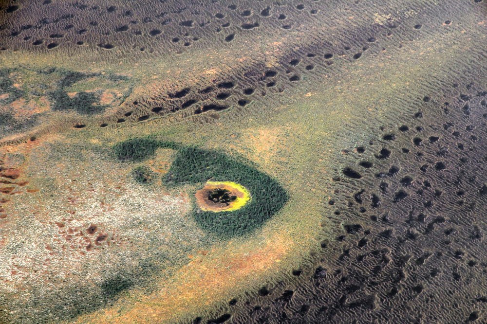
Flying low over a river delta and flying high into the north
While remote sensing instruments such as lidar or MAMAP2DL require HALO to conduct research flights at an altitude of around 7 to 10 kilometres, performing in-situ comparison measurements often requires flying as deeply as possible into the air masses from various emission sources to be sampled. This is invariably a challenge for the pilots. "For CoMet 2.0 Arctic, for example, we carried out extensive low-level flights over the Mackenzie River Delta and over oil and gas production regions at 500 to 600 metres above ground level," reports DLR research pilot Marc Puskeiler. The Mackenzie River Delta, just north of Inuvik, is one of the wetlands in the Canadian Arctic surveyed on the HALO flights. Wetland vegetation absorbs and stores carbon. When it decomposes, it releases carbon dioxide and methane. These processes make wetlands like the river delta one of the most important, albeit least understood, sources and sinks of global methane and carbon dioxide. "This task calls for flying skills and extensive preparation," says Puskeiler. "In Canada, in particular, we discussed our various flight plans in detail with the national aviation safety authority NAV Canada and representatives of the indigenous peoples living in the areas we fly to." HALO research flights take off from Edmonton airfield in the Canadian state of Alberta.
Methane: a powerful greenhouse gas
In general terms, carbon dioxide is widely known to be the greenhouse gas emitted in the greatest quantities by human activity. What is less well known is that despite having a 200-times lower concentration within the atmosphere than carbon dioxide, methane also has a very large greenhouse gas potential. According to a report by the Intergovernmental Panel on Climate Change in 2021, over the first 20 years, an emitted methane molecule is 86 times more damaging to the environment than a carbon dioxide molecule. For 100 years, this value drops to a still considerable 28-fold climate impact, as methane is degraded faster in the atmosphere. Overall, carbon dioxide has accounted for about 65 percent of global warming since the start of the industrial revolution, and methane for about 18 percent of all greenhouse gases emitted by humans. Since 1750, the concentration of methane in the atmosphere has more than doubled, while that of carbon dioxide has increased by around 44 percent over the same period.
Greenhouse gas emissions from forest fires
Forest fires are another source of large-scale greenhouse gas emissions. "We are also monitoring these fires as part of our current HALO research flights," reports Andreas Fix. "In addition to the carbon dioxide that is obviously released in such fires, they can become a significant source of methane if combustion is not complete." Measuring flights near fires cannot be planned in advance, so they can only be added to routes at short notice. Nevertheless, the CoMet 2.0 Arctic team managed to fly to a large forest fire on the edge of the Rocky Mountains.
Wide-ranging collaboration on research flights
The Comet 2.0 Arctic mission of the German research partners DLR, the Max Planck Institute for Biogeochemistry in Jena, the University of Bremen and the Ludwig-Maximilians-Universität München, is part of a wide range of international collaboration activities. Internationally, the research campaign is part of the AMPAC initiative (Arctic Methane and Permafrost Challenge) by ESA and NASA, which aims to document analysis of Arctic climate gas emissions in a coordinated manner. As part of these efforts, HALO completed research flights with NASA's research aircraft, a B200 and a G III, back in August. The Canadian space agency CSA is flying high-altitude research balloons for numerous comparative measurements. At the same time in the Mackenzie River Delta, the Geological Survey of Canada (GSC) is active with ground, helicopter and ship measurements. Small aircraft on behalf of the Environmental Defense Fund investigate methane sources such as coal mines, landfills and oil extraction plants. Here, too, HALO conducts joint measurement flights with partners.
Overall, HALO will operate around 140 flight hours as part of the CoMet 2.0 Arctic mission, which is financed by DLR, MPI Jena and the DFG. In September, the researchers are eagerly hoping for suitable flying weather over the Hudson Bay Lowlands for the remainder of the mission. After Siberia, these are the second largest wetlands in the northern hemisphere, covering an area larger than Germany. Their exact methane emissions are one of the great unknowns in the struggle for more precise climate forecasting. HALO's long range is crucial for performing such flights. The previous CoMet mission took place in 2018 and analysed greenhouse gas sources across Europe, travelling between Finland and North Africa. This allowed methane emissions from an entire region, the Upper Silesian coalfield, to be quantified for the first time with the help of aircraft measurements.
Links
About HALO
The HALO (High Altitude and Long Range) research aircraft is a joint initiative of German environmental and climate research institutions. HALO is funded by grants from the German Federal Ministry of Education and Research (BMBF), the German Science Foundation (DFG), the Helmholtz Association, the Max Planck Society (MPG), the Leibniz Association, the State of Bavaria, the Karlsruhe Institute of Technology (KIT), the Forschungszentrum Jülich, and the German Aerospace Center (DLR).