A decade of satellite data reception in Inuvik
A decade of satellite data reception in Inuvik
Inuvik ground station
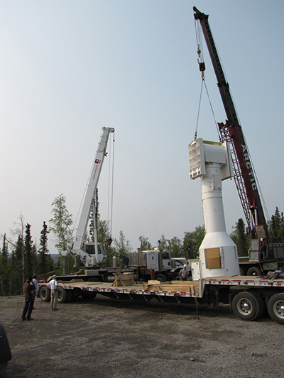
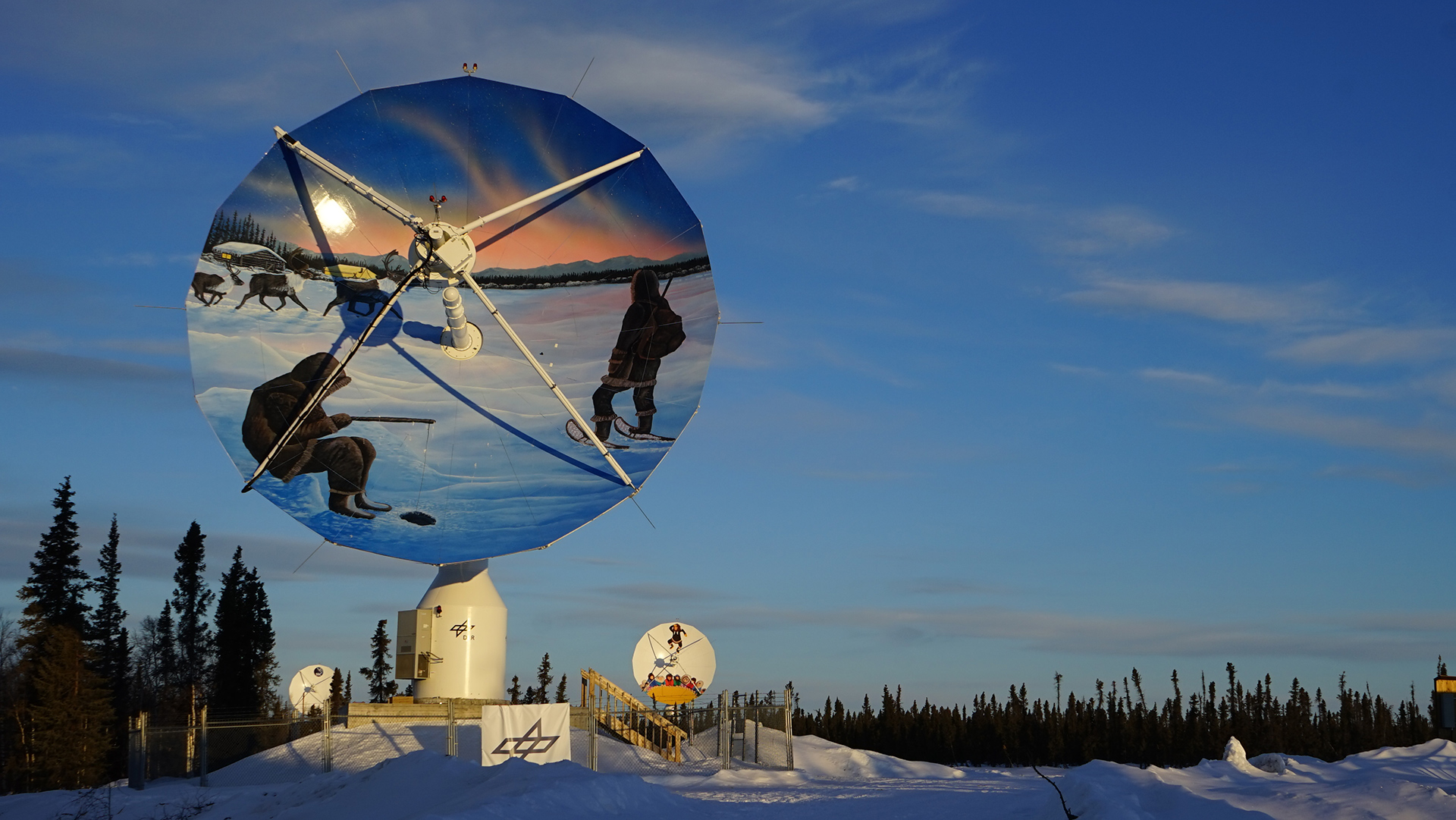
Since June 2019, the satellite ground stations that make up the Inuvik Satellite Station Facility have been decorated with artworks by local indigenous artists. They symbolise important aspects of the traditional way of life of Inuvik’s indigenous people. The image on the DLR antenna was created by Ronnie Simon of the Gwich’in people. Right: Station construction in 2009.
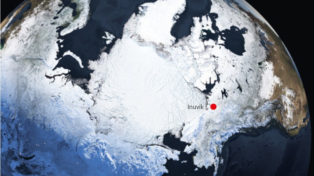
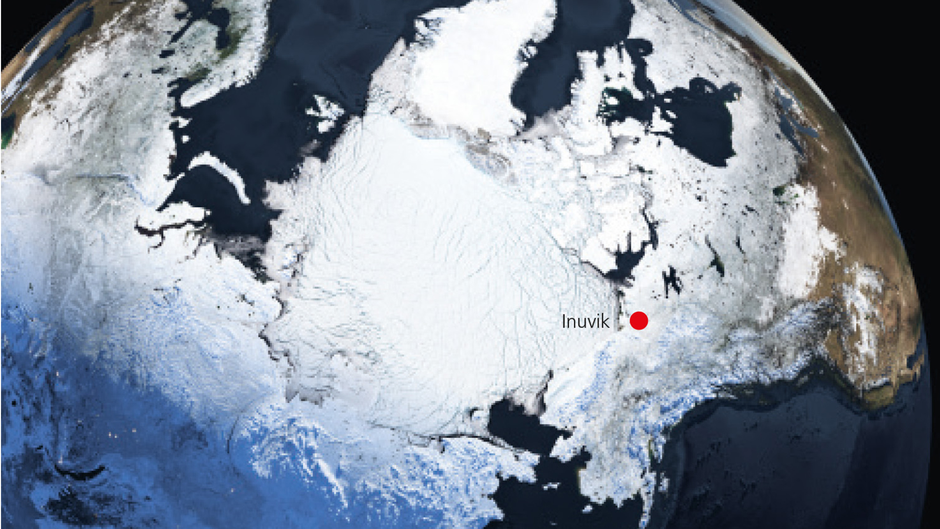
Inuvik is located in Canada, at approximately 68 degrees north and 133 degrees west, and is accessible year-round by road via the Dempster Highway or by regional airlines. Inuvik means ‘Place of Man’ in Inuvialuktun. The city was founded in 1953 as a logistics centre in the Northwest Territories and was initially named New Aklavik. In 1958, it was renamed Inuvik. As of 2018, 60 percent of its inhabitants are of European origin, 25 percent are Inuit and 15 percent Métis. In addition to English, the local languages are Inuvialuktun and Gwich’in.
When the Sun is shining and there is no wind, Inuvik’s annual average temperature of minus 10 degrees Celsius does not seem so bad. But when the weather turns, the Arctic reveals its true nature. Storm clouds gather in the infinite blue sky, gusts of wind blow a gale, and buildings and vegetation vanish into the white vastness within minutes. In winter, the temperature can drop to as low as minus 45 degrees Celsius. During the short summer, clouds of mosquitoes billow from the countless puddles, ponds and lakes. With temperatures rising up to 30 degrees Celsius, the permafrost is transformed into a slushy morass. Why on Earth would anyone want to set up a ground station here?
Set up of Inuvik ground station
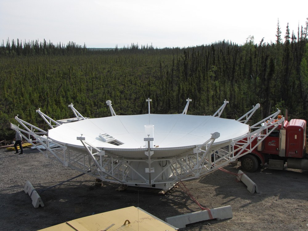
The fact that the site is located on permafrost places special demands on antenna construction. Sixteen supporting pillars driven 14 metres into the permafrost ground keep the 31-tonne structure stable even during Arctic storms and thaws.
Inuvik lies within the Arctic Circle, in the Northwest Territories of Canada. It is located just 150 kilometres south of the Arctic Ocean, and less than 2500 kilometres from the North Pole. DLR’s Earth Observation Center (EOC) has been operating an antenna for receiving satellite data in this inhospitable region for 10 years. The facility is DLR’s second ground station in a polar region, following the German Antarctic Receiving Station GARS O’Higgins. Ground stations inside the polar circles make it possible to establish contact with the same satellite several times a day, as the orbit of most Earth observation satellites takes them near the poles roughly every 45 minutes. Inuvik can receive data from a satellite for up to two-and-a-half hours per day. This makes it indispensable for data-intensive operations such as those of the German TanDEM-X mission, which is used for threedimensional mapping of Earth’s surface. Since 2018, the antenna has also been used for the European Copernicus Earth Observation Programme and receives data from the Sentinel-5P environmental satellite.
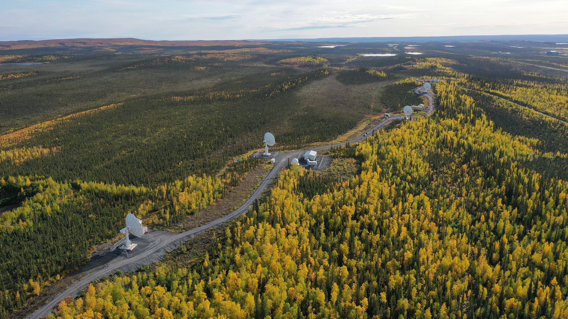
At the time of its anniversary in June 2020 the antenna was not alone. While its inauguration was witnessed merely by trees and a few onlookers, the DLR ground station is now accompanied by other antennas. They are part of what has become the Inuvik Satellite Station Facility (ISSF). The ISSF currently comprises five antennas and is managed by the Canada Centre for Mapping and Earth Observation (CCMEO).
The 13-metre reflector of the antenna
It can point accurately at the target satellites and maintain reliable contact with them as they fly overhead – even during extreme weather conditions.
At home – indigenous art and chatting while shopping
The fact that the site is located on permafrost places special demands on antenna construction. Sixteen supporting pillars driven 14 metres into the permafrost ground keep the 31-tonne structure stable even during Arctic storms and thaws. This is the only method of ensuring that the 13-metre reflector can point accurately at the target satellites and maintain reliable contact with them as they fly overhead – even during extreme weather
conditions. To date, the DLR antenna has recorded more than 30,000 passes by the TanDEM-X satellites alone. Up to 350 gigabytes of data are received every day and transferred to the EOC in Oberpfaffenhofen.
Yet its foundation is not the only thing that makes this ground station unique. As of last year, instead of the usual white paint, the Inuvik antennas boast an array of brightly coloured artworks. The DLR antenna is adorned by a typical Inuit ice fishing scene created by local indigenous artist Ronnie Simon, which is part of the ‘Antenna as Canvas’ project. The art installation transforms the Earth observation technological masterpieces into a remarkable symbol of the bond between the indigenous population and the station operators in Inuvik. Representatives of the Gwich’in, Inuvialuit and Métis people were involved in the construction of the station from the very beginning and blessed the facility during its inauguration in 2010.
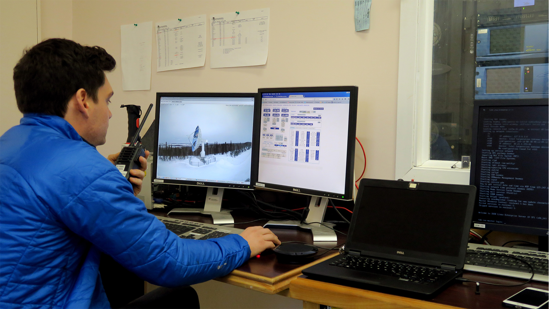
Each of the approximately 3500 inhabitants is familiar with the satellite ground station, which sits on a hill overlooking the road between the settlement and Inuvik Airport, the lifeline for local supply and infrastructure. Thanks to the Dempster Highway and regional airlines, it is now accessible all year round. ‘The Germans’ are also familiar faces, as Erhard Diedrich of the EOC is well aware. Although the system is now largely automated and can be operated from Germany, it is visited by DLR employees two or three times a year to perform maintenance work. Diedrich is responsible for the DLR antenna and therefore a regular visitor to Inuvik. He frequently hears: ‘Ah, you’re from the ground station …’.
"When I go shopping in town wearing my DLR jacket, people often approach me and strike up a conversation. It feels great to be greeted so warmly." This development is a particular source of pride for the remote sensing expert, as he had a lot of explaining to do in the beginning. "Back in those days, my explanations of what I was doing in Inuvik were met with incredulous astonishment and a certain amount of head-shaking", he recalls. After more than 10 years of activity by the EOC team, it is as though the receiving facility has always been there; it is simply part of the local scenery.
Sustainability – research instead of mining
The construction and operation of the Arctic antenna was considered hugely important – not just among German researchers. Canadian government authorities and research partners have supported the scientists’ ambitious project since they first made contact, and remain the driving force behind remote sensing activities in Inuvik to this day. Like the local Aurora College, the ISSF satellite ground station with its DLR antenna is an example of the sustainable facilities that are urgently needed in Inuvik. For decades, northern Canada has been dominated by mining. This is putting increasing pressure on the highly sensitive Arctic ecosystem and is affecting the regional economy due to fluctuating yields.
Discussions between DLR, CCMEO and the government of the Northwest Territories led to a special expansion of the ground station, which included the Herculean feat of laying a fibre-optic connection to Inuvik. The Mackenzie Valley Fibre Link traverses more than 1115 kilometres of Arctic permafrost and was completed in 2017, within two years. Previously, Inuvik’s telecommunications with the outside world relied on microwave relay stations along the Dempster Highway. The new fibre optic link is used not only to operate the ISSF, but also provides Inuvik’s inhabitants with a fast internet connection, which they can use to access training and telemedical care, for example.
The Earth observation data received by the DLR ground station provide information about the condition of Earth’s surface, ice, vegetation, oceans and atmosphere. Permafrost regions around the globe are currently experiencing massive changes as a result of global warming. The permafrost is thawing. Parts of the Canadian coast and infrastructure are already being lost due to the onset of erosion. Yet the real danger lies within the ice itself. The frozen ground stores enormous quantities of greenhouse gases, which are released when it thaws
Monitoring such changes over vast expanses of land is only possible with space-based Earth observation. Satellites can make a real contribution to understanding the Earth system and supporting international measures to combat climate change.
Due to its permafrost, Inuvik is also a focal point for environmental and climate researchers from all over the world, who come here to investigate the changes directly on site. They receive support from the Aurora Research Institute, which puts offices, laboratories and technical equipment at their disposal. In cooperation with their counterparts from the EOC, data services may soon be added to the list, including information about the current state of the ice derived from radar data. The DLR Earth Observation Center has initiated sustainable development with its first receiving facility in northern Canada. The remote sensing experts from Oberpfaffenhofen look back on 10 years of successful data reception operations. They also look forward to the advancement of research over the coming decades. Its close proximity to the pole, good supply routes, rapid internet connection and, most importantly, the warm welcome on the ground, make Inuvik the ideal place to receive data from international satellite missions. The EOC is quite at home in the Arctic.
The DLR ground station in the Arctic is run by the German Remote Sensing Data Center, part of the Earth Observation Center. It is located on the site of the Inuvik Satellite Station Facility (ISSF), which is managed by the Canada Centre for Mapping and Earth Observation (CCMEO). The ISSF has four more antenna systems, which are operated by the Swedish Space Corporation (SSC), Natural Resources Canada and the French space agency CNES (Centre National d’Etudes Spatiales).


