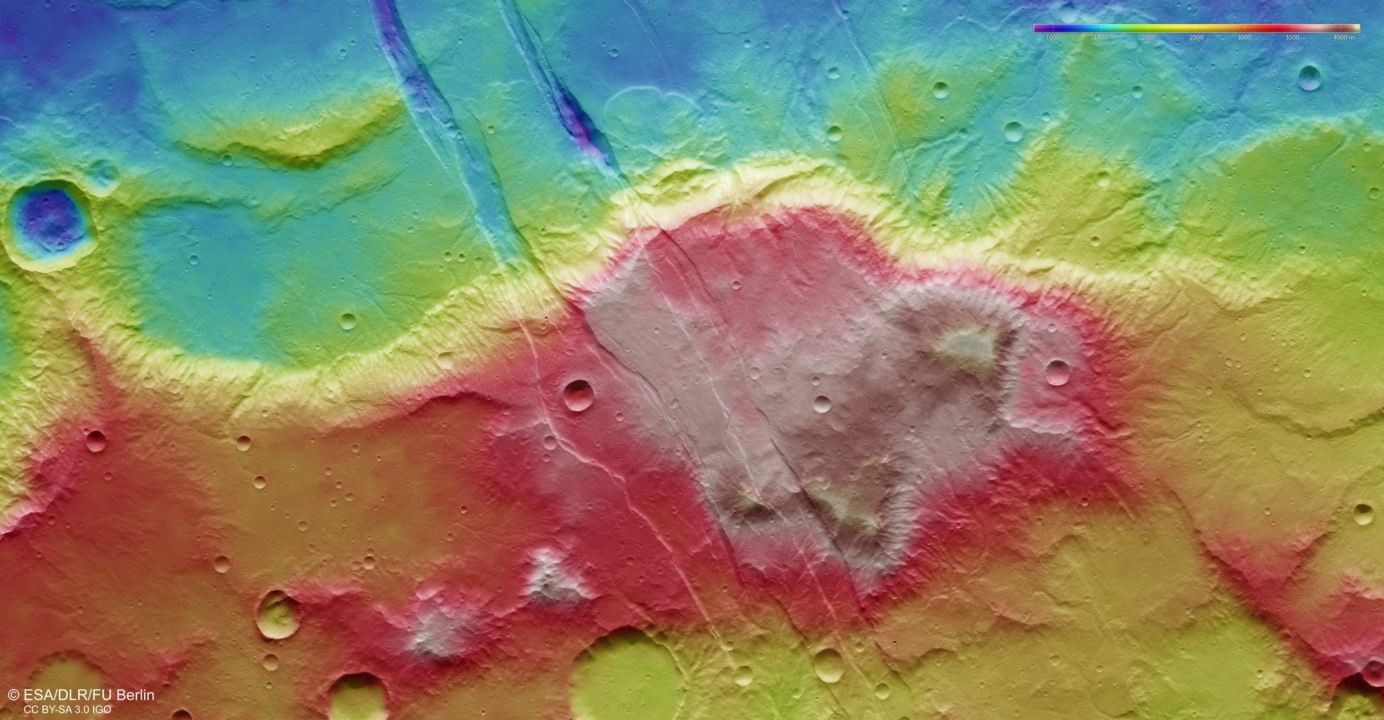
False-colour representation of the topography of the Sirenum Fossae

False-colour representation of the topography of the Sirenum Fossae
Digital topographical models of the surface of Mars, with an accuracy of up to 10 metres per picture element (pixel), are derived from the nadir channel (oriented perpendicularly to the surface of Mars) and the stereo channels of the HRSC camera operated by DLR. These colour-coded images clearly depict the absolute elevations above a reference level, the areoid (from Ares, the Greek name for Mars). The elevation values can be read based on the colour scale in the top right of the image.
The Sirenum Fossae are located on the Tharsis plateau, a region strongly marked by volcanic activity and associated tectonic processes, rising to a height of up to 5000 metres. The image clearly shows how the younger graben, resulting from stretching of the Martian crust, cross older, pre-existing structures. In some places, the graben are up to 1500 metres deep.