PHAROS – successful demonstration of a system solution for catastrophe management during forest fires in Catalonia
May 18, 2016
PHAROS – successful demonstration of a system solution for catastrophe management during forest fires in Catalonia
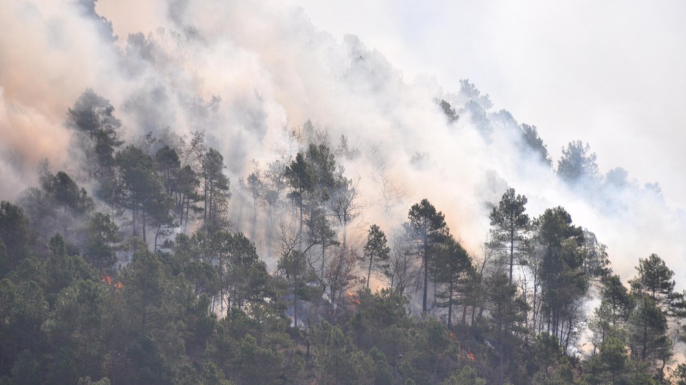
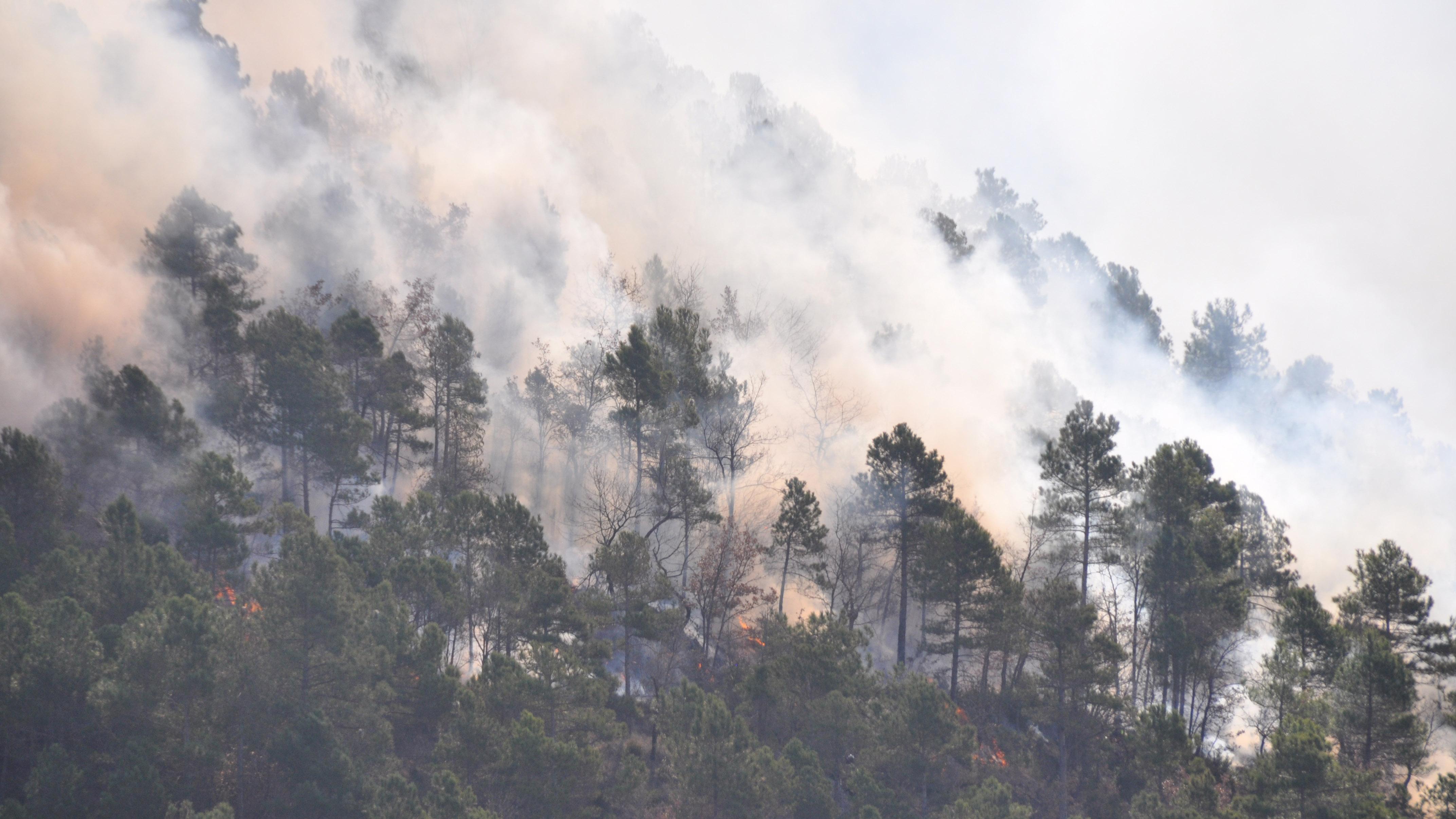
Controlled forest fire
To test the suitability of PHAROS, the DLR scientists went to Spain. Forest fires are one of the most dangerous situations. Together with the local emergency services, a controlled forest fire was ignited and then studied with PHAROS.
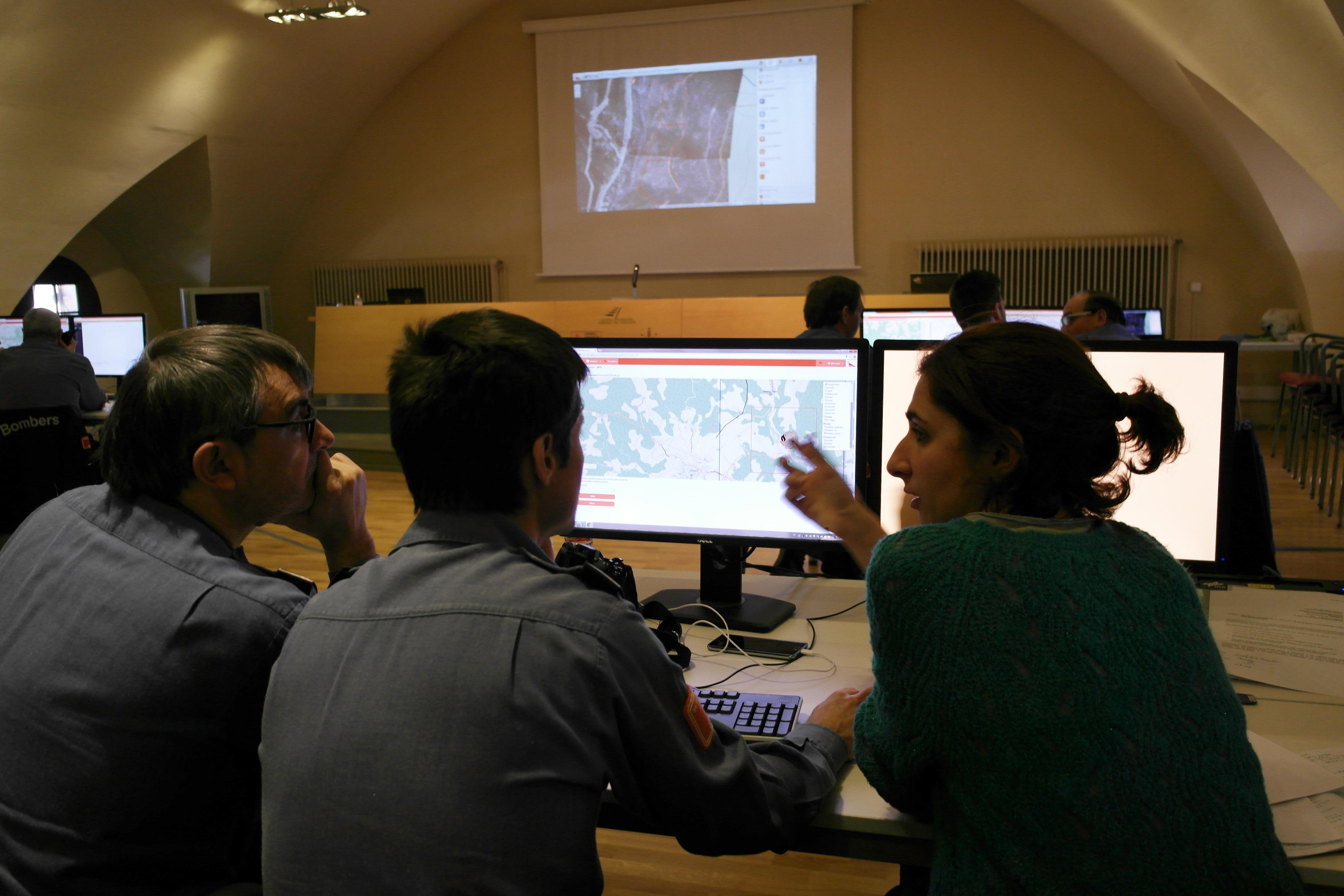
PHAROS control room during the pilot demonstration
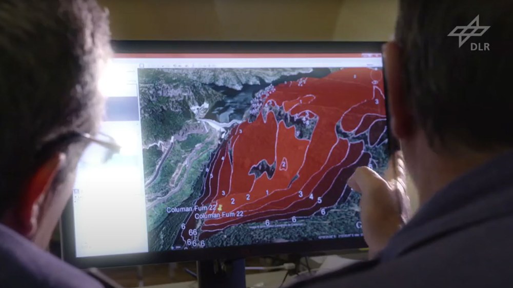
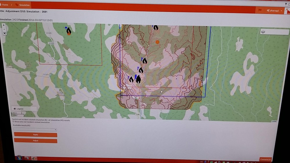
In the pilot demonstration in Spain, DLR researchers were able to test PHAROS together with the local emergency services. In the control room, the scientists received the measurement results, which could also be included in the program.
PHAROS generates a situational awareness and helps users to assess the situation and make decisions. Here, the sources of fire were mapped, and possible spread scenarios displayed.
The Earth trembles, rivers burst their banks and tsunamis destroy coastal regions. Natural and man-made disasters make our high technology society ever more sensitive. The current disaster management systems have the drawback that they cannot be flexibly adapted to the respective situation. Hazards and disasters have a similar course but are nevertheless different. The German Aerospace Center (Deutsches Zentrum für Luft- und Raumfahrt; DLR) has developed a system that takes this into account. PHAROS (Project on a Multi-Hazard Open Platform for Satellite Based Downstream Services) supports crisis managers, operations managers and relief workers in every phase of disaster response. The system is built as an open service platform and can be flexibly adapted to the circumstances at hand. Earth observation data, measurements from sensors, simulation tools and communication technologies are combined in a single platform.
All-rounder PHAROS: arrangement of situation reports, decision-making tools, communications platform
With PHAROS, situational data can be comprehensively recorded, collected, processed and distributed. It serves as a communication platform for the various crisis task forces, and can also be used to warn the local population. Simulation modules integrated into PHAROS can show how a disaster (for example a forest fire) will develop. A support system for decision making, PHAROS assists operation managers in making decisions and in planning and developing measures for fighting the fire or protecting the population. Sources of information are flexibly integrated into the system. Satellites provide up-to-date, large-scale maps and detect things such as pockets of fire through the smoke in otherwise inaccessible dangerous areas. GPS devices show the locations of the aid workers on site; local land registries provide information on existing infrastructures and safety hazards. The data and sensor information is complemented with simulation-based analyses and predictions, such as weather and propagation models. The overall view provided by this information enables endangered properties and infrastructures to be identified in good time and counter-measures to be implemented.
Strength of the modular system demonstrated under real conditions
The special feature of the system is its holistic approach and modularity. As a result of this, PHAROS can easily be adapted to different catastrophe scenarios using new modules, and additional sources of information can quickly be added. To demonstrate PHAROS, a natural disaster that frequently occurs in Europe was selected, which also enables an effective simulation in the context of a practice drill. In early March, three forest fires were ignited in a controlled manner in Solsona, Spain, to test PHAROS and the local task forces under real conditions.
PHAROS: system solution for catastrophe management
PHAROS: System solution for catastrophe management
Your consent to the storage of data ('cookies') is required for the playback of this video on Youtube.com. You can view and change your current data storage settings at any time under privacy.
PHAROS: System solution for catastrophe management
PHAROS: system solution for catastrophe management
For the exercise, several DLR developments were combined in PHAROS at once, such as the 4K camera system developed under DLR Project Projekt VABENE ++. This was mounted on the DLR BO 105 research helicopter helicopter for the demonstration in Solsona. The system uses sensors from three digital SLR cameras that can image a particularly wide area due to their differing viewing angles and, from an altitude of 750 metres, can provide a ground resolution of around 10 centimetres. Images of the fire zone are taken at intervals of a few seconds, immediately corrected on board using the aircraft's GPS and movement data and a terrain model, equalised and sent to a ground station via a microwave data link. Within seconds, the experts on site receive the geo-referenced aerial images on their terminal devices. They can then use the data to accurately determine the sources of the fire and its progress. In addition to the DLR development, the FireWatch camera system, which was developed by partners, was used. It consists of several rotating cameras linked into a single system that can observe extensive forest areas. They also detect small fires reliably and pinpoint their location.
Warning the population
In addition to the situational report and decision-making support, PHAROS offers the possibility of warning the local population promptly and continuously. A specially developed app informs the inhabitants of the hazards and measures to take. The modular design of PHAROS enables additional communication channels to be easily added. Various methods of doing so were investigated in the project, such as cell broadcasting, which enables a more accurate localisation of the recipients, or global satellite navigation systems. The limited capacity of satellite navigation systems for the transmission of messages is made possible with an efficient communication protocol together with predefined ‘Alerting Libraries’. Alerting Libraries allow warning messages to be sent to the affected population with one click. PHAROS does this in multiple languages. Alerts can be automatically translated and issued as voice output. Hence the system is suitable for use in any country in Europe.
Cooperation partners
PHAROS was sponsored for three years under the EU's 7th Framework Programme. Multiple DLR institutes and seven other European partners are involved in the project. The DLR-Institute of Communications and Navigation took charge of overall coordination and the working areas of communication and raising alarms. The The German Remote Sensing Data Center (DFD) (Deutsches Fernerkundungsdatenzentrum; DFD) is supporting the project with its expertise in the areas of Earth observation and decision-making assistance. The integration of helicopter images and satellite image maps was made possible through collaboration with the The Remote Sensing Technology Institute (IMF) VABENE++ (Traffic Management for Large Scale Events and Disasters) project and the Earth Observation Center (EOC) Center for Satellite Based Crisis Information (ZKI) In addition to the 4K data, thermal data was collected using the Fraunhofer Institute of Optronics' helicopter-borne AirSig sensor.

