Land surface has been displaced by up to six metres
February 14, 2023 | Evaluation of satellite data after the earthquake
Land surface has been displaced by up to six metres
Changes to the land surface
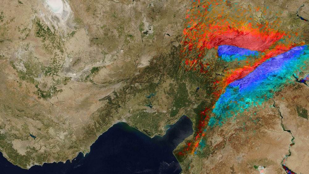
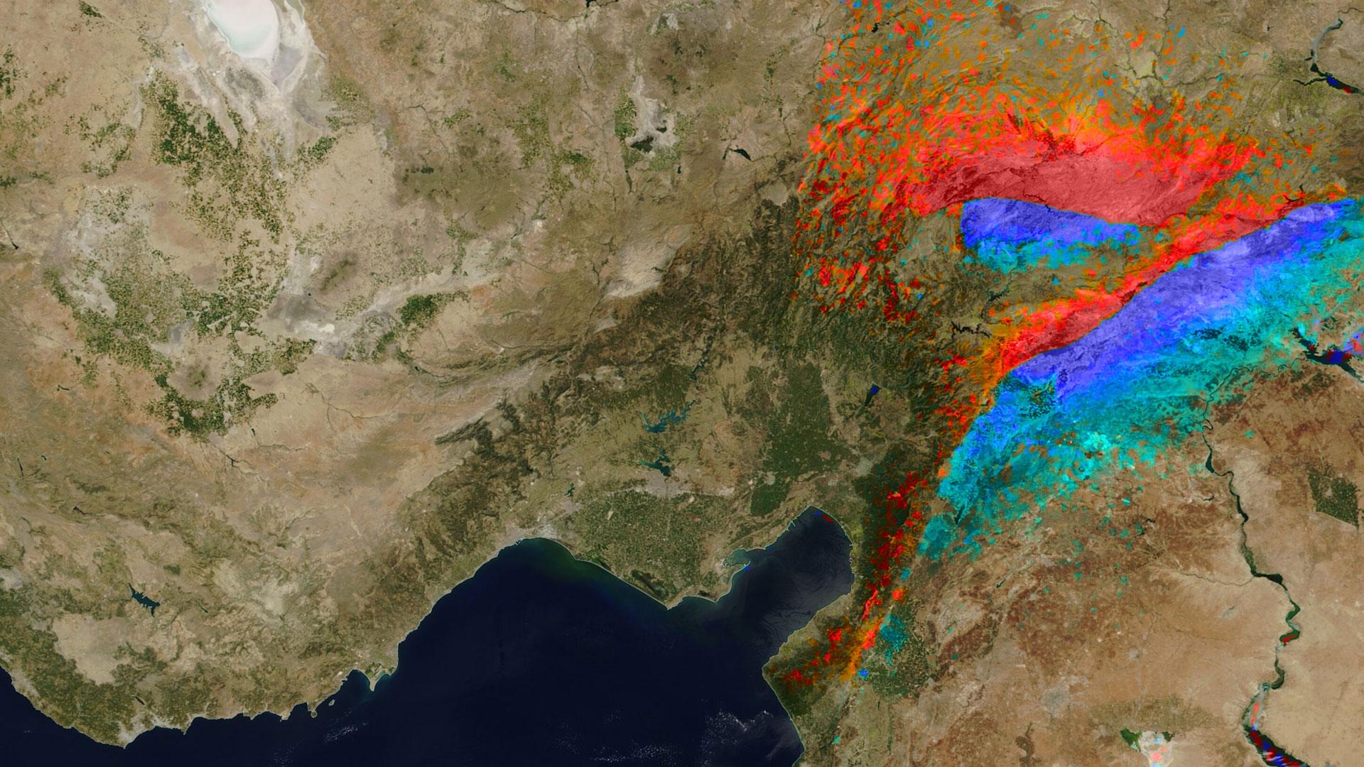
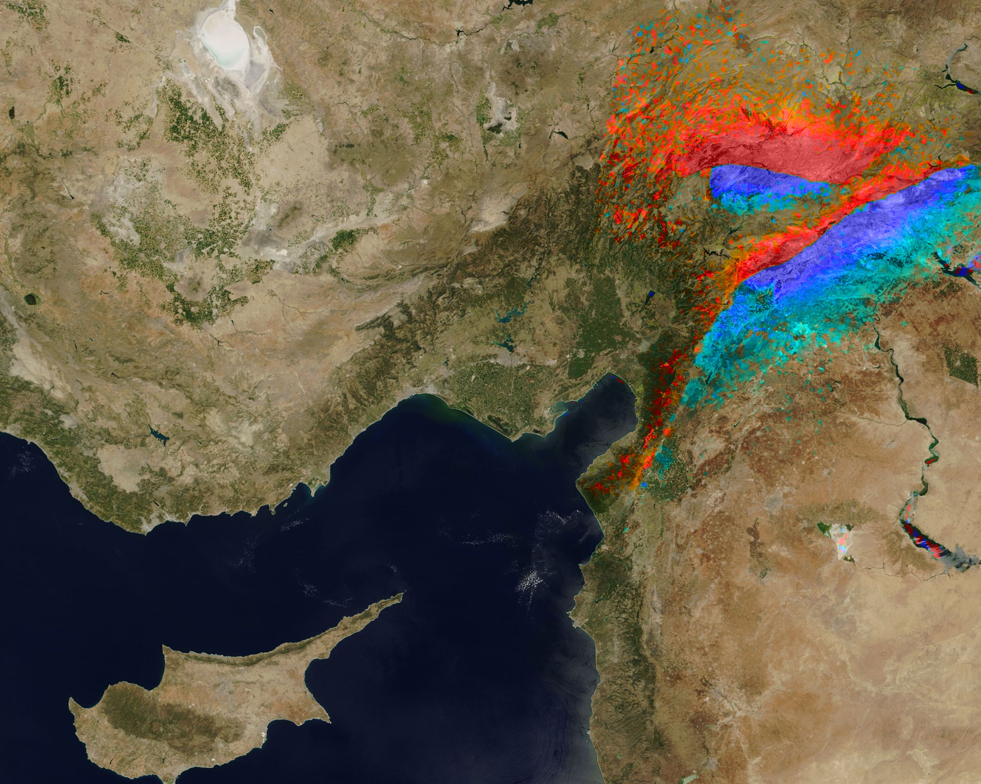
Evaluation of satellite data reveals the land surface displacements caused by the severe earthquakes in Turkey and Syria. The blue areas represent movement in an easterly direction, and the red areas represent movement in a westerly direction.
Satellite images have revealed how the land has shifted as a result of the severe earthquakes in Turkey and Syria. According to an analysis by the German Aerospace Center (Deutsches Zentrum für Luft- und Raumfahrt; DLR), this shift amounts to up to six metres in some places. The researchers analysed and visualised data from the European Sentinel-1 radar satellite. Fractures can be seen on the surface over a length of approximately 250 kilometres.
The larger fracture in the south is a result of the main earthquake that occurred in the early morning hours on 6 February 2023. The second fracture, which lies to the north of the first, was caused by the severe aftershock that occurred during the morning of the same day. The blue areas represent movement in an easterly direction, and the red areas represent movement in a westerly direction.
Changes to the land surface (Overview)
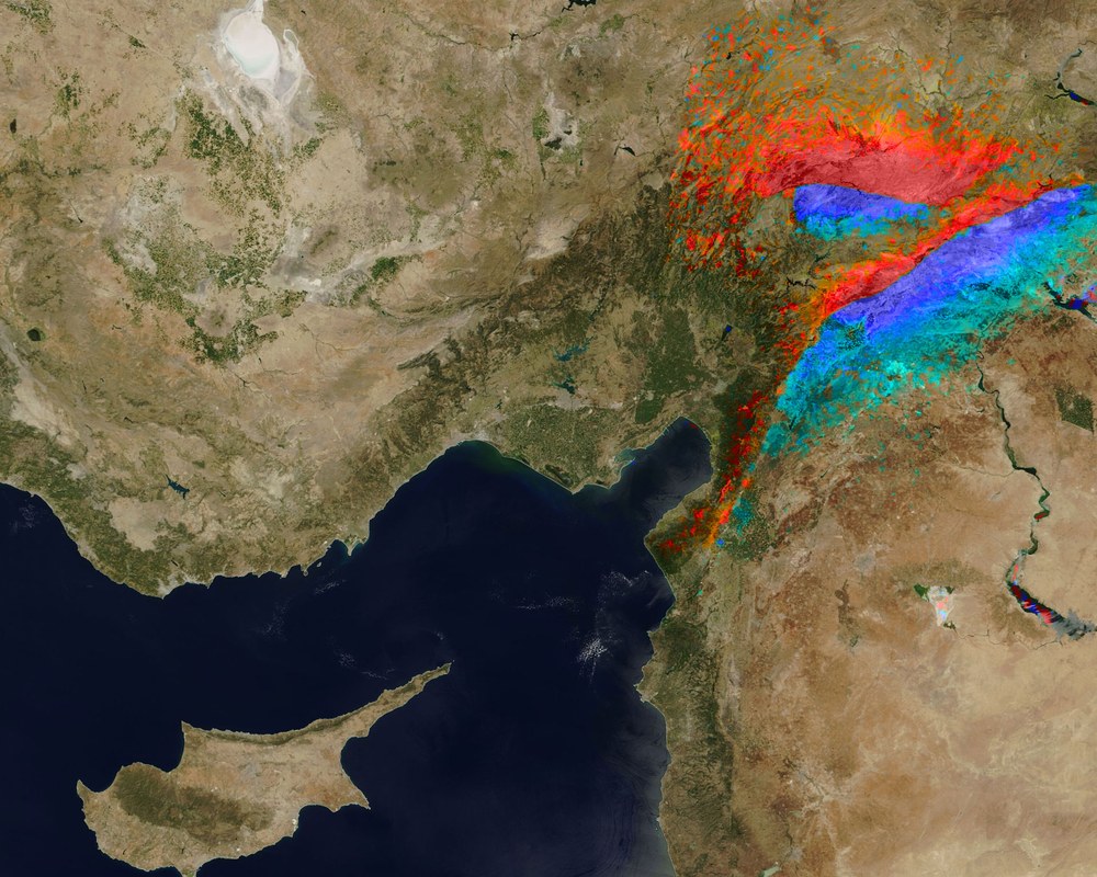
Evaluation of satellite data reveals the land surface displacements caused by the severe earthquakes in Turkey and Syria. The blue areas represent movement in an easterly direction, and the red areas represent movement in a westerly direction. Cyprus can be seen in the bottom left of the image.
Both regions in which the earthquakes took place belong geologically to the Eastern Anatolian Fault, where the Anatolian and Arabian plates collide. This creates stresses in Earth's crust, which were released during the earthquakes. The resulting movements were precisely recorded by satellites. For the analysis, researchers at the DLR Earth Observation Center compared images acquired on 29 January and 10 February 2023.
The Sentinel-1 radar satellite is part of the Sentinel satellite fleet of the European Copernicus Earth observation programme. Satellite-based Synthetic Aperture Radar (SAR) transmits radar signals towards Earth's surface and uses the reflections to provide images during day or night and under any weather conditions. SAR uses the propagation times of the signals to perform highly accurate measurements of the distance from the satellite to Earth's surface.
DLR supports emergency responders in Turkey
In the first week following the earthquakes, two researchers from the DLR Institute of Optical Sensor Systems were on site in Turkey with a team from I.S.A.R. Germany. DLR provided the new Modular Aerial Camera System (MACS) to assist with situational awareness on the ground. Installed on a high-tech drone from Quantum, the camera system flew over severely affected regions and sent the acquired aerial images in map form directly to the United Nations (UN) Coordination and Management System (ICMS).
At DLR, the Center for Satellite Based Crisis Information (ZKI) also analyses satellite images and processes them into digital maps and other products. This situational information is passed on to responders on the ground. The ZKI is part of the Earth Observation Center in Oberpfaffenhofen.
