February 7, 2023 | Situation images from the air and from Earth orbit
DLR supports emergency responders in Turkey
Situation assessment on site
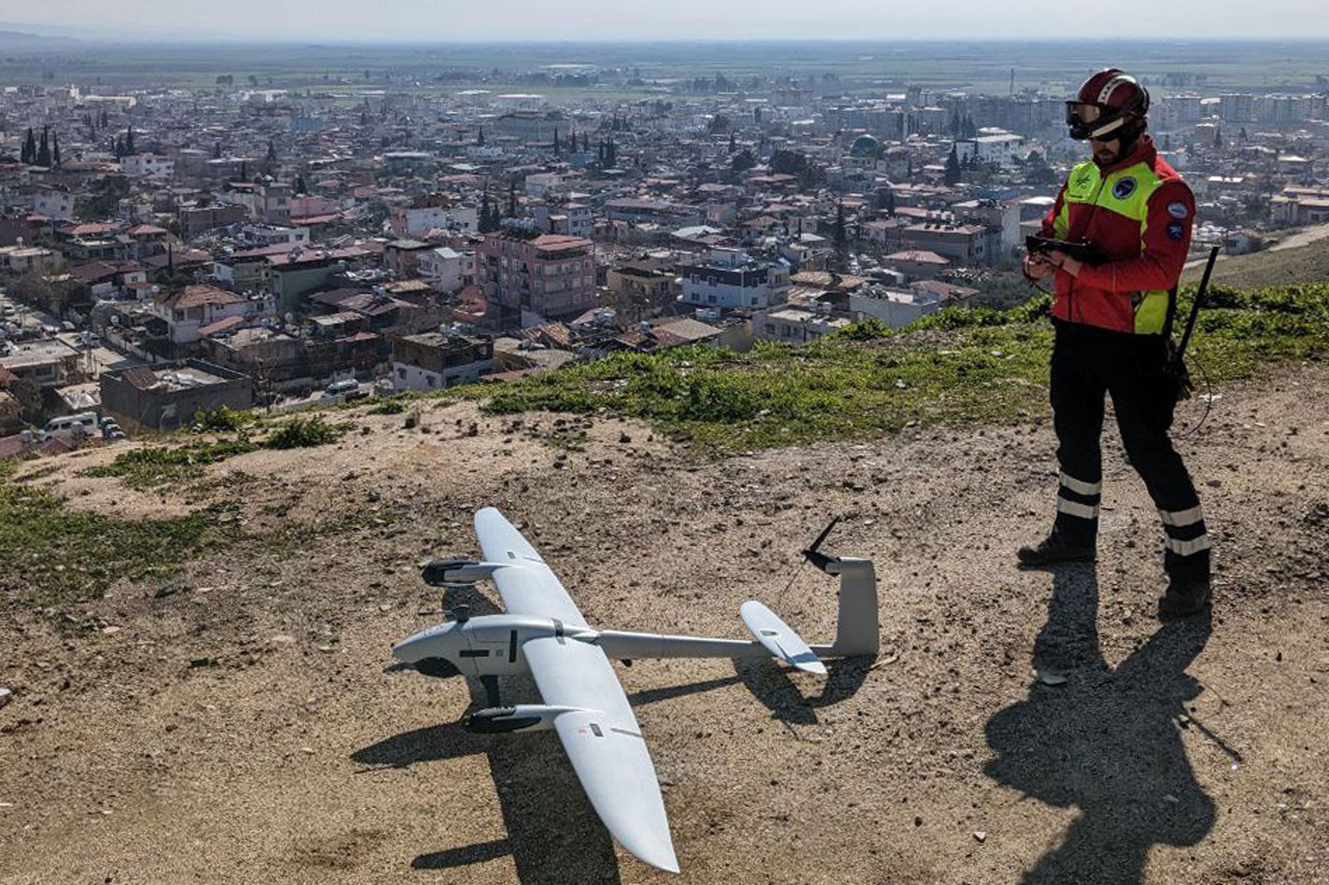
DLR's MACS nano camera system was integrated into a high-tech drone. Its aerial images are forwarded directly to the UN's operational command and control system. This live mapping makes important information immediately available to relief workers. DLR staff are on mission in Kirikhan in southern Turkey.
DLR's MACS nano camera system was integrated into a high-tech drone. Its aerial images are forwarded directly to the UN's operational command and control system. This live mapping makes important information immediately available to relief workers. DLR staff are on mission in Kirikhan in southern Turkey.
DLR personnel and technology are supporting the aid organisation I.S.A.R. Germany in regions affected by the recent severe earthquakes in Turkey and Syria.
The Modular Aerial Camera System (MACS) and a high-tech drone will be used to map the extent of the damage in real time.
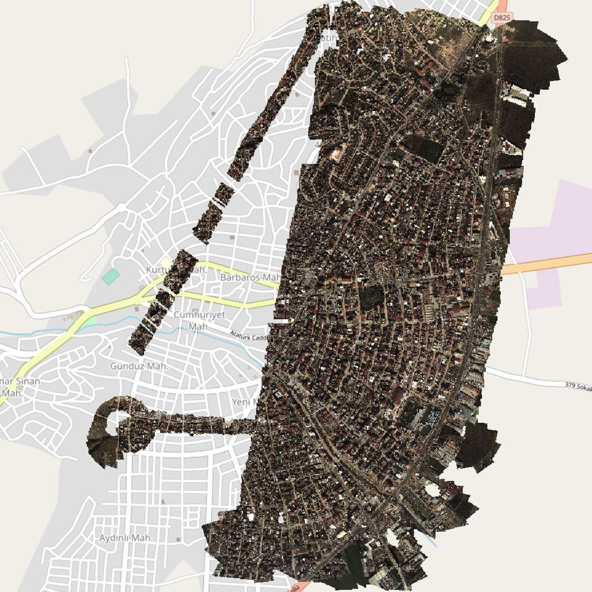
The Center for Satellite Based Crisis Information (ZKI) is also analysing satellite Earth observation data.
Focus: Security, Earth observation, disaster management, technology transfer
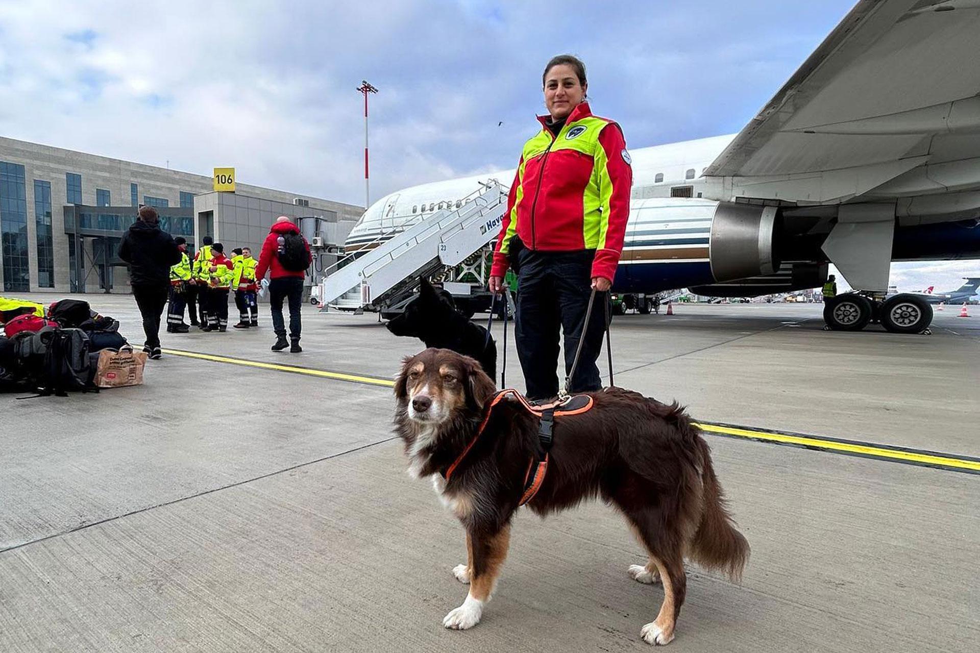
The German Aerospace Center (Deutsches Zentrum für Luft- und Raumfahrt; DLR) is supporting rescue teams in areas affected by the recent earthquakes in Turkey. Two researchers from the DLR Institute of Optical Sensor Systems arrived in the area on 7 February 2023, together with a team from International Search And Rescue (I.S.A.R.) Germany. DLR is providing the new Modular Aerial Camera System (MACS) to assist with situational awareness on site.
A high-tech drone from Quantum Systems with an in-built MACS-nano camera system will fly over severely affected regions and send the images acquired from the air directly to the United Nations (UN) Operations Command System (ICMS) in the form of a map. "This live mapping makes the information immediately available to all nations involved in the operation," says Ralf Berger, head of security research at the DLR Institute of Optical Sensor Systems, where the camera and the live mapping process were developed.
In addition to providing technical support to improve situational awareness, the two DLR researchers are also part of the I.S.A.R. Germany team and are supporting the rescue and recovery of people trapped beneath debris. DLR and the aid organisation I.S.A.R. Germany have worked together closely since 2016. Together, they test and deploy new technical developments for use in crisis and disaster response, most recently in an exercise conducted last November.
Close coordination with authorities and aid organisations
Researchers at the DLR Center for Satellite Based Crisis Information (ZKI) are also analysing satellite images and processing them into digital maps. This situational information is also passed on to teams on the ground. As part of the DLR Earth Observation Center, the ZKI specialises in the analysis of satellite data for crisis relief. The ZKI works closely with authorities and non-governmental organisations within Germany and internationally.
"The situational information provided by Earth observation satellites not only offers an overview of the situation on the ground, it can also serve as a basis for assessing the state of local infrastructure. Rescue workers can only get to the scene of operations quickly if they know which roads are still passable, for example," explains ZKI Director Monika Gähler. The ZKI is currently processing very high-resolution optical satellite data and is cooperating intensively with European Space Imaging.
The ZKI participates in global networks such as the International Charter 'Space and Major Disasters'. Here, the ZKI provide up-to-date information in the event of earthquakes, volcanic eruptions, tsunamis, floods, forest fires, storms and other disasters around the world. After the severe explosion in the port of Beirut in August 2020, for example, the ZKI produced before-and-after maps. These maps provided an initial overview of the damage. The ZKI also analysed the latest image data acquired from the air during the flooding disaster in Germany in the summer of 2021. These high-resolution aerial images were processed in real time on board an aircraft using the MACS camera. The DLR Institute of Optical Sensor Systems and the DLR Remote Sensing Technology Institute were also involved here.


