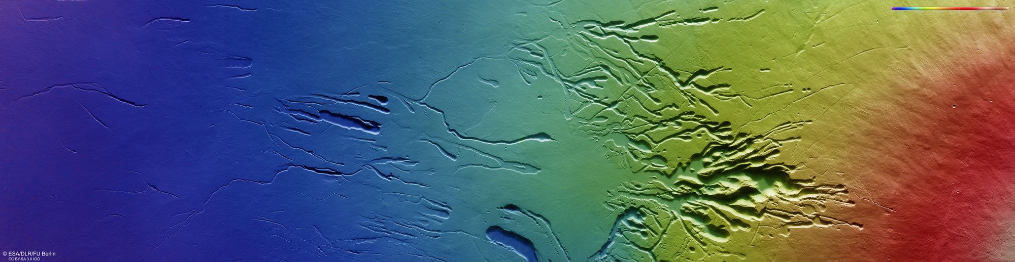
Topographic image map of the southwest flank of Ascraeus Mons

Topographic image map of the southwest flank of Ascraeus Mons
The DLR High Resolution Stereo Camera on the Mars Express spacecraft uses its sensors to image the surface of Mars from different angles. Teams of scientists at the DLR Institute of Planetary Research and the Freie Universität Berlin compute digital terrain models using data acquired by the two stereo channels, which are directed obliquely forwards and backwards towards the surface, and the nadir channel, which is directed perpendicularly onto Mars. The colour scale at the top right of the image shows the altitude values in relation to an areoid – an equipotential surface on Mars that is used as a reference system. The volcano Ascraeus Mons has a very flat profile with an average slope of only seven degrees. Nevertheless, the difference in elevation from the beginning of the volcano's southern flank on the left side of the image (south) to about the middle of the mountain flank on the right side (north), 300 kilometres away, is about ten kilometres.