Christmas markets as seen by TerraSAR-X and TanDEM-X


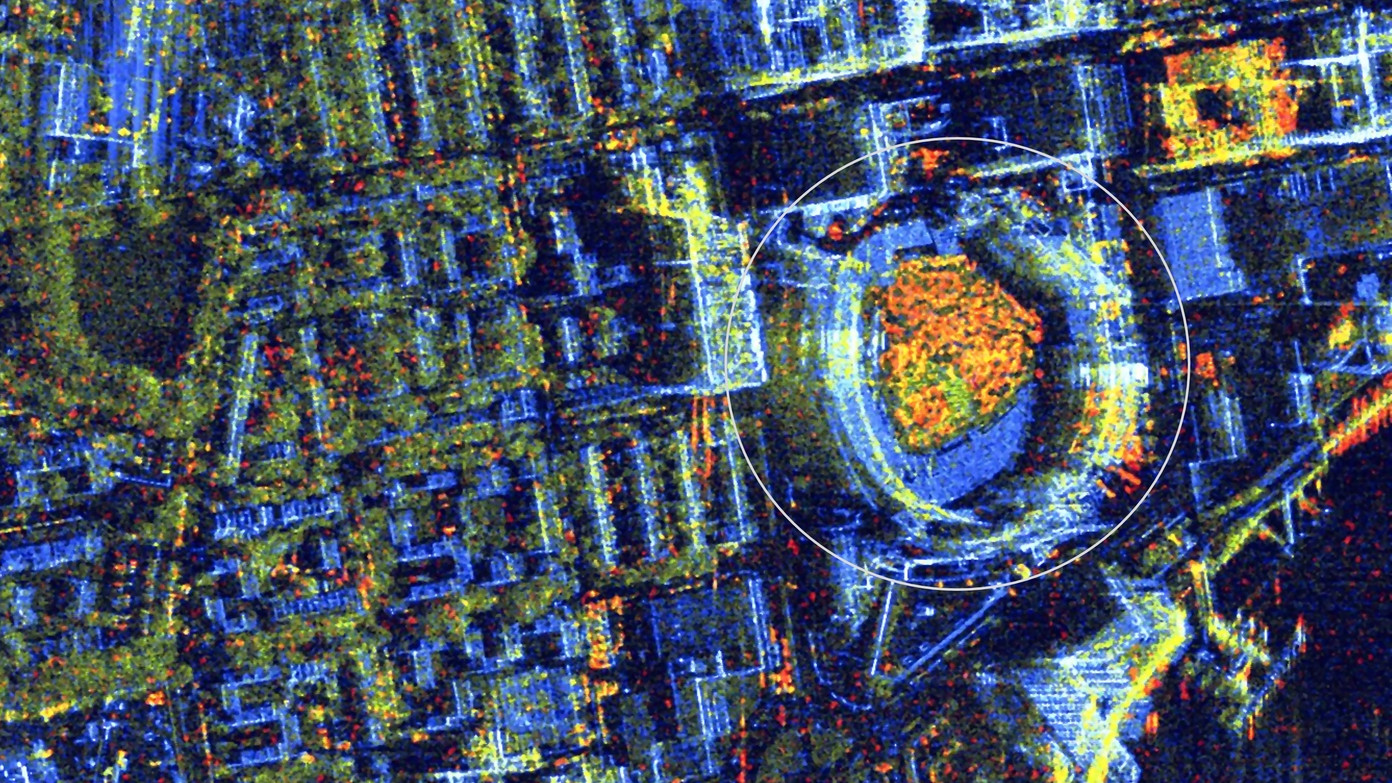
Christmas magic at the baseball stadium of Washington D.C. in the USA
In December, the Washington Nationals stadium becomes an ice fairy tale, the Enchant Christmas. Visitors can expect a huge Christmas tree, ice skating rinks, a maze of lights and, of course, lots of sales stands. The image was compiled from a TanDEM-X image taken on 4 November 2023 and a TerraSAR-X image taken on 7 December 2023.
Christmas market at Union Square in New York City, USA
The Union Square Holiday Market is held in the centre of Manhattan. South Place at the southern end of Union Square is home to a variety of culinary delights and arts and crafts. The images for this picture were taken on 05 November 2023 by TerraSAR-X and on 08 December 2023 by TanDEM-X and then combined.
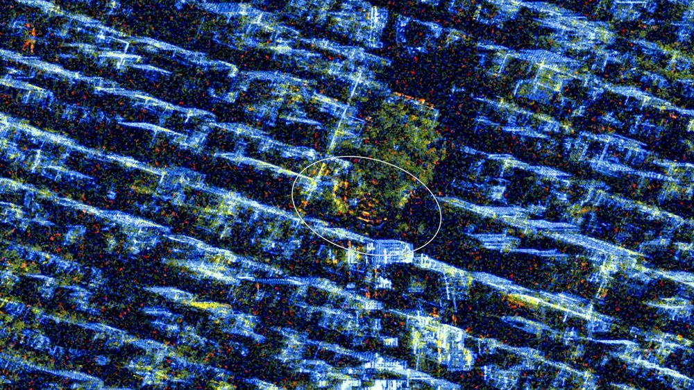
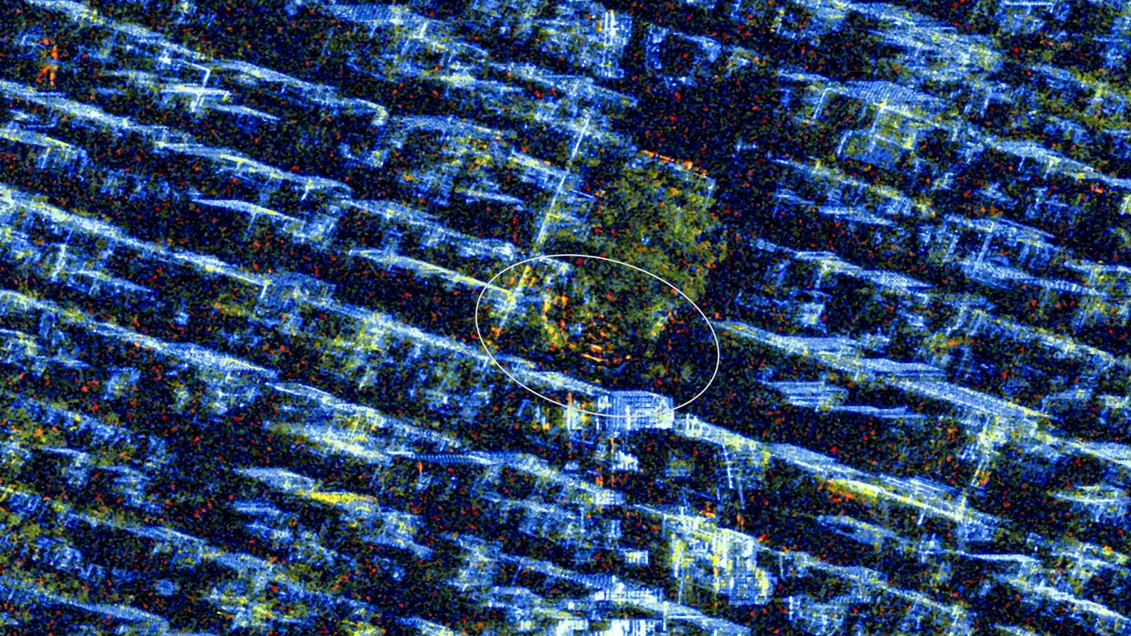
Maritime Christmas market in the Hanseatic City of Lübeck, Germany
The actual Lübeck Christmas market takes place on the Market Square in the Old Town. Directly to the north is the historic Christmas market on the square in front of St Mary's Church (oval marking). There is also the Maritime Christmas Market on Lübeck's Koberg in the the Old Town with stands and Hanseatic specialties, as well as the Christmas bazaar of a marzipan manufacturer. The image was compiled from two Staring SpotLight images acquired on 13 November 2023 and 5 December 2023 using the TerraSAR-X satellite.

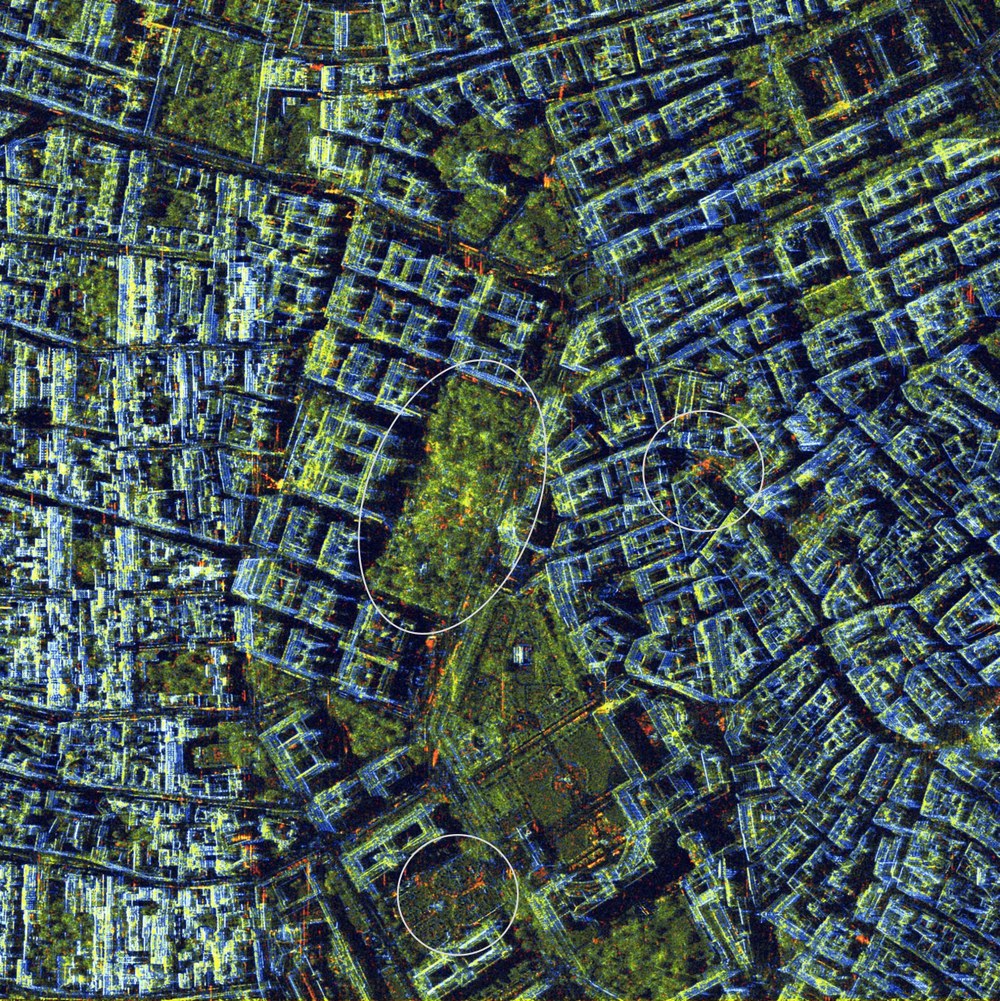
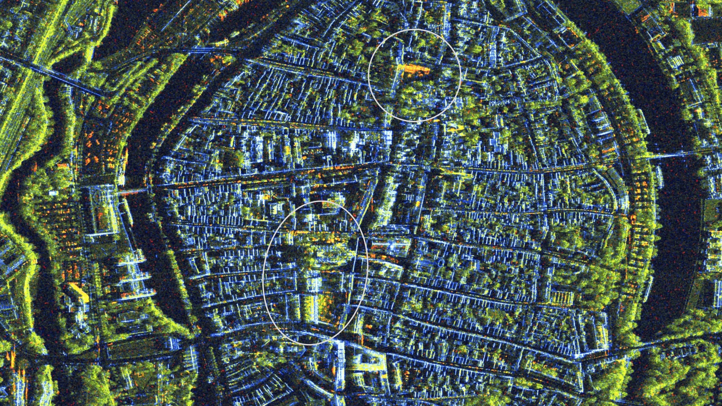
Christkindles market in Nuremberg, Germany
The Christkindlesmarkt has been held on the main market square in Nuremberg for almost 400 years. With its stands made of cloth and wood, it attracts over two million visitors from all over the world. The orange-coloured area in the centre of the image shows the main area of the Christkindlesmarkt on the Hauptmarkt. Just below it to the left on the Pegnitz river, you find the Christmas punchbowl village. Both can be seen in the centre of the image. And in 2023, the Nuremberg Winter Village was set up on Jakobsplatz in the lower left-hand area of the Old Town. This image is a combination of an image acquired by the TanDEM-X satellite on 13 November 2023 and one acquired by the TerraSAR-X satellite on 5 December 2023 to make the changes visible.

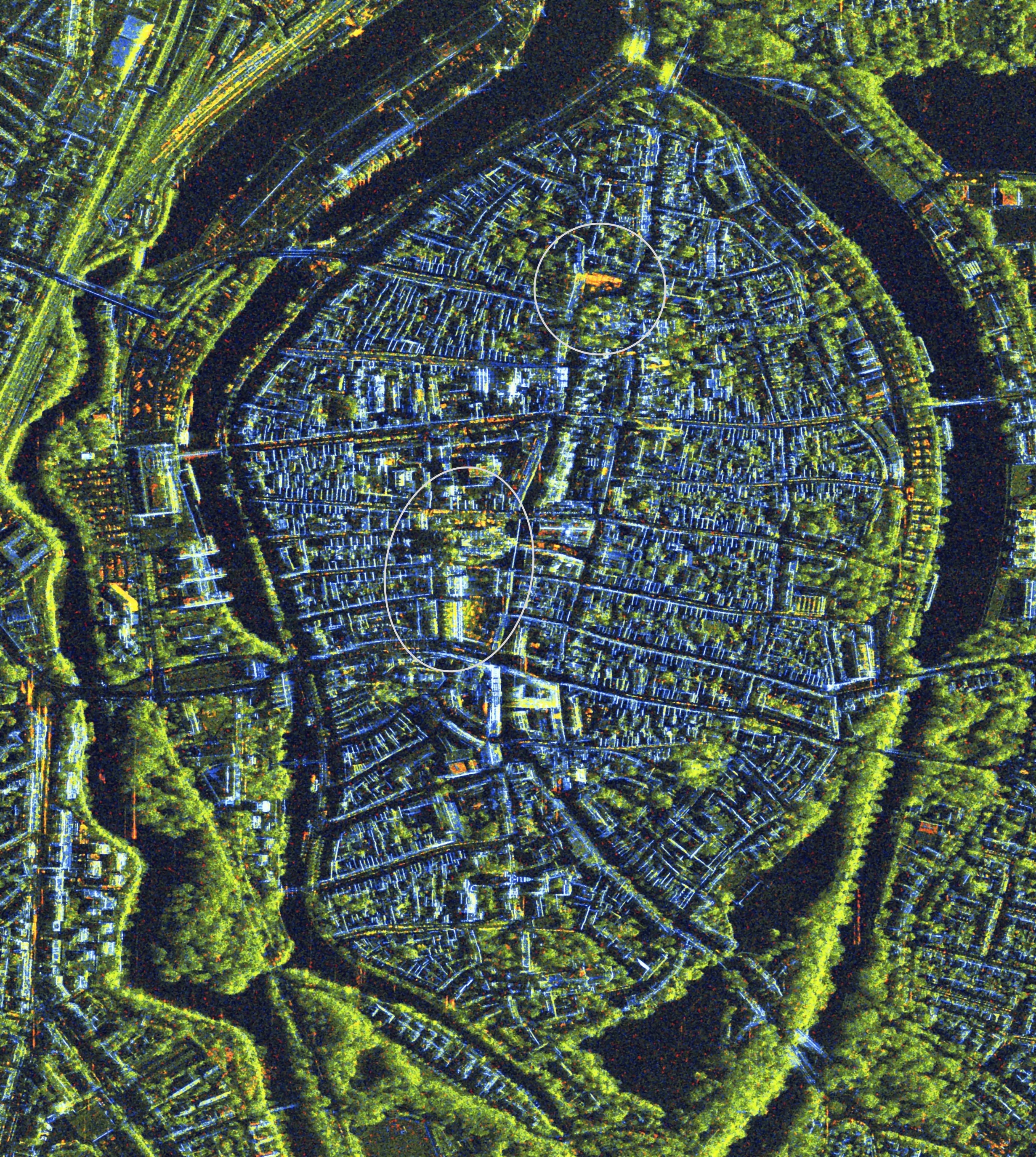
Maritime Christmas market in Lübeck,Germany
The actual Lübeck Christmas market takes place on the Market Square in the Old Town. Directly to the north is the historic Christmas market on the square in front of St Mary's Church (oval marking). There is also the Maritime Christmas Market on Lübeck's Koberg in the the Old Town) with stands and Hanseatic specialties, as well as the Christmas bazaar of a marzipan manufacturer. The image was compiled from two Staring SpotLight images acquired on 13 November 2023 and 5 December 2023 using the TerraSAR-X satellite.
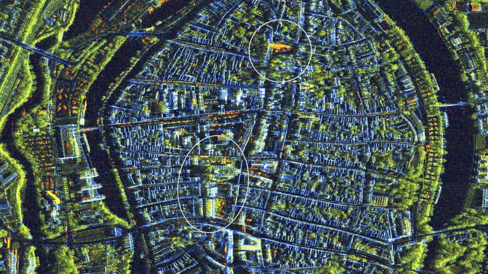
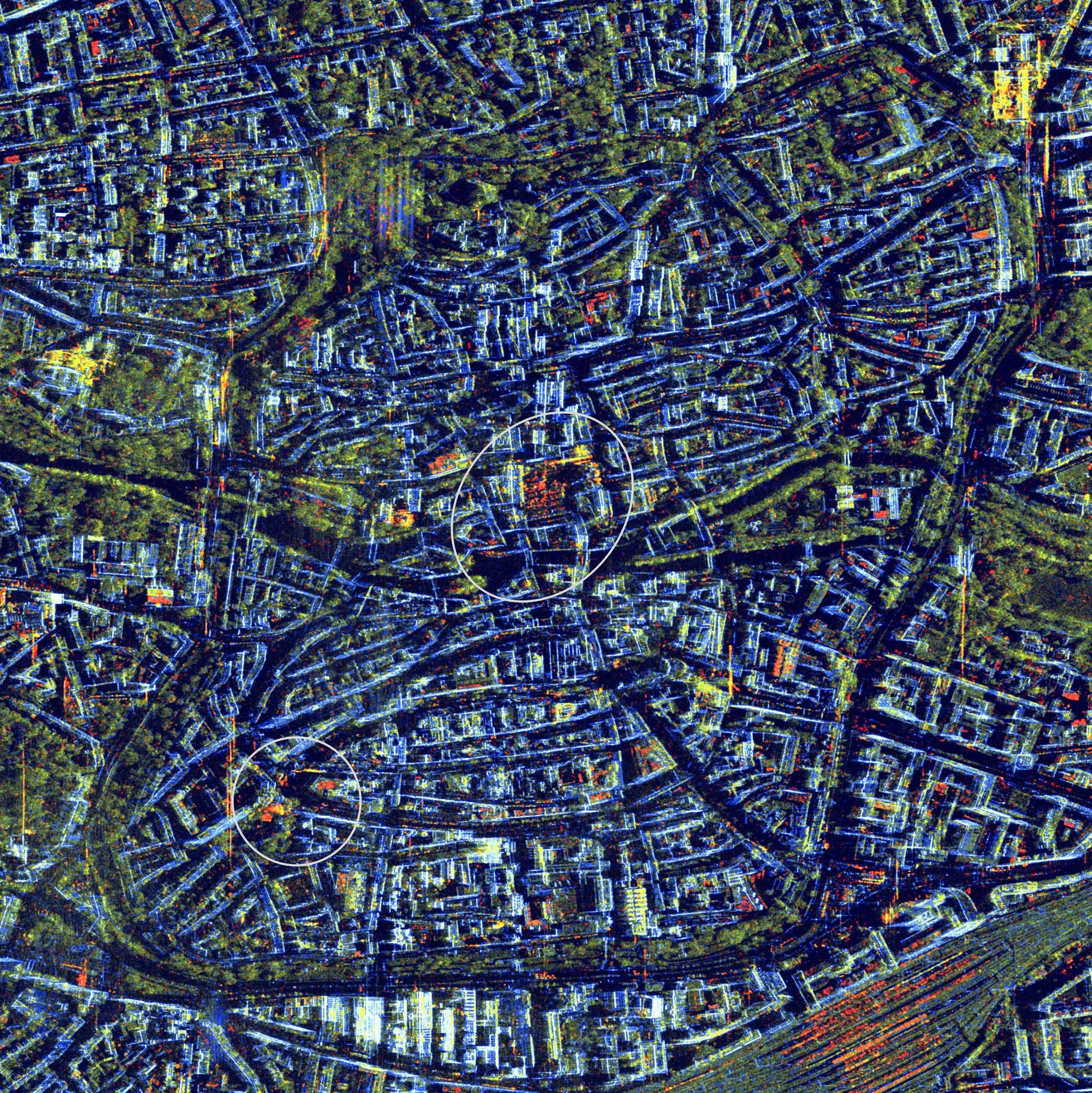
Christmas markets around City Hall Square in Vienna, Austria
The Christmas market in Vienna takes place on and around Rathausplatz (oval marking). It offers a variety of stands, a nativity scene trail and an ice skating rink on the tree-covered square. Many of the stalls were already set up before the first image was captured, which is why there is little change to the square itself. There are also various other markets such as the Christmas village on Maria-Theresien-Platz (at the bottom) or the Altwiener Christkindlmarkt on the Freyung, on the right of the image. The images for this picture were acquired with the TerraSAR-X satellite on 9 November 2023 and 1 December 2023 and then combined to make the changes visible.