Colour plan view of the Noctis Labyrinthus region

Colour plan view of the Noctis Labyrinthus region
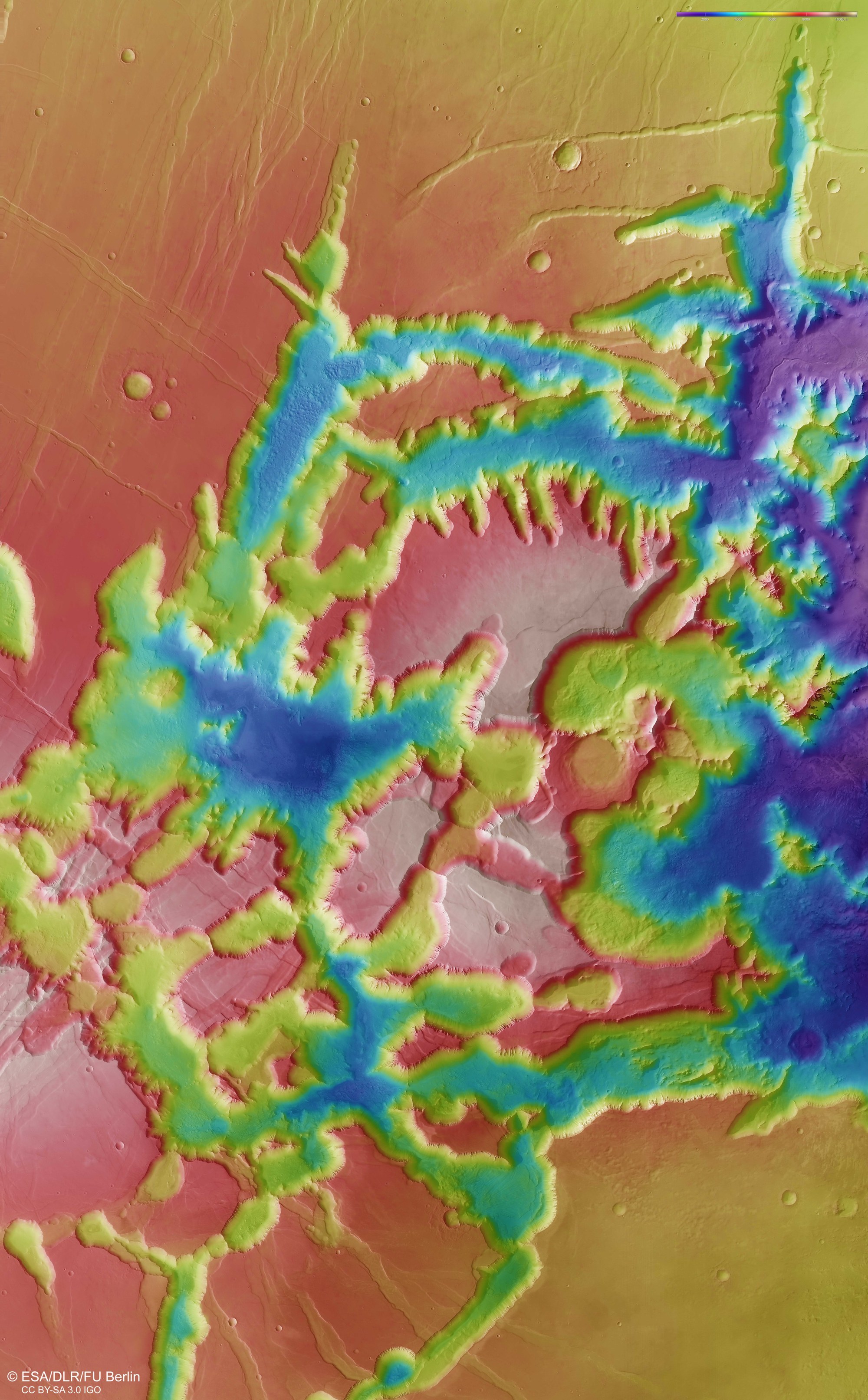
The image mosaic, including eight image sequences acquired by the DLR HRSC instrument on board Mars Express, shows the eastern part of the Noctis Labyrinthus region, which stretches approximately 1160 kilometres from east to west along the martian equator. The ground resolution is about 12.5 metres per pixel, which is almost the highest resolution achievable with HRSC from its elliptical Mars orbit. The colour image was generated from data acquired by the nadir channel which is aligned vertically at the surface of Mars and the colour channels directed obliquely towards the surface. If one zooms into the image, the remains of large landslides on the valley floor become visible in many places.