Visualisation of the TanDEM-X digital elevation model over southern Bavaria
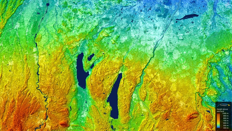

Visualisation of the TanDEM-X digital elevation model over southern Bavaria
This region is known for its lakes. In addition to the city of Munich (top right), the image shows Lake Starnberg (centre), Lake Ammer (left of centre), the Peißenberg mountain (bottom left) and the rivers Lech (left), Isar (centre) and Mangfall (right).