Mission planning for multiple uncrewed aerial vehicles

Mission planning for multiple uncrewed aerial vehicles
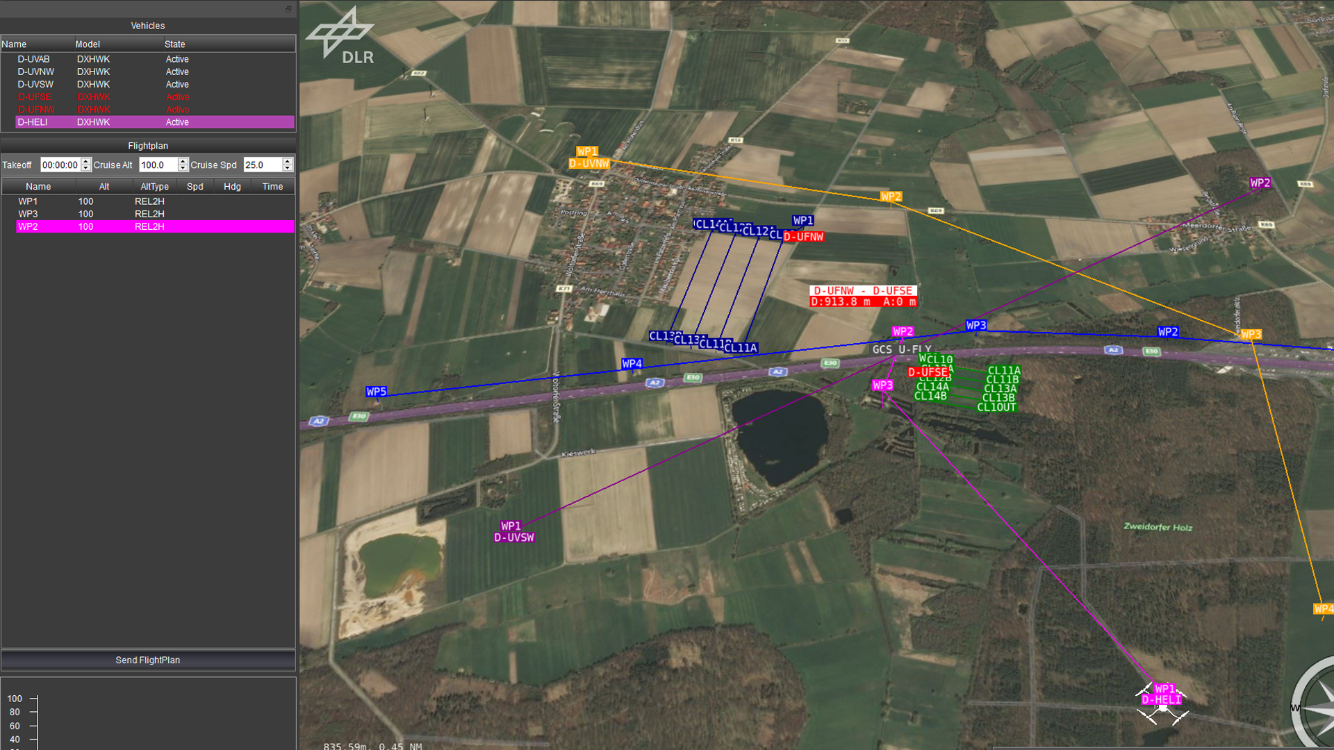
This image shows the 'U-Fly' ground control station developed by the DLR Institute of Flight Guidance for mission planning involving multiple uncrewed aircraft systems (UAS). A shared map provides a clear overview of planned routes, operational areas and relevant areas subject to flight restrictions, so that flights can be efficiently coordinated, avoid conflicts and make optimal use of available airspace.