Mapping – burnt areas in Valparaíso, Chile


Mapping – burnt areas in Valparaíso, Chile
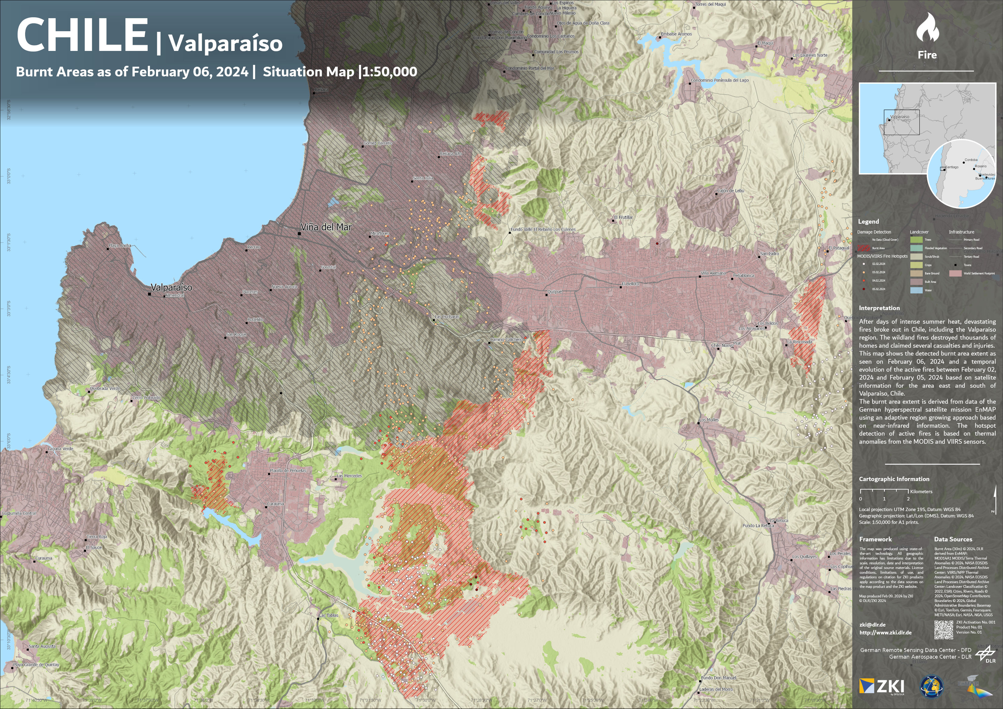
This map shows the large wildfire that occurred in February 2024 in the vicinity of Valparaíso in Chile. For the analysis, DLR's Earth Observation Center used data from the German environmental satellite EnMAP along with the method now licensed to OroraTech.