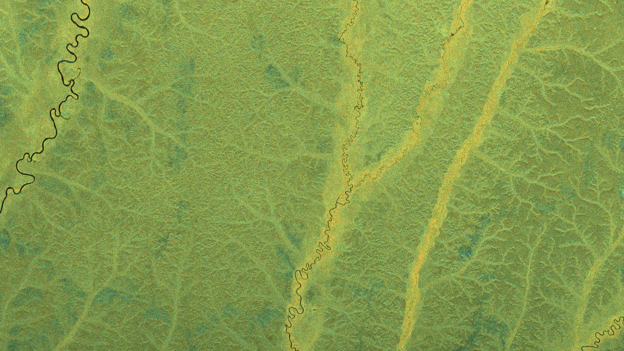
BIOMASS radar image – Tropical rainforest in the Congo Basin in Central Africa

BIOMASS radar image – Tropical rainforest in the Congo Basin in Central Africa
This is the second-largest tropical rainforest in the world, after the South American Amazon. The reddish hues alongside the meandering rivers indicate pronounced ground-trunk and/or water-trunk interactions beneath the canopy. The pronounced topographical variations across the subsurface of the forest are a result of the penetrability of the P-band radar.
Polarimetric HSI representation (hue, saturation, intensity): The colour (hue component) indicates the type of scattering mechanism. Blue colours represent surface-like scatterers (like bare ground), green tones represent dipole-like scatterers (such as vegetation or volumetric scatterers) and red colours indicate dihedral-like scatterers (such as interactions between ground and tree trunks in forests or between ground and building walls in urban areas). These images and results were produced as part of the ESA-funded 'ESA Biomass In-Orbit Commissioning' project. All radar images were processed by DLR.
Credit:
ESA