Topographic image map of Idaeus Fossae

Topographic image map of Idaeus Fossae
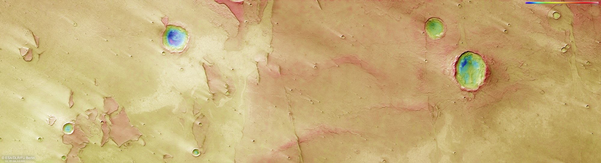
DLR's HRSC stereo camera on board Mars Express captures the Martian surface from multiple viewing angles using its nine sensors following the orbiter's ground track. From this data, the DLR Institute of Space Research and the Freie Universität Berlin generate digital terrain models. The colour scale at the top right of the image indicates elevation values. The negative values indicate that we are in the northern lowlands of Idaeus Fossae. The four most striking craters, with diameters between five and 20 kilometres, have depths ranging from 500 to nearly 2000 metres.