
Topographic map of the Mamers Valles in the north of Arabia Terra
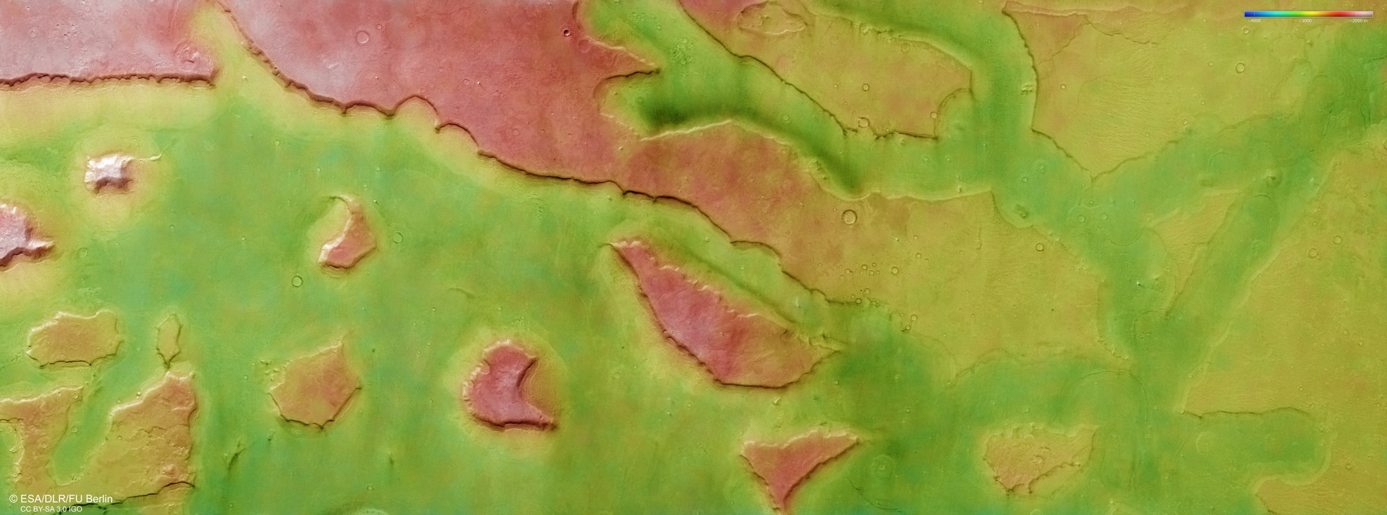

Topographic map of the Mamers Valles in the north of Arabia Terra
DLR's HRSC (High Resolution Stereo Camera) onboard Mars Express captures the Martian surface from multiple angles using nine sensors. From these, the DLR Institute of Space Research and the Planetary Science and Remote Sensing Group at the Freie Universität Berlin calculate digital terrain models. The colour scale in the top right of the image indicates elevation values. This reveals that water flowing with high energy from the Mamers Valles in the south (left in the image) has eroded channels roughly 1500 metres deep into the highlands at the transition to the northern lowlands. In doing so, the water left behind mesas (table mountains) on either side, which are remnants of the highlands.
