Article from DLRmagazine 171: The Arctic is warming more quickly than the rest of the planet – a research team is trying to find out why.
A polar hot spot?
Anthropogenic climate change is threatening particularly vulnerable ecosystems such as those in the Arctic
In the HALO-(AC)³ campaign, an international research team flew five aircraft in and above the Arctic clouds to collect data to answer questions about why this region is warming faster than the rest of the world.
Anthropogenic climate change is threatening particularly vulnerable ecosystems such as those in the Arctic. Here, the Earth's surface is warming at almost three times the global average. The reasons for this so-called Arctic amplification are not yet known, so an international research team flew five aircraft in and above the Arctic clouds to collect data that might help answer this question.
In Kiruna, Sweden's northernmost city, the summers are short and cool while the winters are long, freezing and snowy. Tourists are drawn there for the unspoiled nature, sled dog tours and the northern lights, while researchers come to launch data-collecting rockets or balloons and study climate change in the Arctic. The HALO-(AC)³ campaign saw DLR's HALO research aircraft take off from here for 17 nine-hour Arctic flights, each time fully equipped with the latest measurement technology. The campaign was accompanied by one French and one British research aircraft, also stationed in Kiruna, as well as two polar aircraft from the Alfred Wegener Institute (AWI), which took off from Svalbard near the North Pole. Together, these flights examined the properties of the Arctic atmosphere. The researchers involved are united by the goal of better understanding the Arctic climate and the particularly marked warming observed there.
"It is a privilege to be able to see and experience this unique part of the Earth. Its preservation is so important to us."
Prof. Dr Christiane Voigt, cloud physicist from the DLR Institute of Atmospheric Physics
On the trail of Arctic amplification
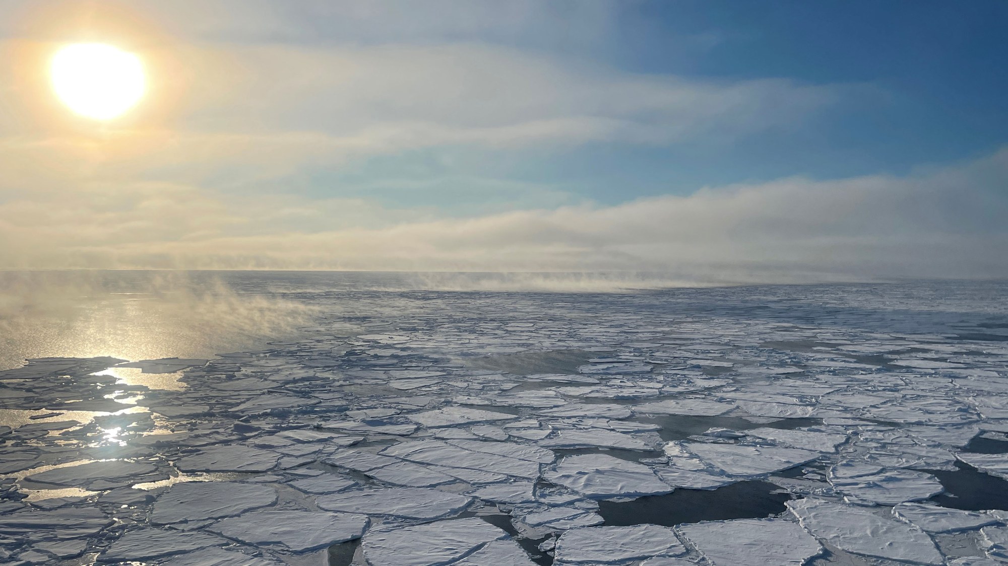
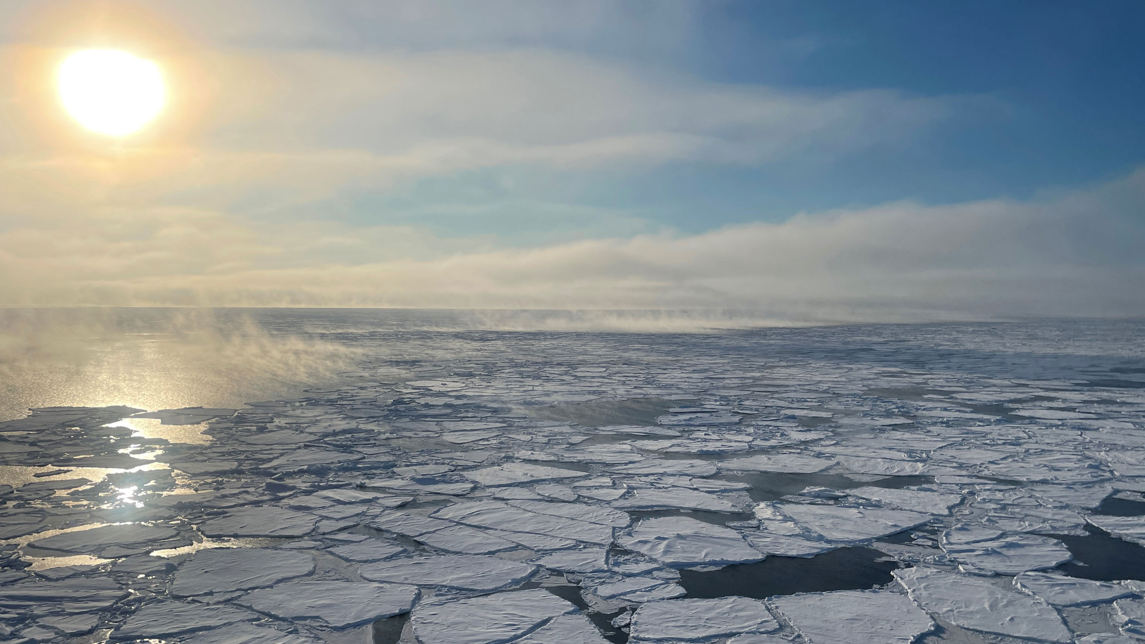
An important phenomenon of change is what is known as Arctic amplification – the above-average temperature increase in the region compared to the global average. By way of comparison, the global climate has warmed by approximately one degree Celsius since 1971. In the Arctic, this increase is around three degrees, and it is possible that this differential will continue to widen due to feedback mechanisms. The change in the temperature gradient between the mid-latitudes and the Arctic could lead to more warm air intrusions flowing towards the North Pole, with colder air moving southward. These warm air intrusions could in turn accelerate the melting of sea ice. The resulting uncovered darker ocean surface would absorb and store thermal energy more effectively than a white ice surface, which reflects solar radiation. This would accelerate the melting of the sea ice, further intensifying the warming of the Arctic.
When white, reflective clouds move over the ocean the picture changes, because cloud cover can have a major impact on the atmospheric radiation budget. Clouds behave differently over the open ocean and over sea ice. This, among other effects, is what the scientists hoped to investigate with aircraft measurements. "It is a privilege to be able to see and experience this unique part of the Earth. Its preservation is so important to us," says Christiane Voigt. The cloud physicist led a team from the DLR Institute of Atmospheric Physics in Svalbard.
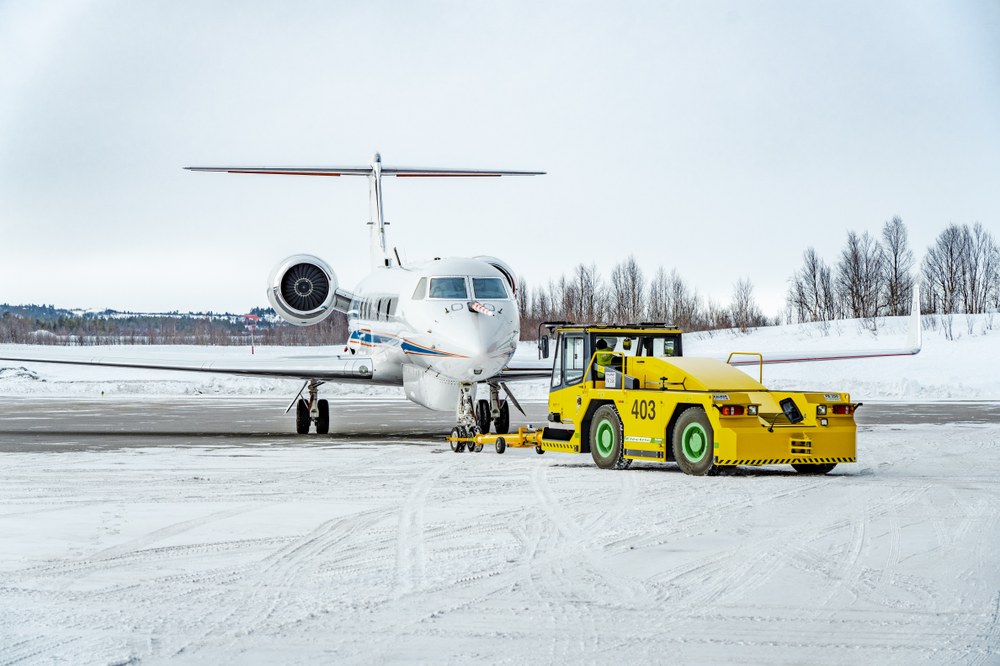
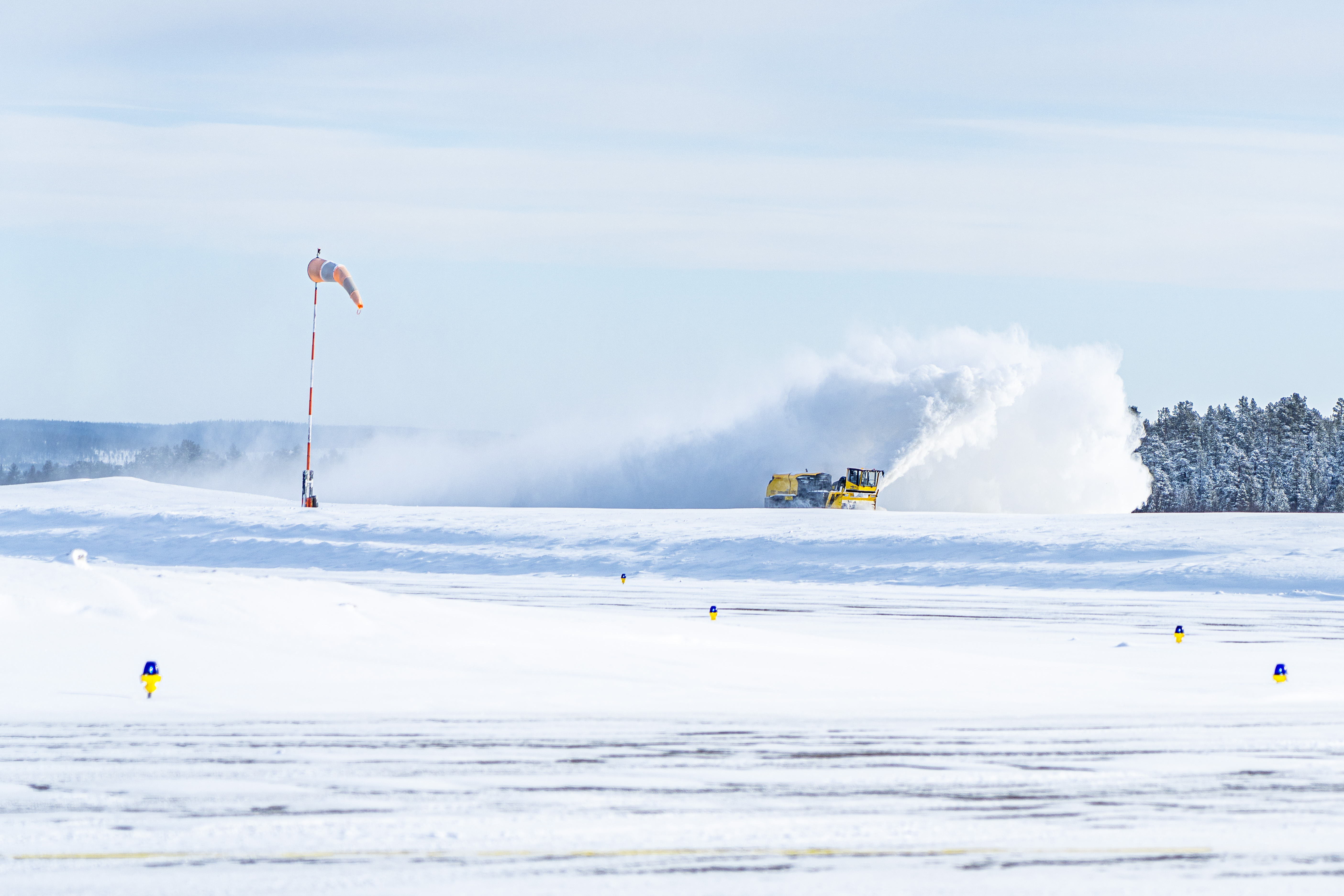
Kiruna airport covered with snow
Before take-off, the runway at Kiruna airport must be cleared of snow.
"Our HALO research aircraft allow us to fly high above the clouds, from where we can measure them and track the movement of the warm air masses," explains Silke Groß of the DLR Institute of Atmospheric Physics. HALO stands for High Altitude and Long Range Research Aircraft. With a range of over 8000 kilometres and a maximum altitude of 15 kilometres, the aircraft is perfectly suited to work in the Arctic. By contrast, a modern airliner like the Airbus A320neo can fly at a maximum altitude of just under 12 kilometres with a range of 3200 kilometres.
During the HALO campaign, the scientists used remote sensing measuring instruments such as radar and lidar to investigate what types of clouds form over the cold Arctic Ocean when warm air hits them. Along the way, the team on board HALO released numerous probes at high altitude. As they descend through the atmosphere, these 'dropsondes' acquire meas- urements of temperature, humidity, wind and pressure. Wind and pressure are also recorded by measuring probes attached to the aircraft. The data provide a good picture of the local meteorological situation.
During the HALO campaign, the scientists used remote sensing measuring instruments such as radar and lidar to investigate what types of clouds form over the cold Arctic Ocean when warm air hits them. Along the way, the team on board HALO released numerous probes at high altitude. As they descend through the atmosphere, these 'dropsondes' acquire meas- urements of temperature, humidity, wind and pressure. Wind and pressure are also recorded by measuring probes attached to the aircraft. The data provide a good picture of the local meteorological situation.
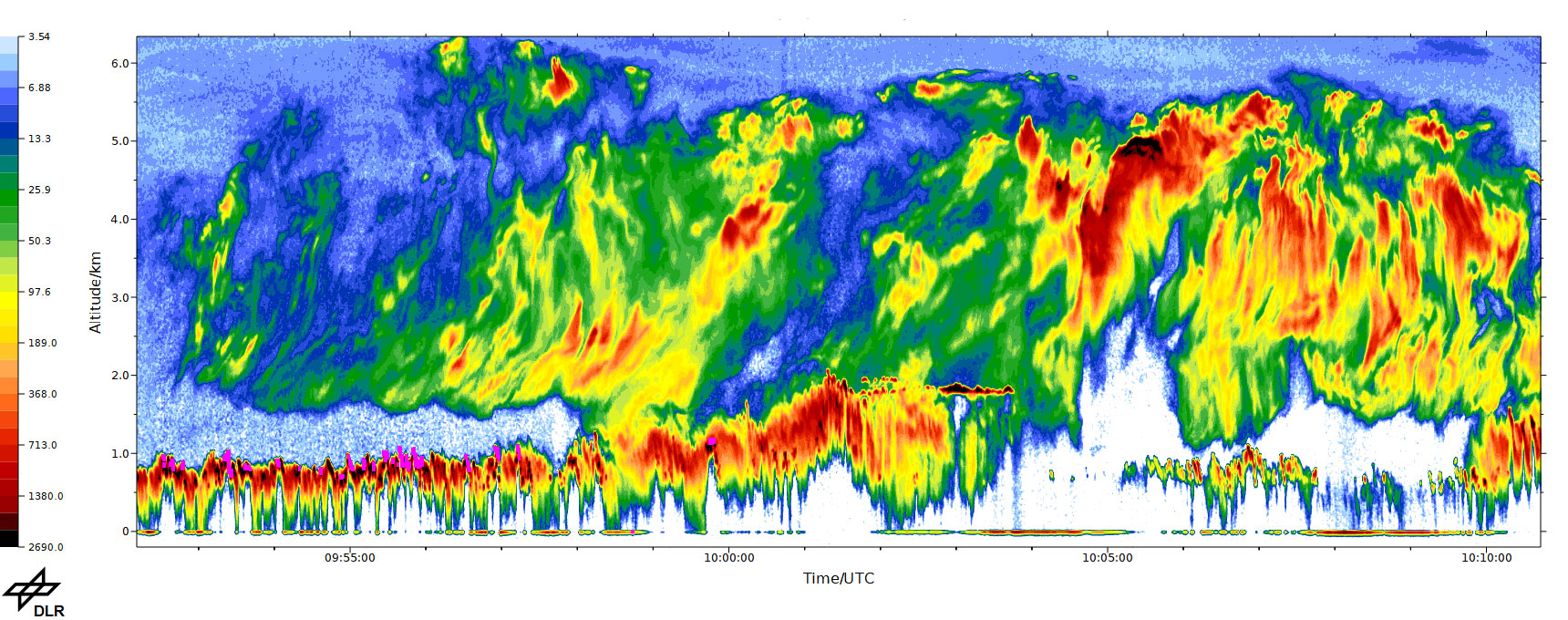
Lidar measurements of the 2D cloud structure below the research aircraft
Cloud-free areas are shown in light blue and white. Everything from dark blue shows the clouds along the flight path, with the intensity of the backscattered light increasing from dark blue to dark red. The illustration highlights the complex structure and interplay of low clouds over the open ocean and ice clouds above. At the beginning of the flight path, the low clouds (height up to approximately two kilometres) are clearly separated from the ice clouds (lower edge at approximately 2.5 kilometres). However, as the flight progresses, the upper edge of the deep clouds increases so that they are now directly connected to the overlying ice clouds.
In Svalbard, the DLR researchers flew directly through low clouds with their cloud probes aboard the P5 polar aircraft. The flight followed a sawtooth pattern below 600 metres altitude through cold, boundary layer clouds. Using high-resolution cloud measurement instruments, the team studied the influence of the Earth's surface – including sea ice, broken sea ice and open ocean – on the formation of clouds as well as their composition, particle size distribution and particle shape. "Initial results from HALO-(AC)³ and the previous campaigns MOSAIC and AFLUX show that the low clouds that form over the ocean in the spring have a higher water content and larger particle diameters than those that form over the sea ice," says Voigt.
From space, white clouds over ice can hardly be distinguished from the bright surface. However, over the dark ocean, low ice clouds alter the radiation balance significantly. The researchers were also interested in the different cloud properties in the warm air intrusions and the cold air outbreaks; the latter lead to a characteristic comb-like line cloud pattern that forms in the cold air overflowing the ocean beyond the edge of the sea ice. But flying in the turbulent boundary layer and in clouds is no easy task. "It's extremely exciting to fly just 60 metres above the ice shelf. The research aircraft used are well suited for the flight manoeuvres involved, and the AWI has many years of expertise in polar flight," adds Voigt. Due to the absence of hangars, HALO could not be stationed in Svalbard over winter, although the polar aircraft and pilots stayed on the apron even in the freezing cold.
A second polar aircraft equipped with remote sensing instruments carried out coordinated measurement flights directly above the P5 to collect data on the effects of radiation high above the clouds. In particularly interesting conditions, HALO, FAAM or the ATR flew in from Sweden to work with the P5 and P5 polar aircraft to investigate changes in the atmospheric radiation flux in the Arctic, the particularly sharp rise in temperature and the influence of clouds.
Cold and complex objects of research
High ice clouds, known as cirrus, are the most common cloud type in the Arctic and immensely influence the global climate. In general, cirrus clouds have a warming effect because they reflect thermal radiation back to Earth. Meanwhile, because they are so cold, they themselves emit little heat into space. At the same time, they also reflect solar radiation. "The interaction of the different effects makes it incredibly complicated to study this type of cloud," says Groß. In addition, there is a difference in the temperature of the surface radiation over ice and over water, the reflection of solar radiation depends on the position of the Sun – whether it is polar night or polar day – and the properties of the clouds, such as their size, shape or the number of ice crystals in turn depend on external conditions such as temperature and humidity. All of these factors influence how cirrus clouds react to solar and terrestrial radiation, and in turn have an effect on the Earth's heat balance.
The researchers are currently evaluating data from the campaign. "The initial results indicate that the distribution of moisture in arctic cirrus clouds differs from that at lower latitudes," says Groß. Relative humidity is an important factor in cloud formation. The researchers assume that it also influences the microphysics and the radiation balance of the clouds. If the warm air intrusions into the Arctic increase, for example, this could have an impact on the radiative effect of the region. "We want to use data from the campaign to investigate the way in which global warming will change," adds Groß.
Weather simulations from the University of Cologne and the Ludwig Maximilian University in Munich served as the basis for flight planning. Data from the European Centre for Medium-Range Weather Forecasts (ECMWF), such as temperature and air pressure, can precisely predict when and at what altitude clouds will form. HALO flew in these areas together with the polar aircraft to examine how accurately the simulations predicted real developments. In this way, modern weather and climate models can be improved. This task will keep researchers busy for years to come. "The fact that we were able to carry out the campaign so successfully was a combination of luck and risk, because forecasting smallscale weather phenomena in detail is anything but simple," says Principal Investigator Manfred Wendisch of the University of Leipzig. For Wendisch, another vital element for the success of the mission is the team, with some 20 doctoral students working on the project. "Young people come up with ideas that you would never think of yourself. We all benefit from that and I'm glad they were involved. The mix of young researchers was the key to success!" adds Wendisch.
HALO-(AC)³ facts and figures
Flight distance covered
approx. 107,700 kilometres
Flights
17
Flight hours
140 hours
Dropsondes released
347
Messages sent on Slack
23,163
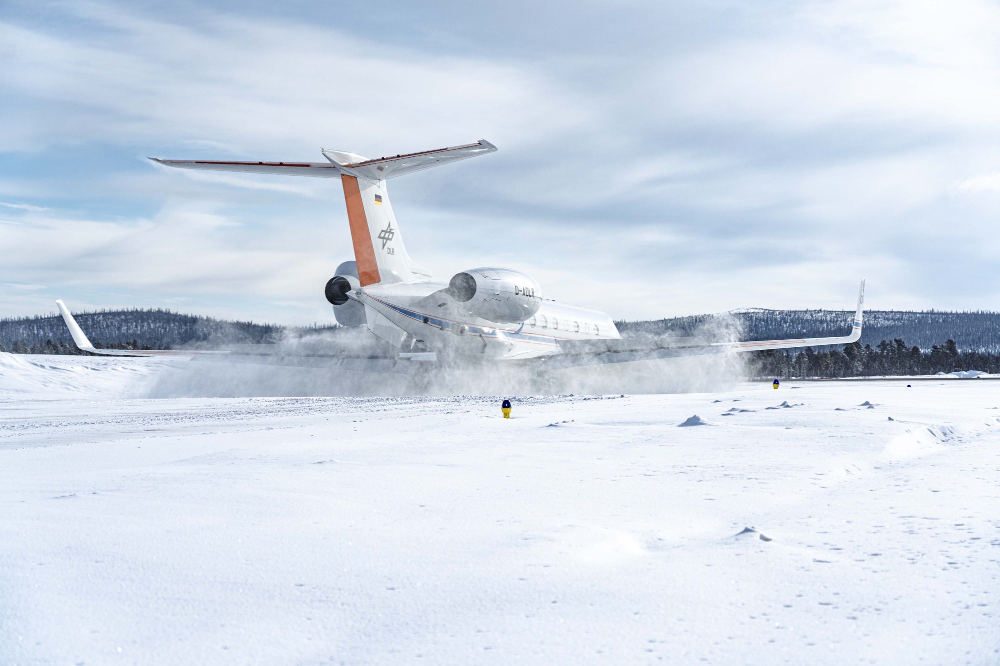
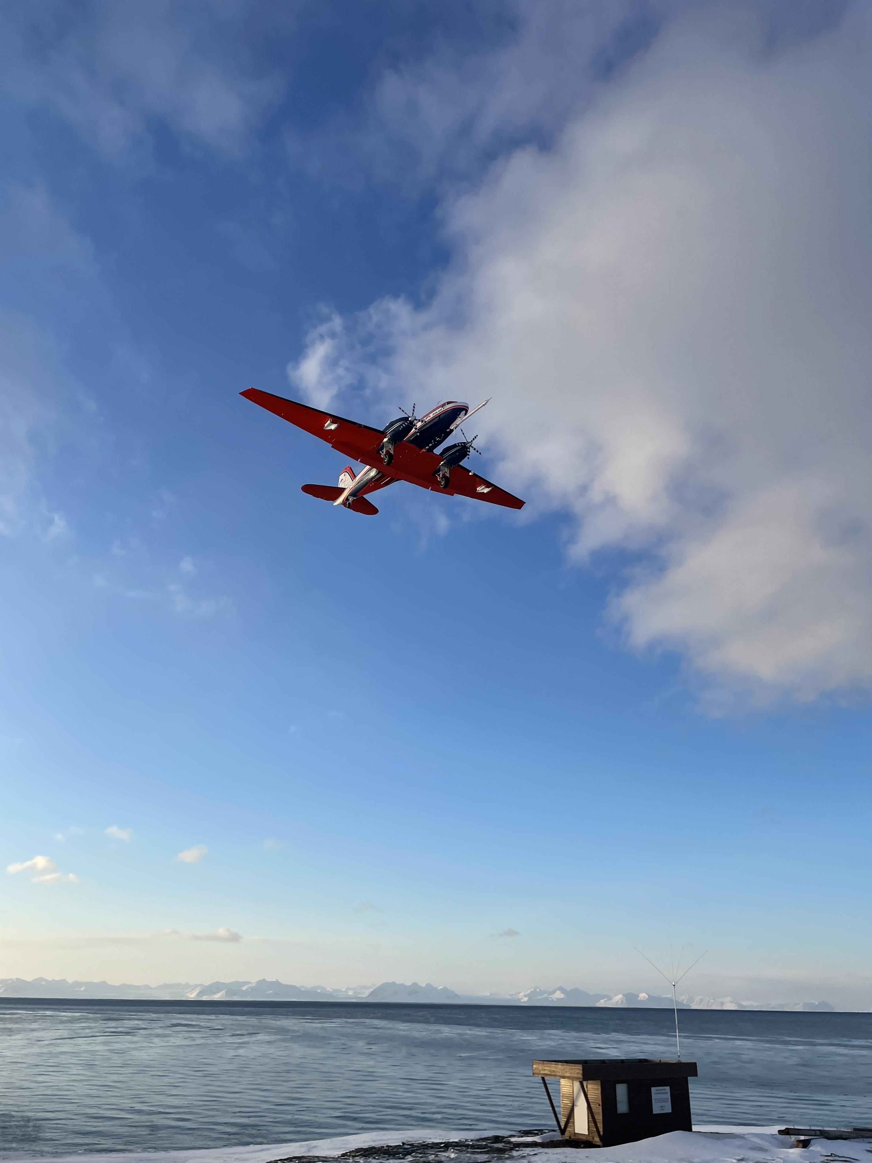
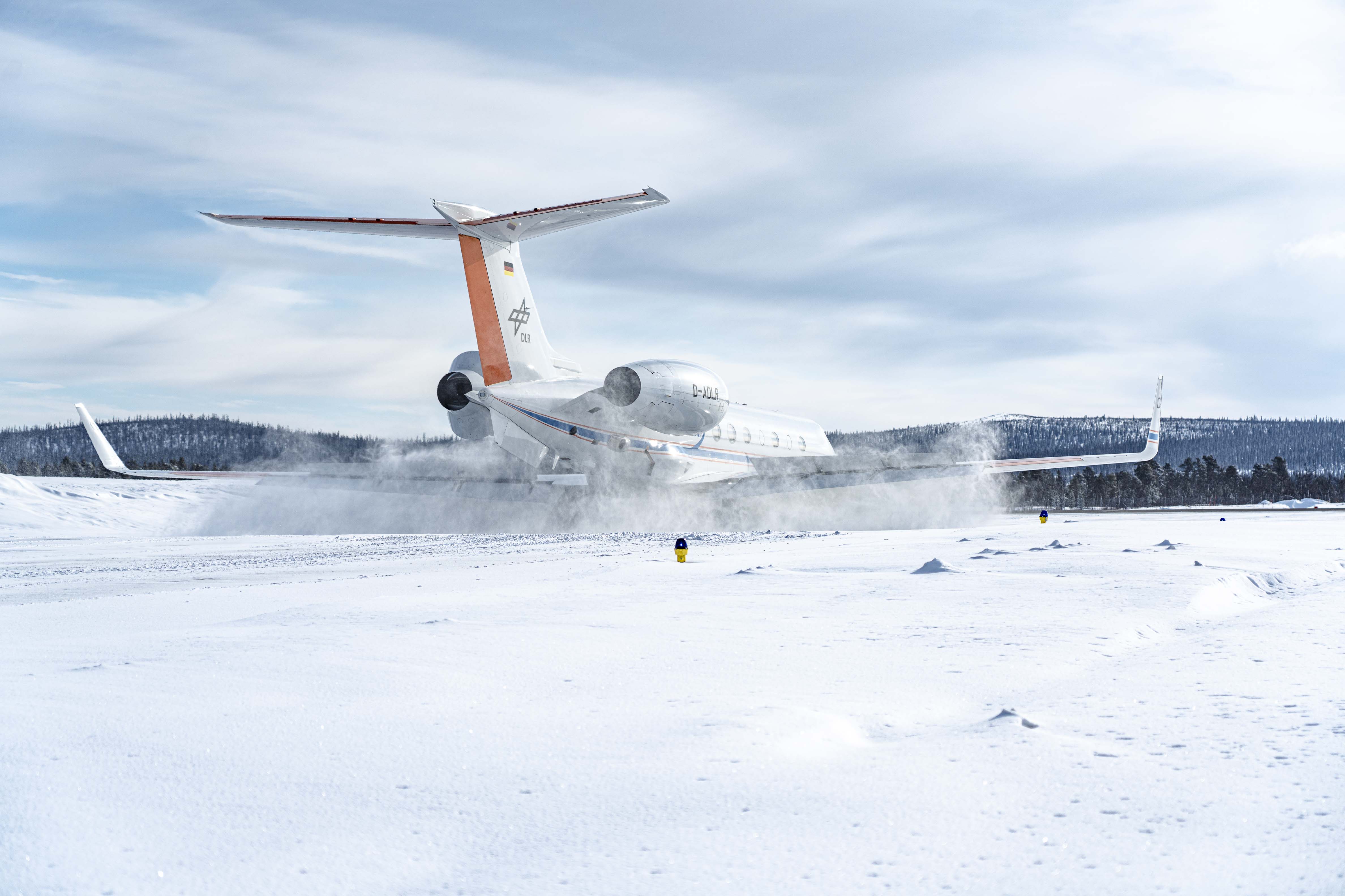
HALO in the Arctic
The DLR research aircraft HALO taking off from Kiruna airport


