Aerospace technologies for humanitarian aid
Aerospace technologies for humanitarian aid
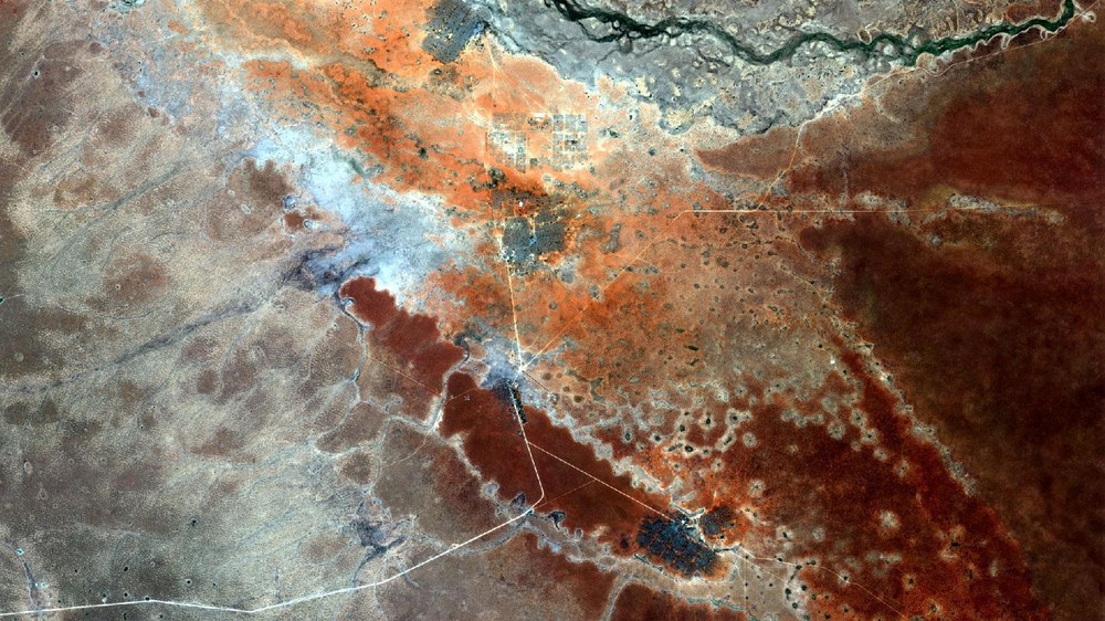
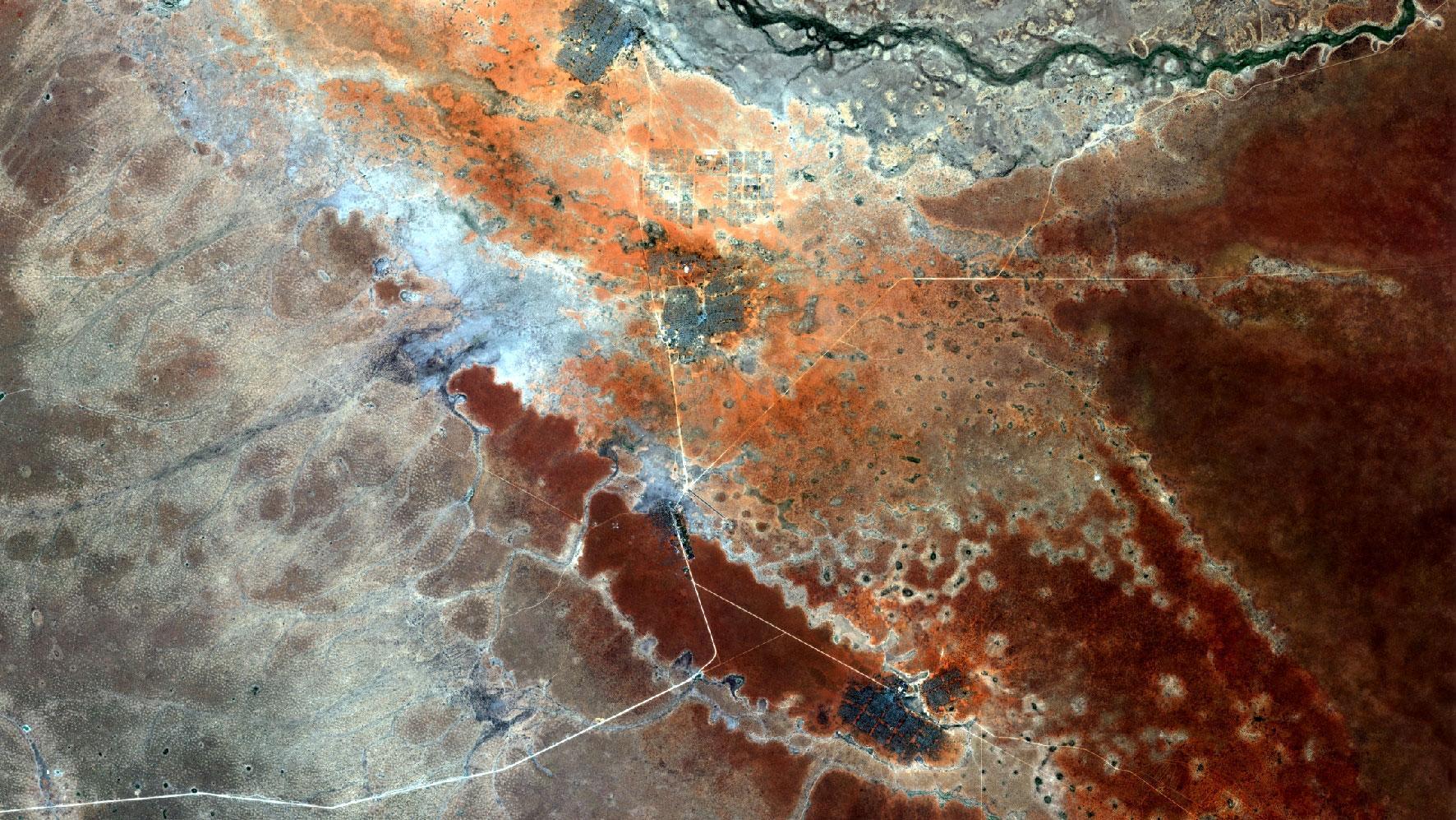
View of Dadaab, Kenya
This Copernicus Sentinel-2A satellite image taken on 11 February 2016 shows Dadaab, the world’s largest refugee camp complex, and its surroundings. Around 328,000 refugees are currently living in the camps.
An increasing number of people around the world are becoming dependent on humanitarian aid. Crisis, conflicts, natural disasters and climate change are all major factors in this shift. Humanitarian aid is often conducted in difficult political circumstances and poor security situations, often under intense time pressure. Aid organisations are thus increasingly looking for technological support to increase the efficacy and sustainability of their operations.
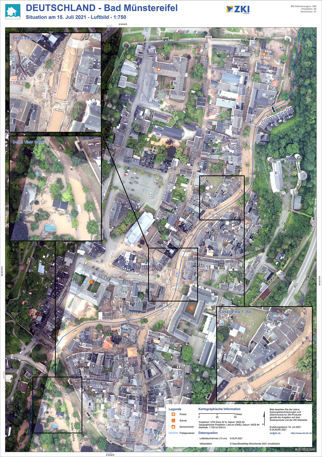
Emergency mapping for crisis situations
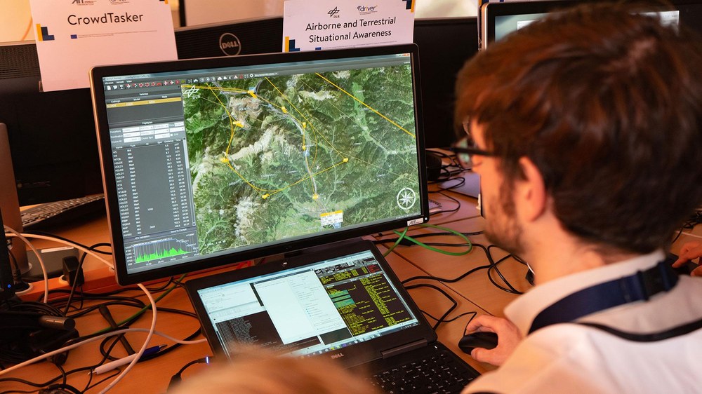
The data acquired by sensors on satellites and aircraft, and the spatial information derived from them, contribute towards a better understanding of humanitarian emergencies and the planning of relief operations. DLR’s Center for Satellite Based Crisis Information (ZKI) provides valuable information to facilitate a rapid response to the destruction sustained during an extreme emergency situation. Satellite data are recorded, analysed and processed to quickly create tailored maps.
DLR is also involved in United Nations programmes such as UN-SPIDER, which aims to improve access to data acquired from space, prevent disasters and manage those that do occur more effectively. It is particularly important to strengthen local organisations and stakeholders, for example by assisting them in the development of their own emergency mapping capabilities. DLR has also been working closely with German agencies such as the THW and International Search and Rescue Germany for many years. The real-time functionality of DLR’s MACS camera system makes it possible, for instance, to map an area of application from the air within minutes.
Scientists and engineers from DLR are collaborating with aid organisations – sometimes with additional support from industry – to develop new technologies and strategies for the improved and more effective provision of humanitarian aid worldwide.


