The DLR components of the ARCHES space-analogue demonstration mission
The DLR components of the ARCHES space-analogue demonstration mission
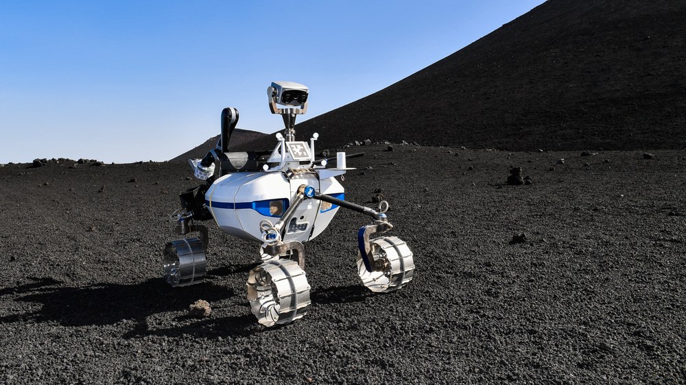
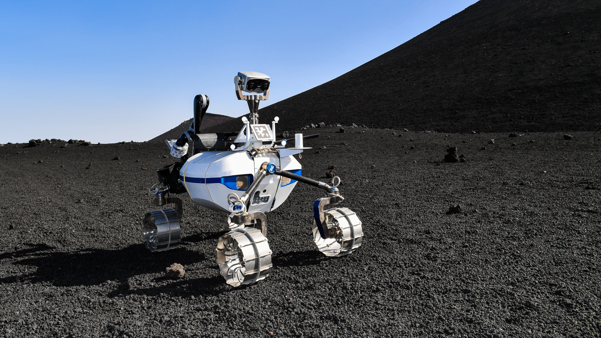
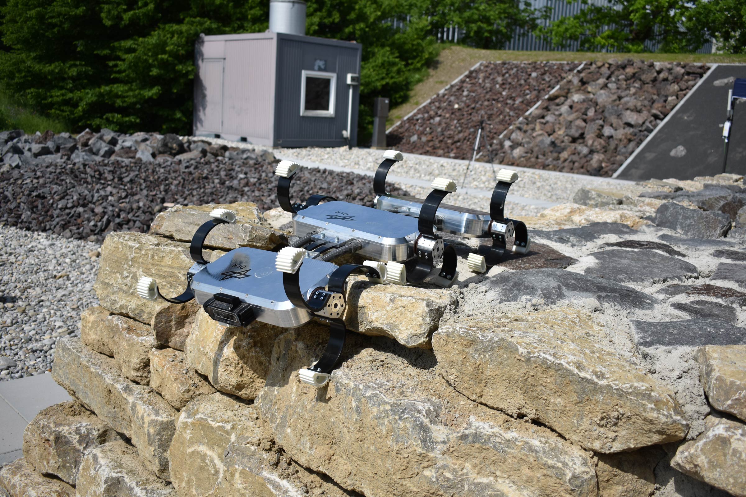
DLR's LRU2 robot during the ARCHES space simulation on Mount Etna
The Lightweight Rover Unit 2 (LRU) during a very unusual outdoor test on Mount Etna. In order to test mission scenarios for robotic exploration on Earth before going to the Moon or Mars, scientists are looking for places on Earth that come close to the conditions on another celestial body. From 13 June to 9 July 2022, Mount Etna on the Italian island of Sicily became a 'quasi-Moon', as the volcanic landscape with its granular surface and solidified lava layers resembles the geological composition of the Moon. ARCHES stands for 'Autonomous Robotic Networks to Help Modern Societies'.
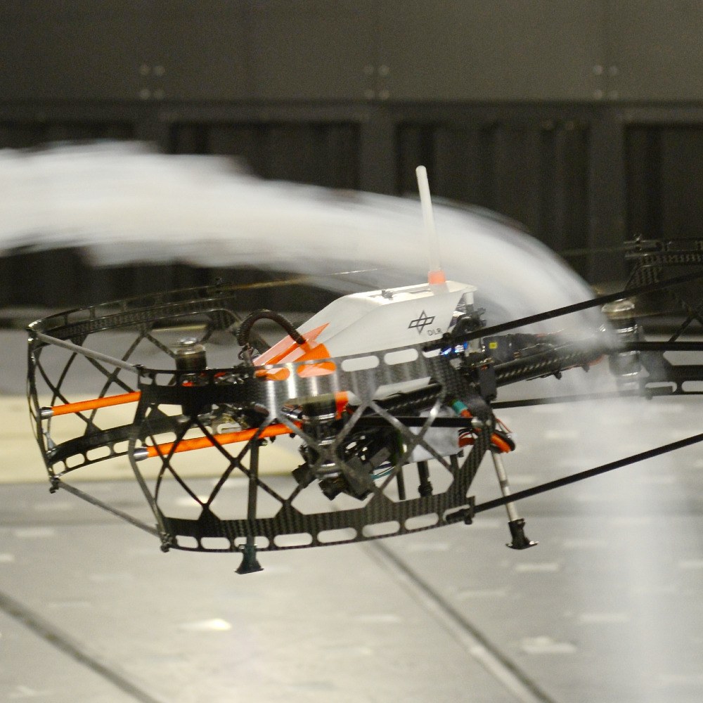
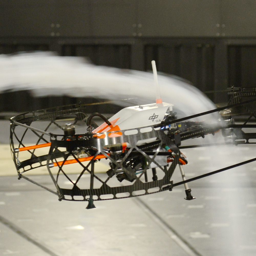
ARDEA is a micro-aerial vehicle that has been developed by DLR. It measures 68 by 68 by 30 centimetres and weighs 2.4 kilograms. The main tasks of this ‘multicopter’ include exploring unfamiliar environments and assisting rescue teams in disaster areas.
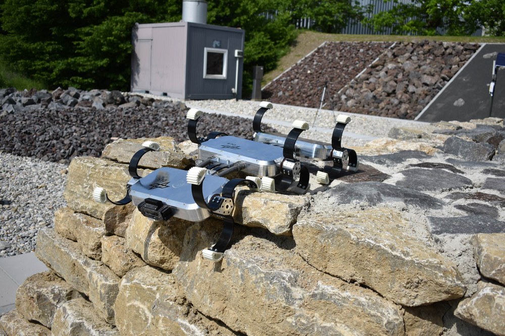
The DLR 'Scout' rover was developed for planetary exploration and missions in difficult-to-access areas on Earth. To do this, it must be extremely mobile and robust. The system is fault- and error-tolerant when it comes to motor or mechanical failures. Scout can also drive upside down and survive falls from a height of more than 1.5 metres.
The micro-aerial Vehicle ARDEA, which was developed by DLR, played a major role in mapping the area of operation. It was a compact drone that could fly very slowly and had extensive onboard computing capabilities. For missions on planets with an atmosphere, such vehicles could move using rotors, as they are on Mount Etna. For a lunar mission, thrusters would be used instead. ARDEA has two cameras – one for all-round vision and one for detailed data. The drone processed the data obtained during the flight for its own navigation and exchanged it with the rovers and the control centre. In ARCHES, ARDEA was operated from the control centre in Catania. During a real space mission, this would be done by crew members who are in an orbiter or space station near the target body.
The scientist – LRU1
DLR's two Lightweight Rover Units (LRUs), which were used in the ARCHES space simulation, also mapped their respective surroundings. All of the collected data were merged into a common map. The different sensors and viewing angles of the three robotic units resulted in an accurate and reliable overall picture, which were used to select areas that appear scientifically interesting. The search was refined by images from LRU1, which was equipped with a thermal camera, a telephoto camera and a spectral filter camera that limited its 'vision' to selected frequency ranges of electromagnetic radiation. LRU1 drove to certain objects within the area of interest, imaged them and sent the resulting data to the scientists in the control centre for analysis of the rock components. It was supported by LRU2, which had a WLAN repeater to ensure a continuous internet connection between LRU1 and the control centre. At ARCHES, another DLR rover known as 'Scout' performed the same task for ESA's 'Interact' rover. After evaluating the images from LRU1, the scientists at the control centre decided exactly where experiments should be placed and where soil samples should be taken. They then moved on to working on the individual mission scenarios.
The assistant – LRU2
The second mobile unit involved in ARCHES is the LRU2 rover. Just like LRU1, it was equipped with navigation cameras, a stereo camera and a colour camera. It also had an arm and a 'tool belt' with a shovel for removing sand and a gripper for removing and handling rocks. In addition, it could carry a transport box in which soil samples, WLAN repeaters or equipment for the various experiment scenarios could be stowed. Depending on which experiment was carried out, LRU2 picked up the appropriate box from the stationary unit, the lander.
The ARCHES experiments
In the 'Collecting samples' scenario, LRU2 travelled to the lander after receiving the appropriate command from the control centre and picked up an empty box there. It then searched for a safe route to the target area, where it collected a sample of granular matter or solid rock and transported it back to the lander. In the case of a real mission, it would then be returned to Earth and examined in greater detail there.
The Laser-Induced Breakdown Spectroscopy (LIBS) scenario involved determining the elements contained in a sample using laser spectroscopy. This was a variant of atomic emission spectroscopy that was comparatively easy to apply. LIBS was integrated into an experiment box that was collected by LRU2 from the lander and placed beside a rock of interest in the target area. The laser could be used from a distance of less than 10 centimetres. The vaporisation of the rock material caused the formation of a plasma. This was subjected to spectral analysis, with the results being sent to the control centre to determine its composition.
The Low Frequency Array (LOFAR) scenario focused on the search for life beyond Earth. As part of ARCHES, it tested the placement of the experiment hardware for use in a future lunar mission. On the far side of the Moon, combined receivers will be arranged over a large area to scan the radio portion of the electromagnetic spectrum for possible signs of intelligent extraterrestrial life. For the analogue mission on Etna, LRU2 distributed six boxes, each with a LOFAR antenna, to create a simple pyramid structure that imitates the pattern that will later be used on the lunar surface.
DLR and the Karlsruhe Institute of Technology (KIT) were working together on the space-analogue mission as part of the ARCHES project. The European Space Agency (ESA) was also taking part in this project. DLR was also involved in the second part of the project, a deep-sea-analogue mission, directed by the Helmholtz centres for Polar and Marine Research (Alfred Wegener Institute, AWI) and for Ocean Research (GEOMAR). Their findings are communicated to all partners to make them usable independently of the respective deployment scenarios. This applies both to the hardware and the joint analysis and interpretation of data by the network’s robots and their interaction with humans.